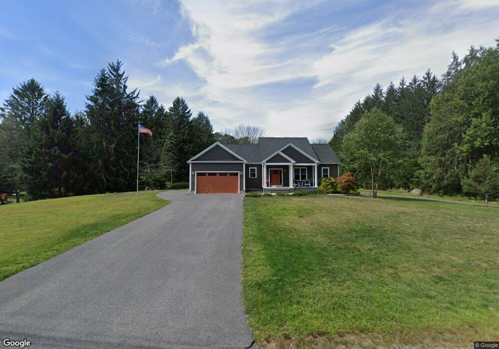
16 Purchase St Rehoboth, MA 02769
Estimated Value: $640,855 - $871,000
3
Beds
2
Baths
1,545
Sq Ft
$461/Sq Ft
Est. Value
About This Home
This home is located at 16 Purchase St, Rehoboth, MA 02769 and is currently estimated at $711,714, approximately $460 per square foot. 16 Purchase St is a home located in Bristol County with nearby schools including Dighton-Rehoboth Regional High School.
Ownership History
Date
Name
Owned For
Owner Type
Purchase Details
Closed on
Jan 27, 1993
Sold by
Ferreira Frank
Bought by
Sousa Michael and Sousa Lisa
Current Estimated Value
Purchase Details
Closed on
Jul 1, 1988
Sold by
Macleod Ruth
Bought by
Sousa Michael
Create a Home Valuation Report for This Property
The Home Valuation Report is an in-depth analysis detailing your home's value as well as a comparison with similar homes in the area
Home Values in the Area
Average Home Value in this Area
Purchase History
| Date | Buyer | Sale Price | Title Company |
|---|---|---|---|
| Sousa Michael | $70,000 | -- | |
| Sousa Michael | $125,000 | -- |
Source: Public Records
Mortgage History
| Date | Status | Borrower | Loan Amount |
|---|---|---|---|
| Open | Sousa Michael | $231,500 | |
| Closed | Sousa Michael | $50,000 | |
| Closed | Sousa Michael | $105,000 |
Source: Public Records
Tax History
| Year | Tax Paid | Tax Assessment Tax Assessment Total Assessment is a certain percentage of the fair market value that is determined by local assessors to be the total taxable value of land and additions on the property. | Land | Improvement |
|---|---|---|---|---|
| 2025 | $61 | $548,500 | $189,000 | $359,500 |
| 2024 | $5,672 | $499,300 | $189,000 | $310,300 |
| 2023 | $5,746 | $496,200 | $185,400 | $310,800 |
| 2022 | $5,757 | $454,400 | $185,400 | $269,000 |
| 2021 | $280 | $446,600 | $177,600 | $269,000 |
| 2020 | $5,414 | $435,100 | $177,600 | $257,500 |
| 2018 | $275 | $216,500 | $169,800 | $46,700 |
| 2017 | $3,516 | $279,900 | $169,800 | $110,100 |
| 2016 | $3,401 | $279,900 | $169,800 | $110,100 |
| 2015 | $3,230 | $262,400 | $162,600 | $99,800 |
| 2014 | $3,114 | $250,300 | $155,400 | $94,900 |
Source: Public Records
Map
Nearby Homes
- 19 Cedar St Unit 21
- 2188 Cedar St
- 2625 Lewis St
- 46 Mikayla Ann Dr
- 2713 Horton St
- 2206 Williams St
- 2681 Courtlyn Rd
- 1593 Old Williams St
- 0 Wellington St
- 185 Moulton St
- 0 Horton St Unit 73333337
- 42 Linden Ln
- 74R Club House Dr Unit 74R
- 73H Club House Dr Unit Lot 73H
- 35 Clubhouse Dr Unit RR35
- RR36 Club House Dr Unit Lot RR36
- RR33 Club House Dr Unit Lot RR33
- RR38 Club House Unit RR38
- RR34 Club House Dr Unit RR34
- R42 Club House Dr Unit R42
Your Personal Tour Guide
Ask me questions while you tour the home.