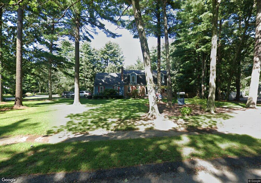
16 Quail Run Rd Norfolk, MA 02056
Estimated Value: $825,103 - $1,135,000
4
Beds
3
Baths
2,600
Sq Ft
$359/Sq Ft
Est. Value
About This Home
This home is located at 16 Quail Run Rd, Norfolk, MA 02056 and is currently estimated at $932,276, approximately $358 per square foot. 16 Quail Run Rd is a home located in Norfolk County with nearby schools including H. Olive Day School and Freeman-Kennedy School.
Ownership History
Date
Name
Owned For
Owner Type
Purchase Details
Closed on
Aug 1, 1996
Sold by
Fairneny Robert J
Bought by
Lindmark Todd A and Lindmark Joann G
Current Estimated Value
Home Financials for this Owner
Home Financials are based on the most recent Mortgage that was taken out on this home.
Original Mortgage
$82,500
Interest Rate
8.27%
Mortgage Type
Purchase Money Mortgage
Purchase Details
Closed on
Apr 16, 1987
Sold by
Finkenaur Robert
Bought by
Fairneny Robt J
Create a Home Valuation Report for This Property
The Home Valuation Report is an in-depth analysis detailing your home's value as well as a comparison with similar homes in the area
Home Values in the Area
Average Home Value in this Area
Purchase History
| Date | Buyer | Sale Price | Title Company |
|---|---|---|---|
| Lindmark Todd A | $265,000 | -- | |
| Lindmark Todd A | $265,000 | -- | |
| Fairneny Robt J | $279,500 | -- |
Source: Public Records
Mortgage History
| Date | Status | Borrower | Loan Amount |
|---|---|---|---|
| Open | Fairneny Robt J | $115,000 | |
| Closed | Fairneny Robt J | $82,500 | |
| Previous Owner | Fairneny Robt J | $149,000 |
Source: Public Records
Tax History Compared to Growth
Tax History
| Year | Tax Paid | Tax Assessment Tax Assessment Total Assessment is a certain percentage of the fair market value that is determined by local assessors to be the total taxable value of land and additions on the property. | Land | Improvement |
|---|---|---|---|---|
| 2025 | $10,717 | $671,100 | $191,600 | $479,500 |
| 2024 | $10,152 | $652,000 | $193,800 | $458,200 |
| 2023 | $9,780 | $596,000 | $193,800 | $402,200 |
| 2022 | $9,804 | $538,700 | $182,200 | $356,500 |
| 2021 | $9,688 | $538,500 | $188,000 | $350,500 |
| 2020 | $9,892 | $530,700 | $188,700 | $342,000 |
| 2019 | $9,536 | $521,400 | $188,700 | $332,700 |
| 2018 | $9,353 | $502,300 | $197,900 | $304,400 |
| 2017 | $9,219 | $506,000 | $197,900 | $308,100 |
| 2016 | $9,031 | $499,500 | $203,000 | $296,500 |
| 2015 | $8,570 | $485,300 | $193,500 | $291,800 |
| 2014 | $8,169 | $468,700 | $193,500 | $275,200 |
Source: Public Records
Map
Nearby Homes
- 14 Robin Rd
- 26 Ridge Rd
- 3 Pheasanthill Rd
- 38 Robin Rd
- 23 Fredrickson Rd
- 45 King St
- 14 Essex St
- 6 Trailside Way
- 2 Diamond St
- 7 Keeney Pond Rd
- 8 Analore Cir
- 12 Keeney Pond Rd
- 18 Keeney Pond Rd
- 6 Forest Grove Ave
- 16 Keeney Pond Rd
- 48 Mirror Lake Ave
- 246 Forest Grove Ave
- 45 Joshua Rd
- 10 W Birch Rd
- 3 Lake St