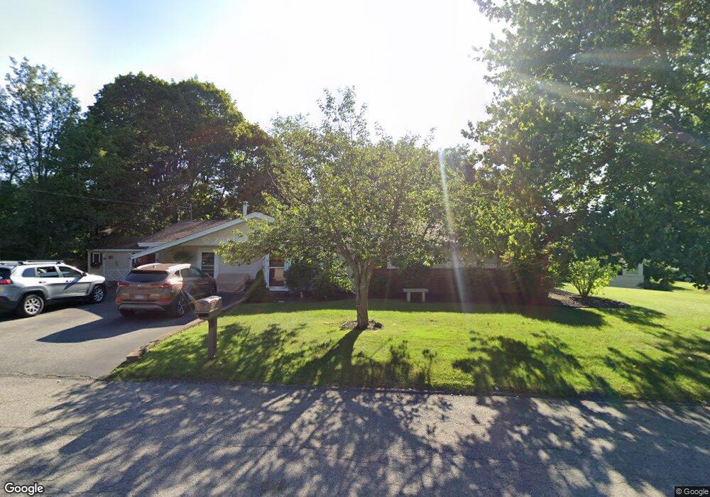
16 Robert Rd Brockton, MA 02302
Montello NeighborhoodEstimated Value: $468,090 - $483,000
3
Beds
2
Baths
1,272
Sq Ft
$374/Sq Ft
Est. Value
About This Home
This home is located at 16 Robert Rd, Brockton, MA 02302 and is currently estimated at $475,523, approximately $373 per square foot. 16 Robert Rd is a home located in Plymouth County with nearby schools including Brookfield Elementary School, Mary E. Baker Elementary School, and Downey Elementary School.
Create a Home Valuation Report for This Property
The Home Valuation Report is an in-depth analysis detailing your home's value as well as a comparison with similar homes in the area
Home Values in the Area
Average Home Value in this Area
Tax History
| Year | Tax Paid | Tax Assessment Tax Assessment Total Assessment is a certain percentage of the fair market value that is determined by local assessors to be the total taxable value of land and additions on the property. | Land | Improvement |
|---|---|---|---|---|
| 2025 | $5,043 | $416,400 | $162,500 | $253,900 |
| 2024 | $4,977 | $414,100 | $162,500 | $251,600 |
| 2023 | $4,803 | $370,000 | $112,900 | $257,100 |
| 2022 | $4,394 | $314,500 | $102,600 | $211,900 |
| 2021 | $4,399 | $303,400 | $96,000 | $207,400 |
| 2020 | $4,406 | $290,800 | $83,900 | $206,900 |
| 2019 | $4,140 | $266,400 | $80,400 | $186,000 |
| 2018 | $4,017 | $250,100 | $80,400 | $169,700 |
| 2017 | $3,668 | $227,800 | $80,400 | $147,400 |
| 2016 | $3,488 | $200,900 | $76,600 | $124,300 |
| 2015 | $3,240 | $178,500 | $76,600 | $101,900 |
| 2014 | $3,312 | $182,700 | $76,600 | $106,100 |
Source: Public Records
Map
Nearby Homes
- 1004 S Franklin St
- 45 Braintree Ave
- 170 Elsie Rd
- 12 Hamilton Way
- 719 S Franklin St Unit C Block 1
- 133 Ardsley Cir
- 14 Leonard Ln
- 40 Christopher Rd
- 52 Quincy St
- 61 Kent St
- 105 Oscar Ave
- 265 Winter St
- 215 North Ave
- 68 Spring St
- 24 Reeds Ln
- 31 Atlanta St
- 18 Banks St
- 97 Studley Ave
- 95 Rindone St
- 11 Winsten St
Your Personal Tour Guide
Ask me questions while you tour the home.