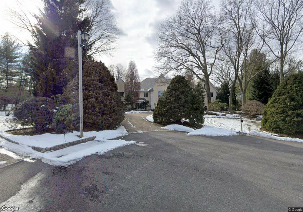
16 S Pond Rd Cresskill, NJ 07626
Estimated Value: $2,975,000 - $3,328,395
6
Beds
9
Baths
6,995
Sq Ft
$456/Sq Ft
Est. Value
About This Home
This home is located at 16 S Pond Rd, Cresskill, NJ 07626 and is currently estimated at $3,187,349, approximately $455 per square foot. 16 S Pond Rd is a home located in Bergen County with nearby schools including Cresskill High School, Spring School, and Lubavitch On The Palisades.
Ownership History
Date
Name
Owned For
Owner Type
Purchase Details
Closed on
Mar 2, 2020
Sold by
Rotenberg Jeffrey
Bought by
Gurvitz Benjamin Roei and Rafelson Rebecca Morgan
Current Estimated Value
Home Financials for this Owner
Home Financials are based on the most recent Mortgage that was taken out on this home.
Original Mortgage
$1,500,000
Outstanding Balance
$1,330,972
Interest Rate
3.6%
Mortgage Type
New Conventional
Estimated Equity
$1,856,377
Purchase Details
Closed on
Feb 26, 2005
Sold by
Hershan Clyde
Bought by
Rotenberg Jeffrey
Home Financials for this Owner
Home Financials are based on the most recent Mortgage that was taken out on this home.
Original Mortgage
$1,100,000
Interest Rate
5.61%
Create a Home Valuation Report for This Property
The Home Valuation Report is an in-depth analysis detailing your home's value as well as a comparison with similar homes in the area
Home Values in the Area
Average Home Value in this Area
Purchase History
| Date | Buyer | Sale Price | Title Company |
|---|---|---|---|
| Gurvitz Benjamin Roei | $1,875,000 | First American Title Ins Co | |
| Rotenberg Jeffrey | $3,325,000 | -- |
Source: Public Records
Mortgage History
| Date | Status | Borrower | Loan Amount |
|---|---|---|---|
| Open | Gurvitz Benjamin Roei | $1,500,000 | |
| Previous Owner | Rotenberg Jeffrey | $1,100,000 |
Source: Public Records
Tax History Compared to Growth
Tax History
| Year | Tax Paid | Tax Assessment Tax Assessment Total Assessment is a certain percentage of the fair market value that is determined by local assessors to be the total taxable value of land and additions on the property. | Land | Improvement |
|---|---|---|---|---|
| 2025 | $46,442 | $2,095,600 | $478,300 | $1,617,300 |
| 2024 | $45,810 | $2,019,200 | $455,800 | $1,563,400 |
| 2023 | $45,285 | $1,973,700 | $446,800 | $1,526,900 |
| 2022 | $45,285 | $1,881,400 | $409,800 | $1,471,600 |
| 2021 | $44,879 | $1,837,800 | $403,800 | $1,434,000 |
| 2020 | $51,612 | $2,122,200 | $401,300 | $1,720,900 |
| 2019 | $55,140 | $2,290,800 | $399,800 | $1,891,000 |
| 2018 | $39,139 | $2,321,400 | $394,800 | $1,926,600 |
| 2017 | $61,569 | $2,261,900 | $577,000 | $1,684,900 |
| 2016 | $59,737 | $2,261,900 | $577,000 | $1,684,900 |
| 2015 | $57,882 | $2,261,900 | $577,000 | $1,684,900 |
| 2014 | $56,140 | $2,261,900 | $577,000 | $1,684,900 |
Source: Public Records
Map
Nearby Homes
- 10 S Pond Rd
- 16 Fairway Ct
- 5 S Pond Rd
- 369 E Madison Ave
- 359 E Madison Ave
- 11 Fairway Ct
- 9 S Pond Rd
- 8 Fairway Ct
- 351 E Madison Ave
- 6 S Pond Rd
- 14 Mcgrath Dr
- 10 Mcgrath Dr
- 20 Mcgrath Dr
- 26 Huyler Landing Rd
- 4 Huyler Landing Rd
- 372 E Madison Ave
- 360 E Madison Ave
- 378 E Madison Ave
- 44 Mcgrath Dr
- 28 Mcgrath Dr