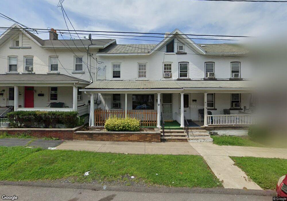
16 S Webster Ave Scranton, PA 18505
South Side NeighborhoodEstimated Value: $105,000 - $156,000
3
Beds
1
Bath
912
Sq Ft
$145/Sq Ft
Est. Value
About This Home
This home is located at 16 S Webster Ave, Scranton, PA 18505 and is currently estimated at $131,794, approximately $144 per square foot. 16 S Webster Ave is a home located in Lackawanna County with nearby schools including John G. Whittier Elementary School, South Scranton Intermediate, and Scranton High School.
Ownership History
Date
Name
Owned For
Owner Type
Purchase Details
Closed on
Jun 25, 2007
Sold by
Buskovitz Michael and Buskovitz Nancy
Bought by
Ash And Bri Llc
Current Estimated Value
Purchase Details
Closed on
May 15, 2007
Sold by
Dorohovech Judith C
Bought by
Carroll Annette
Purchase Details
Closed on
Dec 21, 2004
Sold by
Carroll Vincent J and Carroll Annette
Bought by
Dorohovech Judith C
Create a Home Valuation Report for This Property
The Home Valuation Report is an in-depth analysis detailing your home's value as well as a comparison with similar homes in the area
Home Values in the Area
Average Home Value in this Area
Purchase History
| Date | Buyer | Sale Price | Title Company |
|---|---|---|---|
| Ash And Bri Llc | $38,500 | None Available | |
| Carroll Annette | -- | None Available | |
| Dorohovech Judith C | -- | None Available |
Source: Public Records
Tax History
| Year | Tax Paid | Tax Assessment Tax Assessment Total Assessment is a certain percentage of the fair market value that is determined by local assessors to be the total taxable value of land and additions on the property. | Land | Improvement |
|---|---|---|---|---|
| 2025 | $1,674 | $5,357 | $600 | $4,757 |
| 2024 | $1,526 | $5,357 | $600 | $4,757 |
| 2023 | $1,526 | $5,357 | $600 | $4,757 |
| 2022 | $1,493 | $5,357 | $600 | $4,757 |
| 2021 | $1,493 | $5,357 | $600 | $4,757 |
| 2020 | $1,464 | $5,357 | $600 | $4,757 |
| 2019 | $1,376 | $5,357 | $600 | $4,757 |
| 2018 | $1,376 | $5,357 | $600 | $4,757 |
| 2017 | $1,351 | $5,357 | $600 | $4,757 |
| 2016 | $380 | $5,357 | $600 | $4,757 |
| 2015 | $1,005 | $5,357 | $600 | $4,757 |
| 2014 | -- | $5,357 | $600 | $4,757 |
Source: Public Records
Map
Nearby Homes
- 611 Moosic St
- 131 Prospect Ave
- 636 Orchard St
- 321 Prospect Ave
- 305 S Irving Ave
- 409 Prospect Ave
- 522 524 River St
- 432 Taylor Ave
- 217 Crown Ave
- 417 S Irving Ave
- 910 Orchard St
- 342 Harrison Ave
- 529 Taylor Ave
- 501-503 Cedar Ave
- 439 Alder St
- 1019 Moosic St
- 509 Bogart Place
- 550 Clay Ave Unit 8C
- 1513 1515 Vine St
- 315 Stafford Ave
Your Personal Tour Guide
Ask me questions while you tour the home.