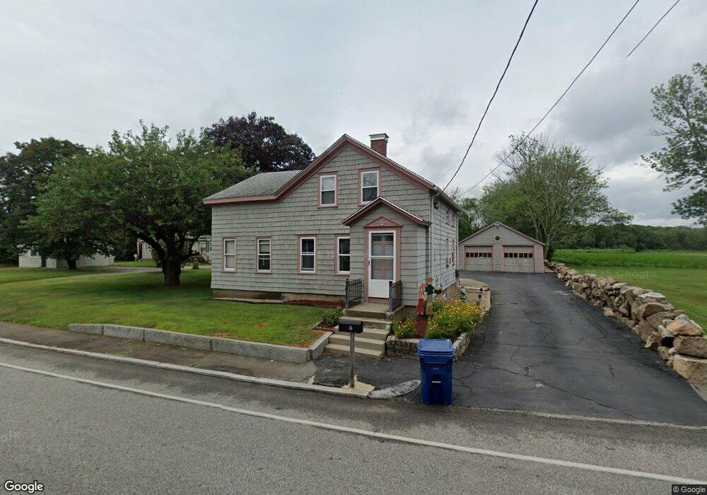
16 Sanford Rd Westport, MA 02790
North Westport NeighborhoodEstimated Value: $430,000 - $524,000
5
Beds
--
Bath
1,678
Sq Ft
$279/Sq Ft
Est. Value
About This Home
This home is located at 16 Sanford Rd, Westport, MA 02790 and is currently estimated at $468,237, approximately $279 per square foot. 16 Sanford Rd is a home located in Bristol County with nearby schools including Alice A. Macomber Primary School, Westport Elementary School, and Westport Middle-High School.
Ownership History
Date
Name
Owned For
Owner Type
Purchase Details
Closed on
Jul 24, 1996
Sold by
Paul Rita H
Bought by
Paul Michael L and Paul Nancy A
Current Estimated Value
Home Financials for this Owner
Home Financials are based on the most recent Mortgage that was taken out on this home.
Original Mortgage
$82,500
Outstanding Balance
$6,034
Interest Rate
8.37%
Mortgage Type
Purchase Money Mortgage
Estimated Equity
$462,203
Create a Home Valuation Report for This Property
The Home Valuation Report is an in-depth analysis detailing your home's value as well as a comparison with similar homes in the area
Home Values in the Area
Average Home Value in this Area
Purchase History
| Date | Buyer | Sale Price | Title Company |
|---|---|---|---|
| Paul Michael L | $110,000 | -- |
Source: Public Records
Mortgage History
| Date | Status | Borrower | Loan Amount |
|---|---|---|---|
| Open | Paul Michael L | $20,000 | |
| Open | Paul Michael L | $82,500 |
Source: Public Records
Tax History Compared to Growth
Tax History
| Year | Tax Paid | Tax Assessment Tax Assessment Total Assessment is a certain percentage of the fair market value that is determined by local assessors to be the total taxable value of land and additions on the property. | Land | Improvement |
|---|---|---|---|---|
| 2025 | $2,473 | $332,000 | $165,800 | $166,200 |
| 2024 | $2,402 | $310,800 | $146,900 | $163,900 |
| 2023 | $2,350 | $288,000 | $133,500 | $154,500 |
| 2022 | $2,290 | $270,100 | $133,500 | $136,600 |
| 2021 | $2,174 | $252,200 | $115,600 | $136,600 |
| 2020 | $2,087 | $247,600 | $111,000 | $136,600 |
| 2019 | $1,948 | $235,600 | $111,000 | $124,600 |
| 2018 | $1,769 | $216,500 | $112,100 | $104,400 |
| 2017 | $1,678 | $210,500 | $108,500 | $102,000 |
| 2016 | $1,637 | $206,900 | $104,900 | $102,000 |
| 2015 | $1,537 | $193,800 | $107,300 | $86,500 |
Source: Public Records
Map
Nearby Homes
- 128 Old Bedford Rd
- 33 William St
- 25 Beaulieu St
- 6 Beaulieu St
- 9 Register Ave
- 125 Angell St
- 34 Alsop St
- 219 Earle St Unit 3
- 217 Earle St Unit 2
- 215 Earle St Unit 1
- 37 Eaton St
- 3 Diane Way
- 85 Reney St
- 1792 Pleasant St Unit 1808
- 172 Earle St
- 89 Lafayette St
- 10 Choate St
- 383 Alden St
- 31 Choate St
- 529 Eastern Ave
- Lot 18-H Sanford Rd
- 20 Sanford Rd
- 21 Sanford Rd
- 10 Sanford Rd
- 25 Sanford Rd
- 101 Old Bedford Rd
- 15 Alberto Dr
- 14 Alberto Dr
- 14 Senechal St
- 8 Senechal St
- 93 Old Bedford Rd
- 13 Senechal St
- 41 Sanford Rd
- 11 Senechal St
- 43 Sanford Rd
- 5 Senechal St
- 22 Hebert Terrace
- 85 Old Bedford Rd
- 19 Alberto Dr
- 19 Alberto Dr Unit 2