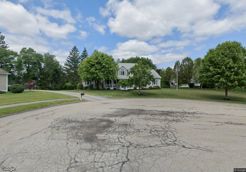
16 Saybrook Way Auburn, MA 01501
Pakachoag NeighborhoodEstimated Value: $857,890 - $985,000
4
Beds
3
Baths
3,254
Sq Ft
$290/Sq Ft
Est. Value
About This Home
This home is located at 16 Saybrook Way, Auburn, MA 01501 and is currently estimated at $943,723, approximately $290 per square foot. 16 Saybrook Way is a home located in Worcester County with nearby schools including Auburn Senior High School and Shrewsbury Montessori School - Auburn Campus.
Ownership History
Date
Name
Owned For
Owner Type
Purchase Details
Closed on
May 31, 2001
Sold by
Emerson Homes Inc
Bought by
Bonzey John R and Bonzey Deborah M
Current Estimated Value
Home Financials for this Owner
Home Financials are based on the most recent Mortgage that was taken out on this home.
Original Mortgage
$200,000
Interest Rate
7.09%
Mortgage Type
Purchase Money Mortgage
Create a Home Valuation Report for This Property
The Home Valuation Report is an in-depth analysis detailing your home's value as well as a comparison with similar homes in the area
Home Values in the Area
Average Home Value in this Area
Purchase History
| Date | Buyer | Sale Price | Title Company |
|---|---|---|---|
| Bonzey John R | $392,892 | -- |
Source: Public Records
Mortgage History
| Date | Status | Borrower | Loan Amount |
|---|---|---|---|
| Open | Bonzey John R | $208,000 | |
| Closed | Bonzey John R | $196,305 | |
| Closed | Bonzey John R | $200,000 |
Source: Public Records
Tax History Compared to Growth
Tax History
| Year | Tax Paid | Tax Assessment Tax Assessment Total Assessment is a certain percentage of the fair market value that is determined by local assessors to be the total taxable value of land and additions on the property. | Land | Improvement |
|---|---|---|---|---|
| 2025 | $121 | $844,900 | $177,400 | $667,500 |
| 2024 | $12,331 | $825,900 | $170,700 | $655,200 |
| 2023 | $11,596 | $730,200 | $144,900 | $585,300 |
| 2022 | $10,592 | $629,700 | $144,900 | $484,800 |
| 2021 | $10,525 | $580,200 | $128,000 | $452,200 |
| 2020 | $10,432 | $580,200 | $128,000 | $452,200 |
| 2019 | $6,180 | $569,400 | $126,800 | $442,600 |
| 2018 | $5,957 | $563,300 | $118,600 | $444,700 |
| 2017 | $5,766 | $544,200 | $107,500 | $436,700 |
| 2016 | $9,761 | $539,600 | $110,900 | $428,700 |
| 2015 | $9,279 | $537,600 | $110,900 | $426,700 |
| 2014 | $9,165 | $530,100 | $105,500 | $424,600 |
Source: Public Records
Map
Nearby Homes
- 204-212 Hampton St
- 61 Elmwood St
- 22 Lesley Ave
- 2 Breezy Bend
- 37 Elmwood St
- 3 Lower Windbrook Dr
- 47 Washington St Unit 26
- 6 Newton St
- 326 Pakachoag St
- 2 Mystic St
- 72 Sophia Dr
- 30 Davenport St
- 29 Steele St
- 557 SW Cutoff Unit 107
- 557 SW Cutoff Unit 17
- 557 SW Cutoff Unit 79
- 557 SW Cutoff Unit 35
- 55 Tennyson St
- 10 Steele St
- 52 Harrison Ave