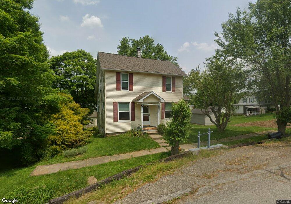
16 Scott Ave Butler, OH 44822
Estimated Value: $166,673 - $203,000
3
Beds
1
Bath
1,589
Sq Ft
$115/Sq Ft
Est. Value
About This Home
This home is located at 16 Scott Ave, Butler, OH 44822 and is currently estimated at $182,418, approximately $114 per square foot. 16 Scott Ave is a home located in Richland County with nearby schools including Clear Fork High School.
Ownership History
Date
Name
Owned For
Owner Type
Purchase Details
Closed on
Jan 19, 2011
Sold by
Taylor Barbara K and Taylor Ronnie C
Bought by
Taylor Barbara K and Taylor Ronnie C
Current Estimated Value
Home Financials for this Owner
Home Financials are based on the most recent Mortgage that was taken out on this home.
Original Mortgage
$36,450
Interest Rate
4.82%
Mortgage Type
New Conventional
Purchase Details
Closed on
Sep 20, 1993
Sold by
Burkhardt Terry J
Bought by
Burkhardt Terry J
Purchase Details
Closed on
Mar 27, 1992
Sold by
Ousley Wayne
Bought by
Burkhardt Terry J
Create a Home Valuation Report for This Property
The Home Valuation Report is an in-depth analysis detailing your home's value as well as a comparison with similar homes in the area
Home Values in the Area
Average Home Value in this Area
Purchase History
| Date | Buyer | Sale Price | Title Company |
|---|---|---|---|
| Taylor Barbara K | -- | Chicago Title | |
| Burkhardt Terry J | $58,000 | -- | |
| Burkhardt Terry J | $47,000 | -- |
Source: Public Records
Mortgage History
| Date | Status | Borrower | Loan Amount |
|---|---|---|---|
| Closed | Taylor Barbara K | $36,450 |
Source: Public Records
Tax History Compared to Growth
Tax History
| Year | Tax Paid | Tax Assessment Tax Assessment Total Assessment is a certain percentage of the fair market value that is determined by local assessors to be the total taxable value of land and additions on the property. | Land | Improvement |
|---|---|---|---|---|
| 2024 | $1,395 | $34,770 | $4,560 | $30,210 |
| 2023 | $1,395 | $34,770 | $4,560 | $30,210 |
| 2022 | $1,177 | $27,870 | $4,330 | $23,540 |
| 2021 | $1,270 | $27,870 | $4,330 | $23,540 |
| 2020 | $1,270 | $27,870 | $4,330 | $23,540 |
| 2019 | $1,149 | $23,740 | $3,660 | $20,080 |
| 2018 | $1,139 | $23,740 | $3,660 | $20,080 |
| 2017 | $1,073 | $23,740 | $3,660 | $20,080 |
| 2016 | $1,042 | $23,180 | $3,560 | $19,620 |
| 2015 | $1,042 | $23,180 | $3,560 | $19,620 |
| 2014 | $1,039 | $23,180 | $3,560 | $19,620 |
| 2012 | $519 | $23,890 | $3,660 | $20,230 |
Source: Public Records
Map
Nearby Homes
- 3898 Ohio 97
- 128 College St
- 224 Blue Bird Dr
- 5449 Hagerman Rd
- 1259 State Route 97 E
- 1260 Ohio 97 Unit 115
- 2070 Riggle Rd
- 1169 State Route 97 E
- 21625 N Liberty Rd
- 4978 Bott Rd
- 5042 Possum Run Rd
- 4169 State Route 97
- 0 Mishey Rd
- 4234 Swigart Rd
- 361 Honey Creek Rd E
- 6533 Durbin Rd
- 0 Kenton Rd
- 6509 Ankneytown Rd
- 76 Smith Rd
- 70 Betty Dr