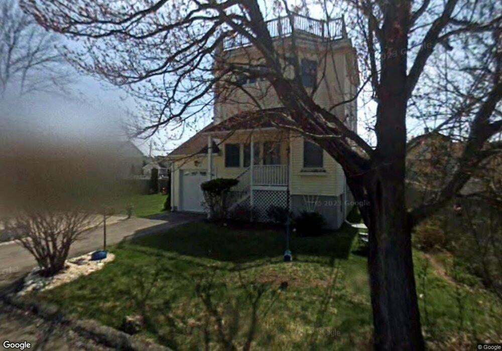
16 Scott St Milford, CT 06460
Devon NeighborhoodEstimated Value: $733,206 - $887,000
3
Beds
4
Baths
2,010
Sq Ft
$405/Sq Ft
Est. Value
About This Home
This home is located at 16 Scott St, Milford, CT 06460 and is currently estimated at $814,552, approximately $405 per square foot. 16 Scott St is a home located in New Haven County with nearby schools including Meadowside School, West Shore Middle School, and Jonathan Law High School.
Ownership History
Date
Name
Owned For
Owner Type
Purchase Details
Closed on
Sep 19, 2008
Sold by
Perry Paul M and Ecsedy Judith A
Bought by
Mccloud Robert C
Current Estimated Value
Home Financials for this Owner
Home Financials are based on the most recent Mortgage that was taken out on this home.
Original Mortgage
$280,000
Interest Rate
6.54%
Purchase Details
Closed on
Apr 17, 1998
Sold by
Carlucci Ronald J
Bought by
Perry Paul and Ecsedy Judith
Purchase Details
Closed on
Aug 15, 1997
Sold by
Markham Clay J
Bought by
Carlucci Ronald J
Purchase Details
Closed on
May 19, 1995
Sold by
Magowan Frances A Est
Bought by
Markham Clay J
Create a Home Valuation Report for This Property
The Home Valuation Report is an in-depth analysis detailing your home's value as well as a comparison with similar homes in the area
Home Values in the Area
Average Home Value in this Area
Purchase History
| Date | Buyer | Sale Price | Title Company |
|---|---|---|---|
| Mccloud Robert C | $480,000 | -- | |
| Mccloud Robert C | $480,000 | -- | |
| Perry Paul | $215,000 | -- | |
| Perry Paul | $215,000 | -- | |
| Carlucci Ronald J | $198,200 | -- | |
| Carlucci Ronald J | $198,200 | -- | |
| Markham Clay J | $47,500 | -- | |
| Markham Clay J | $47,500 | -- |
Source: Public Records
Mortgage History
| Date | Status | Borrower | Loan Amount |
|---|---|---|---|
| Closed | Markham Clay J | $296,500 | |
| Closed | Markham Clay J | $280,000 |
Source: Public Records
Tax History
| Year | Tax Paid | Tax Assessment Tax Assessment Total Assessment is a certain percentage of the fair market value that is determined by local assessors to be the total taxable value of land and additions on the property. | Land | Improvement |
|---|---|---|---|---|
| 2025 | $10,239 | $346,490 | $167,650 | $178,840 |
| 2024 | $10,097 | $346,490 | $167,650 | $178,840 |
| 2023 | $9,414 | $346,490 | $167,650 | $178,840 |
| 2022 | $9,234 | $346,490 | $167,650 | $178,840 |
| 2021 | $7,497 | $271,140 | $114,240 | $156,900 |
| 2020 | $7,505 | $271,140 | $114,240 | $156,900 |
| 2019 | $7,513 | $271,140 | $114,240 | $156,900 |
| 2018 | $7,521 | $271,140 | $114,240 | $156,900 |
| 2017 | $7,535 | $271,140 | $114,240 | $156,900 |
| 2016 | $7,514 | $269,900 | $110,880 | $159,020 |
| 2015 | $7,525 | $269,900 | $110,880 | $159,020 |
| 2014 | $7,347 | $269,900 | $110,880 | $159,020 |
Source: Public Records
Map
Nearby Homes
- 12 Caroline St
- 47 James St
- 9 Cooper Ave
- 38 Wayland Rd
- 76 Meadowside Rd
- 23 Charles St
- 52 Elder St
- 30 Kinlock St
- 139 Rogers Ave
- 308 Meadowside Rd Unit 202
- 308 Meadowside Rd Unit 311
- 8 Oyster Landing Rd
- 13 Dock Rd
- 85 Viscount Dr Unit A26
- 85 Viscount Dr Unit 2F
- 85 Viscount Dr Unit B21
- 85 Viscount Dr Unit 13B
- 85 Viscount Dr Unit B22
- 663 West Ave Unit A22
- 26 Hill St
- 17 Maddox Ave
- 17 Maddox Ave Unit 1/2
- 17 Maddox Ave Unit B
- 17 Maddox Ave Unit A
- 15 Maddox Ave
- 10 Scott St
- 11 Maddox Ave
- 6 Scott St
- 9 Maddox Ave
- 21 Maddox Ave
- 4 Scott St
- 23 Maddox Ave
- 862 E Broadway
- 864 E Broadway Unit 1
- 858 E Broadway
- 25 Maddox Ave
- 14 Maddox Ave
- 856 E Broadway
- 12 Maddox Ave
- 25 Maddox Ave
Your Personal Tour Guide
Ask me questions while you tour the home.