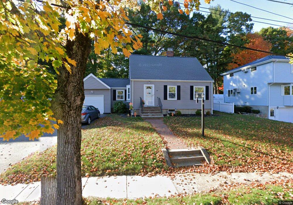
16 Seward Rd Stoneham, MA 02180
Bear Hill NeighborhoodEstimated Value: $800,000 - $870,000
3
Beds
3
Baths
1,932
Sq Ft
$428/Sq Ft
Est. Value
About This Home
This home is located at 16 Seward Rd, Stoneham, MA 02180 and is currently estimated at $827,279, approximately $428 per square foot. 16 Seward Rd is a home located in Middlesex County with nearby schools including Stoneham High School, St. Patrick Elementary School, and St Joseph School.
Ownership History
Date
Name
Owned For
Owner Type
Purchase Details
Closed on
Dec 9, 1991
Sold by
Gerow Leo I and Gerow Margaret E
Bought by
Pineau John R and Pineau Kristin D
Current Estimated Value
Create a Home Valuation Report for This Property
The Home Valuation Report is an in-depth analysis detailing your home's value as well as a comparison with similar homes in the area
Home Values in the Area
Average Home Value in this Area
Purchase History
| Date | Buyer | Sale Price | Title Company |
|---|---|---|---|
| Pineau John R | $149,000 | -- | |
| Pineau John R | $149,000 | -- |
Source: Public Records
Mortgage History
| Date | Status | Borrower | Loan Amount |
|---|---|---|---|
| Open | Pineau John R | $265,000 | |
| Closed | Pineau John R | $240,000 | |
| Closed | Pineau John R | $160,000 |
Source: Public Records
Tax History
| Year | Tax Paid | Tax Assessment Tax Assessment Total Assessment is a certain percentage of the fair market value that is determined by local assessors to be the total taxable value of land and additions on the property. | Land | Improvement |
|---|---|---|---|---|
| 2025 | $7,216 | $705,400 | $379,400 | $326,000 |
| 2024 | $6,872 | $648,900 | $350,900 | $298,000 |
| 2023 | $6,702 | $603,800 | $322,400 | $281,400 |
| 2022 | $5,931 | $569,700 | $303,500 | $266,200 |
| 2021 | $5,619 | $550,800 | $284,500 | $266,300 |
| 2020 | $5,807 | $538,200 | $281,400 | $256,800 |
| 2019 | $5,589 | $498,100 | $258,800 | $239,300 |
| 2018 | $5,524 | $471,700 | $234,500 | $237,200 |
| 2017 | $5,334 | $430,500 | $220,200 | $210,300 |
| 2016 | $5,268 | $414,800 | $220,200 | $194,600 |
| 2015 | $5,157 | $397,900 | $220,200 | $177,700 |
| 2014 | $5,030 | $372,900 | $201,800 | $171,100 |
Source: Public Records
Map
Nearby Homes
- 62 High St Unit Lot 8
- 62 High St Unit 4
- 62 High St Unit Lot 5
- 62 High St Unit Lot 12
- 8 Steele St
- 58 Washington St
- 35 Tremont St
- 3 Valley Rd
- 21 Tremont St Unit B
- 21 Tremont St Unit A
- 1 Tremont St
- 159 Main St Unit 27C
- 159 Main St Unit 39A
- 4 Garfield Ave
- 98 Main St Unit 2
- 11 Valdora Dr
- 66 Main St Unit 15A
- 12 Isola Ln
- 64 Main St Unit 24B
- 68 Main St Unit 21C
Your Personal Tour Guide
Ask me questions while you tour the home.