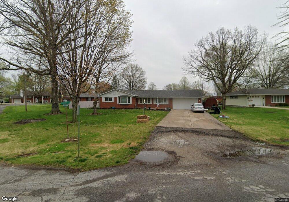
16 Sherry Ln Unit 1 Rochester, IL 62563
Estimated Value: $132,000 - $225,000
--
Bed
--
Bath
--
Sq Ft
0.33
Acres
About This Home
This home is located at 16 Sherry Ln Unit 1, Rochester, IL 62563 and is currently estimated at $170,383. 16 Sherry Ln Unit 1 is a home located in Sangamon County with nearby schools including Rochester Elementary Ec-1 School, Rochester Intermediate School, and Rochester Elementary School.
Ownership History
Date
Name
Owned For
Owner Type
Purchase Details
Closed on
Jul 16, 2025
Sold by
Anthony Phyllis A and Patterson Phyllis A
Bought by
Harris Jennifer R and Farris Sean D
Current Estimated Value
Home Financials for this Owner
Home Financials are based on the most recent Mortgage that was taken out on this home.
Original Mortgage
$150,000
Outstanding Balance
$149,777
Interest Rate
7.5%
Mortgage Type
New Conventional
Estimated Equity
$20,606
Purchase Details
Closed on
Oct 3, 2005
Create a Home Valuation Report for This Property
The Home Valuation Report is an in-depth analysis detailing your home's value as well as a comparison with similar homes in the area
Home Values in the Area
Average Home Value in this Area
Purchase History
| Date | Buyer | Sale Price | Title Company |
|---|---|---|---|
| Harris Jennifer R | $130,000 | Advanced Title | |
| -- | $116,000 | -- |
Source: Public Records
Mortgage History
| Date | Status | Borrower | Loan Amount |
|---|---|---|---|
| Open | Harris Jennifer R | $150,000 |
Source: Public Records
Tax History Compared to Growth
Tax History
| Year | Tax Paid | Tax Assessment Tax Assessment Total Assessment is a certain percentage of the fair market value that is determined by local assessors to be the total taxable value of land and additions on the property. | Land | Improvement |
|---|---|---|---|---|
| 2024 | $3,820 | $53,915 | $11,347 | $42,568 |
| 2023 | $3,754 | $51,211 | $10,778 | $40,433 |
| 2022 | $3,620 | $48,490 | $10,205 | $38,285 |
| 2021 | $3,482 | $46,553 | $9,797 | $36,756 |
| 2020 | $3,419 | $45,955 | $9,671 | $36,284 |
| 2019 | $3,357 | $46,255 | $9,734 | $36,521 |
| 2018 | $3,330 | $45,513 | $9,578 | $35,935 |
| 2017 | $3,280 | $45,032 | $9,477 | $35,555 |
| 2016 | $2,914 | $39,890 | $5,505 | $34,385 |
| 2015 | $2,901 | $39,530 | $5,455 | $34,075 |
| 2014 | $2,881 | $39,240 | $5,415 | $33,825 |
| 2013 | $2,840 | $38,790 | $5,353 | $33,437 |
Source: Public Records
Map
Nearby Homes
- 525 E Mill St Unit 1
- 217 E Main St Unit 1
- 427 Spring Ridge
- 112 Deer Creek Rd Unit 1
- 1204 W Main St
- 27 Mishawaka Dr Unit 1
- 5 Swannanoa Unit 1
- 46 Woodland Trail
- 2265 Jostes Rd
- 3440 Woodhaven Dr Unit 1
- 3491 Woodhaven Dr
- 3149 Beaver Creek Ln
- 3810 Bristlecone Dr Unit 2
- 3120 Red Bud Ln
- 4315 Sage Rd
- 3504 Hoylake Dr
- 329-331 Harbor Point Place
- 312 Harbor Point Place
- 314 Harbor Point Place
- 66 White Birch Rd
- 17 Walberta Dr
- 15 Sherry Ln Unit 1
- 18 Walberta Unit 1
- 0 Walberta Dr
- 14 Sherry Ln Unit 1
- 19 Walberta Dr Unit 1
- 1 Walberta Unit 1
- 1 Walberta Unit 1
- 1 Walberta
- 13 Sherry Ln Unit 1
- 4 Walberta Dr Unit 1
- 3 Walberta Dr Unit 1
- 21 Walberta Dr Unit 1
- 2 Walberta Dr Unit 1
- 20 Walberta Dr Unit 1
- 5 Walberta Dr
- 22 Walberta Unit 1
- 6 Walberta Dr
- 23 Sherry Ln Unit 1
- 7 Walberta Dr Unit 1