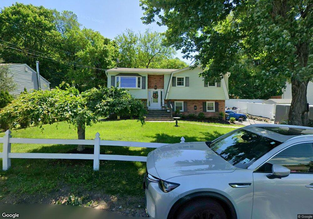
16 Shore Rd Andover, NJ 07821
Estimated Value: $379,118 - $442,000
Studio
--
Bath
1,460
Sq Ft
$281/Sq Ft
Est. Value
About This Home
This home is located at 16 Shore Rd, Andover, NJ 07821 and is currently estimated at $410,030, approximately $280 per square foot. 16 Shore Rd is a home located in Sussex County with nearby schools including Green Hills School and Tranquility Adventist School.
Ownership History
Date
Name
Owned For
Owner Type
Purchase Details
Closed on
Jun 28, 2002
Sold by
Policastro Joseph G and Policastro Arlene G
Bought by
Marschall Ronald and Marschall Laura
Current Estimated Value
Home Financials for this Owner
Home Financials are based on the most recent Mortgage that was taken out on this home.
Original Mortgage
$194,750
Outstanding Balance
$83,202
Interest Rate
6.82%
Estimated Equity
$326,828
Purchase Details
Closed on
Apr 8, 2000
Sold by
Greene Norlburt A and Greene Doris M
Bought by
Policastro Joseph G and Policastro Arlene G
Home Financials for this Owner
Home Financials are based on the most recent Mortgage that was taken out on this home.
Original Mortgage
$80,400
Interest Rate
8.26%
Create a Home Valuation Report for This Property
The Home Valuation Report is an in-depth analysis detailing your home's value as well as a comparison with similar homes in the area
Home Values in the Area
Average Home Value in this Area
Purchase History
| Date | Buyer | Sale Price | Title Company |
|---|---|---|---|
| Marschall Ronald | $205,000 | First American Title Ins Co | |
| Policastro Joseph G | $134,000 | -- |
Source: Public Records
Mortgage History
| Date | Status | Borrower | Loan Amount |
|---|---|---|---|
| Open | Marschall Ronald | $194,750 | |
| Previous Owner | Policastro Joseph G | $80,400 |
Source: Public Records
Tax History
| Year | Tax Paid | Tax Assessment Tax Assessment Total Assessment is a certain percentage of the fair market value that is determined by local assessors to be the total taxable value of land and additions on the property. | Land | Improvement |
|---|---|---|---|---|
| 2025 | $6,278 | $333,800 | $141,000 | $192,800 |
| 2024 | $6,233 | $161,300 | $69,200 | $92,100 |
Source: Public Records
Map
Nearby Homes
- 0 Decker Pond Airport Rd Unit 3945534
- 4 Spruce Dr
- 95 Forest Rd
- 30 Scenic Dr
- 10 Sunny Ln
- 34 Allamuchy Trail
- 88 Kennedy Rd
- 37 Pequest Rd
- 30 MacKerley Rd
- 6 Jans Way
- 3 Roger Dr
- 8 Cub Lake Rd
- 00 Forest Lakes Dr
- 153 Forest Lake Dr N
- 56A Sleepy Hollow Rd
- 24 the Rotunda
- 203 Johnsonburg Rd
- 9 Newton Ave
- 2 Robert St
- 7 U S Highway 206