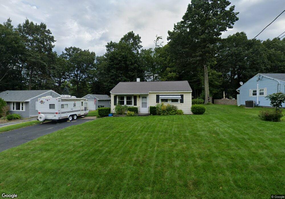
16 Somerset Ln Holden, MA 01520
Estimated Value: $384,000 - $414,000
2
Beds
1
Bath
960
Sq Ft
$418/Sq Ft
Est. Value
About This Home
This home is located at 16 Somerset Ln, Holden, MA 01520 and is currently estimated at $400,848, approximately $417 per square foot. 16 Somerset Ln is a home located in Worcester County with nearby schools including Wachusett Regional High School, Abby Kelley Foster Charter Public School, and Bancroft School.
Create a Home Valuation Report for This Property
The Home Valuation Report is an in-depth analysis detailing your home's value as well as a comparison with similar homes in the area
Home Values in the Area
Average Home Value in this Area
Tax History Compared to Growth
Tax History
| Year | Tax Paid | Tax Assessment Tax Assessment Total Assessment is a certain percentage of the fair market value that is determined by local assessors to be the total taxable value of land and additions on the property. | Land | Improvement |
|---|---|---|---|---|
| 2025 | $4,597 | $331,700 | $151,400 | $180,300 |
| 2024 | $4,147 | $293,100 | $146,900 | $146,200 |
| 2023 | $3,969 | $264,800 | $127,700 | $137,100 |
| 2022 | $3,774 | $227,900 | $99,800 | $128,100 |
| 2021 | $3,663 | $210,500 | $95,000 | $115,500 |
| 2020 | $3,380 | $198,800 | $90,500 | $108,300 |
| 2019 | $3,342 | $191,500 | $90,500 | $101,000 |
| 2018 | $3,048 | $173,100 | $86,200 | $86,900 |
| 2017 | $533 | $169,700 | $86,200 | $83,500 |
| 2016 | $2,798 | $162,200 | $82,100 | $80,100 |
| 2015 | $2,818 | $155,500 | $82,100 | $73,400 |
| 2014 | $2,760 | $155,500 | $82,100 | $73,400 |
Source: Public Records
Map
Nearby Homes
- 314 Main St
- 27 Mayflower Cir
- 23 Gail Dr
- 189 Holden St
- 27 Tea Party Cir Unit 27
- 2 Explorers Way Unit 2
- 160 Shrewsbury St
- 9 Birchwood Dr
- 250 Shrewsbury St
- 156 Newell Rd
- 308 Holden St
- 48 Lexington Cir
- 47 Banbury Ln
- 9 Emily St
- 527 Salisbury St
- 15 Lowell Ave
- 10 Sumac Cir
- 168 Twinbrooke Dr
- 8 (Lot 1) Holmes Dr
- 29 Glenwood St