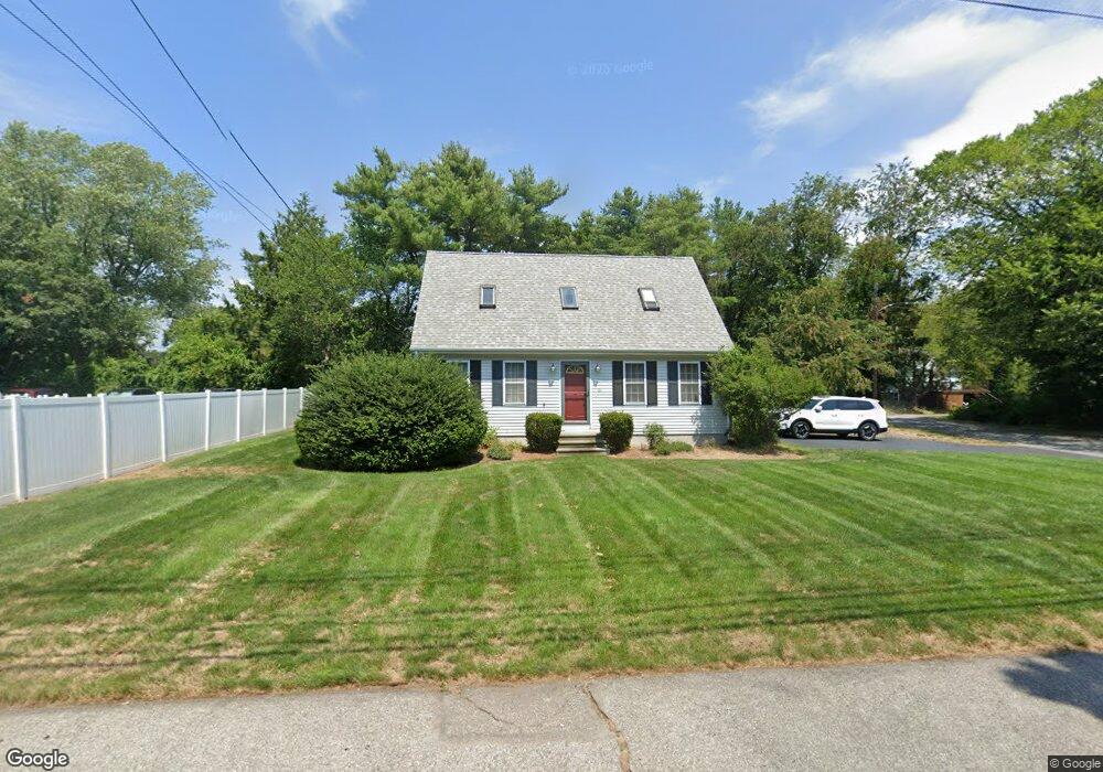
16 Thurber Ave Attleboro, MA 02703
Estimated Value: $520,000 - $539,000
3
Beds
2
Baths
1,387
Sq Ft
$380/Sq Ft
Est. Value
About This Home
This home is located at 16 Thurber Ave, Attleboro, MA 02703 and is currently estimated at $526,855, approximately $379 per square foot. 16 Thurber Ave is a home located in Bristol County with nearby schools including Peter Thacher Elementary School, Robert J. Coelho Middle School, and Attleboro High School.
Ownership History
Date
Name
Owned For
Owner Type
Purchase Details
Closed on
Jan 29, 2001
Sold by
Green Sean M and Green Patti L
Bought by
Pasquarose Paul J and Pasquarose Kelly J
Current Estimated Value
Home Financials for this Owner
Home Financials are based on the most recent Mortgage that was taken out on this home.
Original Mortgage
$168,300
Interest Rate
7.39%
Mortgage Type
Purchase Money Mortgage
Purchase Details
Closed on
May 13, 1996
Sold by
Parent Joseph E and Parent Priscilla R
Bought by
Caponigro Timothy J
Purchase Details
Closed on
Apr 30, 1996
Sold by
Boyce Michael R and Boyce Dorothy C
Bought by
Parent Joseph E and Parent Priscilla R
Create a Home Valuation Report for This Property
The Home Valuation Report is an in-depth analysis detailing your home's value as well as a comparison with similar homes in the area
Home Values in the Area
Average Home Value in this Area
Purchase History
| Date | Buyer | Sale Price | Title Company |
|---|---|---|---|
| Pasquarose Paul J | $187,000 | -- | |
| Caponigro Timothy J | $52,000 | -- | |
| Parent Joseph E | $39,000 | -- |
Source: Public Records
Mortgage History
| Date | Status | Borrower | Loan Amount |
|---|---|---|---|
| Open | Parent Joseph E | $50,000 | |
| Open | Parent Joseph E | $171,000 | |
| Closed | Parent Joseph E | $168,300 |
Source: Public Records
Tax History
| Year | Tax Paid | Tax Assessment Tax Assessment Total Assessment is a certain percentage of the fair market value that is determined by local assessors to be the total taxable value of land and additions on the property. | Land | Improvement |
|---|---|---|---|---|
| 2025 | $5,327 | $424,500 | $135,800 | $288,700 |
| 2024 | $5,135 | $403,400 | $135,800 | $267,600 |
| 2023 | $4,783 | $349,400 | $123,500 | $225,900 |
| 2022 | $4,501 | $311,500 | $117,600 | $193,900 |
| 2021 | $4,378 | $295,800 | $113,100 | $182,700 |
| 2020 | $4,171 | $286,500 | $109,800 | $176,700 |
| 2019 | $3,921 | $276,900 | $107,700 | $169,200 |
| 2018 | $3,709 | $250,300 | $104,600 | $145,700 |
| 2017 | $3,585 | $246,400 | $104,600 | $141,800 |
| 2016 | $3,472 | $234,300 | $102,500 | $131,800 |
| 2015 | $3,276 | $222,700 | $102,500 | $120,200 |
| 2014 | $3,190 | $214,800 | $97,700 | $117,100 |
Source: Public Records
Map
Nearby Homes
- 124 Tiffany St
- 19 Amber Ln
- 52 Carpenter St
- 88 Sandalwood Dr
- 7 Dailey St Unit I
- 6 Dailey St Unit J
- 205 Knight Ave Unit 1
- 152 R Burnside Ave
- Lot B Burnside Ave
- 457 Tiffany St
- 0 Joseph St Unit 73469304
- 0 Tulip Unit 73482326
- 0 Tulip Unit 73482330
- 855 County St Unit 2
- 1251 S Main St
- 6 Cross St
- 126 Linden St Unit A
- 142 Fisher St Unit B
- 142 Fisher St Unit A
- 78 Saveena Dr
Your Personal Tour Guide
Ask me questions while you tour the home.