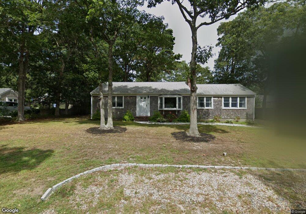
16 Uncle Bobs Way South Dennis, MA 02660
South Dennis NeighborhoodEstimated Value: $401,000 - $594,000
3
Beds
1
Bath
1,187
Sq Ft
$450/Sq Ft
Est. Value
About This Home
This home is located at 16 Uncle Bobs Way, South Dennis, MA 02660 and is currently estimated at $534,315, approximately $450 per square foot. 16 Uncle Bobs Way is a home located in Barnstable County with nearby schools including Dennis-Yarmouth Regional High School.
Ownership History
Date
Name
Owned For
Owner Type
Purchase Details
Closed on
Jan 28, 2021
Sold by
Gallagher Pauline P
Bought by
P Pearsall Gallagher Lt
Current Estimated Value
Purchase Details
Closed on
Jun 24, 1987
Sold by
Shea Elizabeth M
Bought by
Gallagher Thomas W
Home Financials for this Owner
Home Financials are based on the most recent Mortgage that was taken out on this home.
Original Mortgage
$140,000
Interest Rate
10.5%
Mortgage Type
Purchase Money Mortgage
Create a Home Valuation Report for This Property
The Home Valuation Report is an in-depth analysis detailing your home's value as well as a comparison with similar homes in the area
Home Values in the Area
Average Home Value in this Area
Purchase History
| Date | Buyer | Sale Price | Title Company |
|---|---|---|---|
| P Pearsall Gallagher Lt | -- | None Available | |
| Gallagher Thomas W | $124,000 | -- |
Source: Public Records
Mortgage History
| Date | Status | Borrower | Loan Amount |
|---|---|---|---|
| Previous Owner | Gallagher Thomas W | $140,000 |
Source: Public Records
Tax History Compared to Growth
Tax History
| Year | Tax Paid | Tax Assessment Tax Assessment Total Assessment is a certain percentage of the fair market value that is determined by local assessors to be the total taxable value of land and additions on the property. | Land | Improvement |
|---|---|---|---|---|
| 2025 | $2,440 | $563,500 | $131,100 | $432,400 |
| 2024 | $2,295 | $522,700 | $126,100 | $396,600 |
| 2023 | $2,219 | $475,200 | $114,600 | $360,600 |
| 2022 | $2,129 | $380,100 | $114,700 | $265,400 |
| 2021 | $2,007 | $332,800 | $112,500 | $220,300 |
| 2020 | $3,352 | $312,300 | $112,500 | $199,800 |
| 2019 | $3,458 | $298,800 | $121,300 | $177,500 |
| 2018 | $1,675 | $264,200 | $105,000 | $159,200 |
| 2017 | $3,400 | $259,000 | $105,000 | $154,000 |
| 2016 | $1,548 | $237,000 | $110,200 | $126,800 |
| 2015 | $1,517 | $237,000 | $110,200 | $126,800 |
| 2014 | $1,444 | $227,400 | $94,500 | $132,900 |
Source: Public Records
Map
Nearby Homes
- 11 Uncle Stanleys Way
- 153 Bayridge Dr
- 15 Captain Jud Rd
- 4 Ebb Rd
- 17 Margate Ln
- 13 Covey Dr
- 118 Driftwood Ln
- 10 Joanne Dr
- 17 Fairmount Rd
- 17 Fairmount Rd
- 111 Merchant Ave
- 129 Driftwood Ln
- 25 Skerry Rd
- 7 Vinland Dr
- 32 Captain Walsh Dr
- 6 Nimble Hill Dr
- 1 Norseman Dr
- 59 Main St Unit 19-2
- 59 Route 6a Unit 29-4
- 62 Old Fish House Rd
- 15 Uncle Stanleys Way
- 12 Uncle Bobs Way
- 20 Uncle Bobs Way
- 19 Uncle Stanleys Way
- 15 Uncle Bobs Way
- 11 Uncle Bobs Way
- 19 Uncle Bobs Way
- 25 Uncle Stanley
- 24 Uncle Bob's Way
- 12 Uncle Bob's Way
- 8 Uncle Bobs Way
- 25 Uncle Stanleys Way
- 24 Uncle Bobs Way
- 19 Uncle Stanley
- 7 Uncle Bobs Way
- 14 Uncle Bills Way
- 23 Uncle Bobs Way
- 5 Uncle Stanleys Way
- 10 Uncle Bills Way
- 20 Uncle Stanleys Way