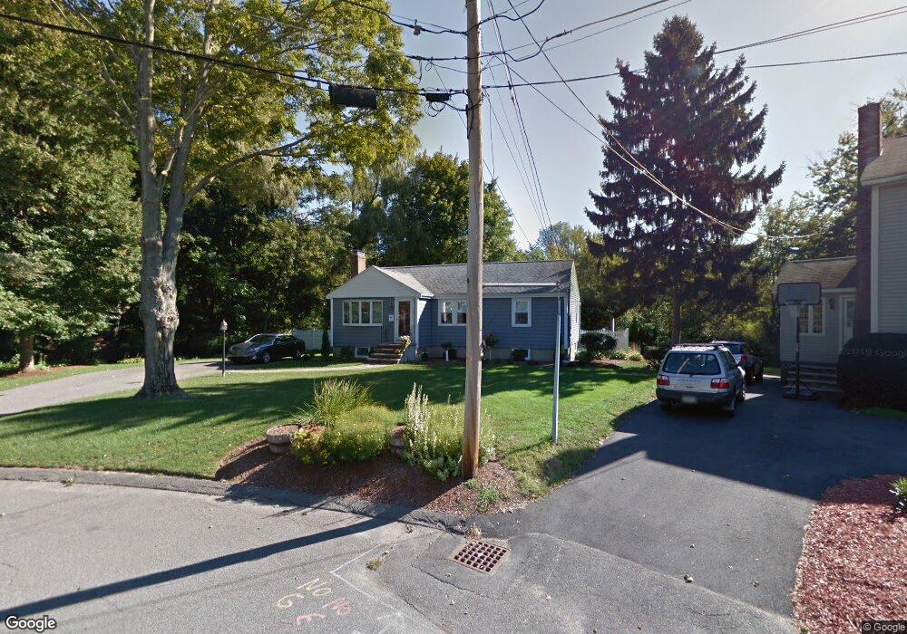
16 Wayland Rd Wakefield, MA 01880
Lakeside NeighborhoodEstimated Value: $703,000 - $795,000
3
Beds
1
Bath
1,381
Sq Ft
$537/Sq Ft
Est. Value
About This Home
This home is located at 16 Wayland Rd, Wakefield, MA 01880 and is currently estimated at $741,146, approximately $536 per square foot. 16 Wayland Rd is a home located in Middlesex County with nearby schools including Wakefield Memorial High School, St Joseph School, and Odyssey Day School.
Ownership History
Date
Name
Owned For
Owner Type
Purchase Details
Closed on
Aug 30, 2018
Sold by
Dicecca Ralph J and Dicecca Karen M
Bought by
Dicecca Ft
Current Estimated Value
Purchase Details
Closed on
Aug 1, 1986
Bought by
Dicecca Ralph J and Dicecca Karen M
Create a Home Valuation Report for This Property
The Home Valuation Report is an in-depth analysis detailing your home's value as well as a comparison with similar homes in the area
Home Values in the Area
Average Home Value in this Area
Purchase History
| Date | Buyer | Sale Price | Title Company |
|---|---|---|---|
| Dicecca Ft | -- | -- | |
| Dicecca Ralph J | -- | -- |
Source: Public Records
Mortgage History
| Date | Status | Borrower | Loan Amount |
|---|---|---|---|
| Previous Owner | Dicecca Ralph J | $303,750 | |
| Previous Owner | Dicecca Ralph J | $70,000 | |
| Previous Owner | Dicecca Ralph J | $35,000 |
Source: Public Records
Tax History Compared to Growth
Tax History
| Year | Tax Paid | Tax Assessment Tax Assessment Total Assessment is a certain percentage of the fair market value that is determined by local assessors to be the total taxable value of land and additions on the property. | Land | Improvement |
|---|---|---|---|---|
| 2025 | $7,336 | $646,300 | $422,700 | $223,600 |
| 2024 | $7,058 | $627,400 | $410,300 | $217,100 |
| 2023 | $6,815 | $581,000 | $379,900 | $201,100 |
| 2022 | $6,509 | $528,300 | $345,400 | $182,900 |
| 2021 | $6,245 | $490,600 | $323,500 | $167,100 |
| 2020 | $6,006 | $470,300 | $310,100 | $160,200 |
| 2019 | $5,826 | $454,100 | $299,400 | $154,700 |
| 2018 | $5,513 | $425,700 | $280,700 | $145,000 |
| 2017 | $5,282 | $405,400 | $267,300 | $138,100 |
| 2016 | $5,159 | $382,400 | $248,800 | $133,600 |
| 2015 | $4,820 | $357,600 | $232,600 | $125,000 |
| 2014 | $4,428 | $346,500 | $225,300 | $121,200 |
Source: Public Records
Map
Nearby Homes