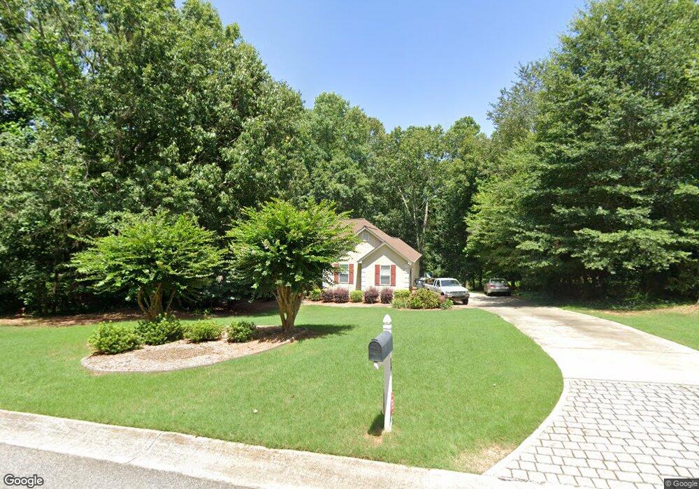
16 Weatherstone Way Sharpsburg, GA 30277
Estimated Value: $396,383 - $436,000
3
Beds
2
Baths
1,917
Sq Ft
$216/Sq Ft
Est. Value
About This Home
This home is located at 16 Weatherstone Way, Sharpsburg, GA 30277 and is currently estimated at $413,846, approximately $215 per square foot. 16 Weatherstone Way is a home located in Coweta County with nearby schools including Thomas Crossroads Elementary School, Lee Middle School, and Northgate High School.
Ownership History
Date
Name
Owned For
Owner Type
Purchase Details
Closed on
Sep 25, 2002
Sold by
Roth Krista R
Bought by
Ginn Krista E and Ginn James W
Current Estimated Value
Home Financials for this Owner
Home Financials are based on the most recent Mortgage that was taken out on this home.
Original Mortgage
$77,000
Interest Rate
6.27%
Mortgage Type
New Conventional
Purchase Details
Closed on
Dec 8, 1995
Sold by
Rudder Ind
Bought by
Roth Krista E
Purchase Details
Closed on
Aug 25, 1995
Bought by
Rudder Industries In
Purchase Details
Closed on
Jul 14, 1993
Bought by
Southwind Properties
Purchase Details
Closed on
Feb 10, 1993
Bought by
Zavada Daniel F
Create a Home Valuation Report for This Property
The Home Valuation Report is an in-depth analysis detailing your home's value as well as a comparison with similar homes in the area
Home Values in the Area
Average Home Value in this Area
Purchase History
| Date | Buyer | Sale Price | Title Company |
|---|---|---|---|
| Ginn Krista E | -- | -- | |
| Roth Krista E | $127,100 | -- | |
| Rudder Industries In | $21,900 | -- | |
| Southwind Properties | $161,000 | -- | |
| Zavada Daniel F | $165,200 | -- |
Source: Public Records
Mortgage History
| Date | Status | Borrower | Loan Amount |
|---|---|---|---|
| Closed | Ginn Krista E | $77,000 | |
| Closed | Roth Krista E | $0 |
Source: Public Records
Tax History Compared to Growth
Tax History
| Year | Tax Paid | Tax Assessment Tax Assessment Total Assessment is a certain percentage of the fair market value that is determined by local assessors to be the total taxable value of land and additions on the property. | Land | Improvement |
|---|---|---|---|---|
| 2025 | $3,378 | $145,768 | $24,000 | $121,768 |
| 2024 | $3,564 | $156,064 | $24,000 | $132,064 |
| 2023 | $3,564 | $131,657 | $22,000 | $109,657 |
| 2022 | $3,009 | $124,896 | $22,000 | $102,896 |
| 2021 | $2,655 | $103,704 | $22,000 | $81,704 |
| 2020 | $2,671 | $103,704 | $22,000 | $81,704 |
| 2019 | $2,769 | $97,752 | $11,000 | $86,752 |
| 2018 | $2,774 | $97,752 | $11,000 | $86,752 |
| 2017 | $1,820 | $65,224 | $11,000 | $54,224 |
| 2016 | $1,801 | $65,224 | $11,000 | $54,224 |
| 2015 | $1,774 | $65,224 | $11,000 | $54,224 |
| 2014 | $1,762 | $65,224 | $11,000 | $54,224 |
Source: Public Records
Map
Nearby Homes
- 115 Platinum Ridge
- 10 Queens Ct
- 208 Silver Maple Ct
- 107 Iron Oak Dr
- 223 Sweetbay Ct
- 125 Red Maple Dr
- 126 Mulberry Ct
- 164 Westberry St
- 916 Gambino Trace
- 75 Tomahawk Dr
- 120 Red Maple Dr
- 156 Westberry St
- 413 Silverbell Ct
- 144 Westberry St
- 515 Palmer Ave
- 95 Tyler Woods Dr
- 121 Northwoods Rd
- 510 Cunninghame Ct
- 325 Caledonia Ct
- 218 Florence Rd
- 20 Weatherstone Ct
- 8 Weatherstone Ct
- 59 Weatherstone Way
- 66 Weatherstone Ct
- 11 Weatherstone Ct
- 0 Weatherstone Way
- 29 Weatherstone Ct
- 41 Weatherstone Ct
- 86 Weatherstone Ct
- 65 Weatherstone Way
- 24 Weatherstone Way
- 120 Weatherstone Ct
- 54 Weatherstone Way
- 59 Weatherstone Ct
- 67 Weatherstone Ct
- 64 Weatherstone Way
- 44 Weatherstone Way
- 34 Weatherstone Way
- 51 Weatherstone Ct
- 90 Weatherstone Ct