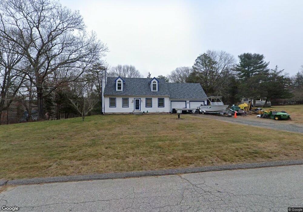
16 Wellington Way Amston, CT 06231
Estimated Value: $350,000 - $587,000
2
Beds
2
Baths
1,426
Sq Ft
$312/Sq Ft
Est. Value
About This Home
This home is located at 16 Wellington Way, Amston, CT 06231 and is currently estimated at $444,942, approximately $312 per square foot. 16 Wellington Way is a home located in Tolland County with nearby schools including Gilead Hill School, Hebron Elementary School, and RHAM Middle School.
Ownership History
Date
Name
Owned For
Owner Type
Purchase Details
Closed on
Mar 1, 1999
Sold by
Romanowski Joseph
Bought by
Haugh Ronald and Haugh Catherine
Current Estimated Value
Purchase Details
Closed on
Jun 21, 1993
Sold by
Dumont Lori
Bought by
Romanowski Joseph and Romanowski Julie
Create a Home Valuation Report for This Property
The Home Valuation Report is an in-depth analysis detailing your home's value as well as a comparison with similar homes in the area
Home Values in the Area
Average Home Value in this Area
Purchase History
| Date | Buyer | Sale Price | Title Company |
|---|---|---|---|
| Haugh Ronald | $145,500 | -- | |
| Romanowski Joseph | $155,000 | -- | |
| Dumont Lori | $50,000 | -- |
Source: Public Records
Mortgage History
| Date | Status | Borrower | Loan Amount |
|---|---|---|---|
| Open | Dumont Lori | $176,200 | |
| Closed | Dumont Lori | $30,000 | |
| Closed | Dumont Lori | $193,000 |
Source: Public Records
Tax History Compared to Growth
Tax History
| Year | Tax Paid | Tax Assessment Tax Assessment Total Assessment is a certain percentage of the fair market value that is determined by local assessors to be the total taxable value of land and additions on the property. | Land | Improvement |
|---|---|---|---|---|
| 2025 | $6,717 | $182,280 | $52,640 | $129,640 |
| 2024 | $6,289 | $182,280 | $52,640 | $129,640 |
| 2023 | $6,050 | $182,280 | $52,640 | $129,640 |
| 2022 | $5,778 | $182,280 | $52,640 | $129,640 |
| 2021 | $5,699 | $156,860 | $52,640 | $104,220 |
| 2020 | $5,699 | $156,860 | $52,640 | $104,220 |
| 2019 | $5,812 | $156,860 | $52,640 | $104,220 |
| 2018 | $5,873 | $156,860 | $52,640 | $104,220 |
| 2017 | $5,804 | $156,860 | $52,640 | $104,220 |
| 2016 | $6,733 | $188,930 | $91,000 | $97,930 |
| 2015 | $6,801 | $188,930 | $91,000 | $97,930 |
| 2014 | $6,754 | $188,930 | $91,000 | $97,930 |
Source: Public Records
Map
Nearby Homes
- 18 Spring Hill Rd
- 20 Mohegan Ln
- 0 Deepwood Dr
- 2 Lots on Deepwood Dr
- 24 Wood Acres Rd
- 282 Deepwood Dr
- 94 Bush Rock Rd
- 0 Park Rd Unit 24130670
- 25 Woodland Dr
- 76 Park Rd
- 59 Park Rd
- 0 Wildwood Dr
- 223 Boretz Rd
- 319 Amston Rd
- 111 Old Hartford Rd
- 6 Village Ct Unit 6
- 39 Jaffee Terrace
- 0 Prospect Hill Rd
- 710 Fieldstone Ct
- 0 Old Hartford Rd
- 8 Judd Brook Ln
- 8 Wellington Way
- 14 Judd Brook Ln
- 21 Wellington Way
- 98 Niles Rd
- 9 Judd Brook Ln
- 7 Wellington Way
- 15 Judd Brook Ln
- 34 Wellington Way
- 92 Niles Rd
- 22 Judd Brook Ln
- 35 Wellington Way
- 88 Niles Rd
- 107 Niles Rd
- 26 Judd Brook Ln
- 113 Niles Rd
- 39 Wellington Way
- 421 Old Colchester Rd
- 413 Old Colchester Rd
- 119 Niles Rd