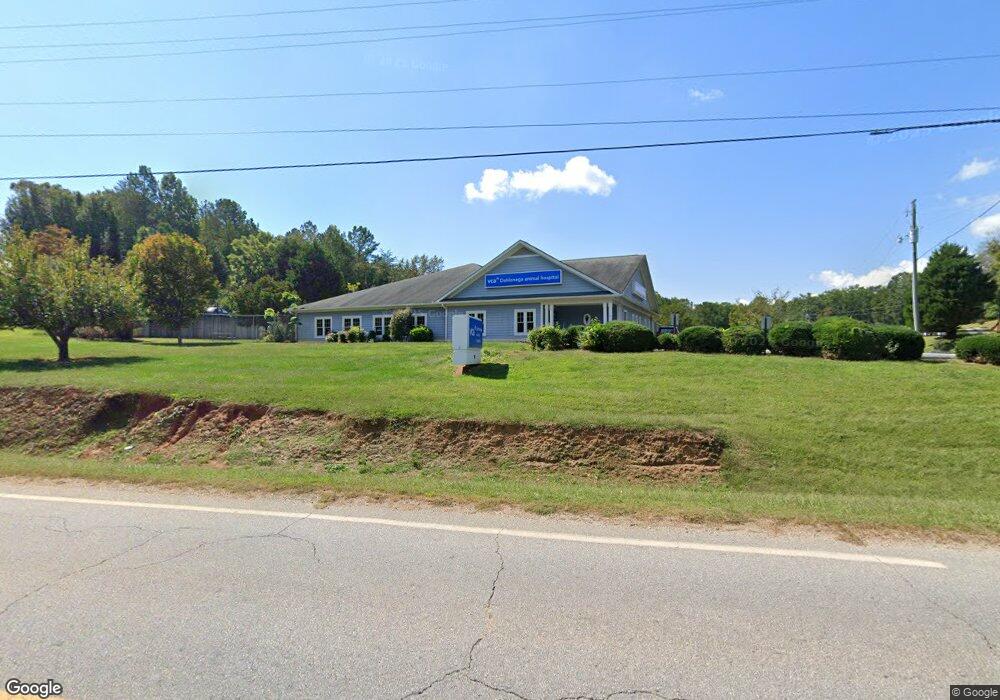
16 Westbrook Rd Dahlonega, GA 30533
Estimated Value: $196,822 - $333,000
--
Bed
1
Bath
1,240
Sq Ft
$228/Sq Ft
Est. Value
About This Home
This home is located at 16 Westbrook Rd, Dahlonega, GA 30533 and is currently estimated at $282,706, approximately $227 per square foot. 16 Westbrook Rd is a home located in Lumpkin County with nearby schools including Clay County Middle School and Lumpkin County High School.
Ownership History
Date
Name
Owned For
Owner Type
Purchase Details
Closed on
Oct 28, 2014
Sold by
Gold Rush Land Holdings Ll
Bought by
Vca Real Property Acquisition
Current Estimated Value
Purchase Details
Closed on
Jan 31, 2012
Purchase Details
Closed on
Aug 13, 2008
Sold by
Orton David F
Bought by
Orton Land
Purchase Details
Closed on
Sep 18, 2003
Sold by
Clary Wallace E
Bought by
Orton David F
Purchase Details
Closed on
Jun 2, 2000
Sold by
Westbrook Carolyn C
Bought by
Clary Wallace E
Create a Home Valuation Report for This Property
The Home Valuation Report is an in-depth analysis detailing your home's value as well as a comparison with similar homes in the area
Home Values in the Area
Average Home Value in this Area
Purchase History
| Date | Buyer | Sale Price | Title Company |
|---|---|---|---|
| Vca Real Property Acquisition | $1,100,000 | -- | |
| -- | $1,015,000 | -- | |
| Orton Land | -- | -- | |
| Orton David F | $116,000 | -- | |
| Clary Wallace E | $70,000 | -- |
Source: Public Records
Tax History Compared to Growth
Tax History
| Year | Tax Paid | Tax Assessment Tax Assessment Total Assessment is a certain percentage of the fair market value that is determined by local assessors to be the total taxable value of land and additions on the property. | Land | Improvement |
|---|---|---|---|---|
| 2024 | $1,095 | $45,711 | $7,531 | $38,180 |
| 2023 | $1,003 | $42,644 | $7,038 | $35,606 |
| 2022 | $1,022 | $41,278 | $5,865 | $35,413 |
| 2021 | $1,019 | $39,801 | $5,865 | $33,936 |
| 2020 | $1,019 | $38,612 | $5,620 | $32,992 |
| 2019 | $1,028 | $38,612 | $5,620 | $32,992 |
| 2018 | $987 | $34,786 | $5,620 | $29,166 |
| 2017 | $1,002 | $34,626 | $5,620 | $29,006 |
| 2016 | $920 | $30,748 | $5,620 | $25,128 |
| 2015 | $830 | $30,748 | $5,620 | $25,128 |
| 2014 | $830 | $31,471 | $5,620 | $25,850 |
| 2013 | -- | $31,832 | $5,620 | $26,211 |
Source: Public Records
Map
Nearby Homes
- 0 Bearden Rd Unit 10598024
- 0 Bearden Rd Unit 7642996
- 1228 Winters Mountain Rd
- 300 Mountain Ridge Dr
- 0 Winters Mountain Rd Unit 7681054
- 0 Winters Mountain Rd Unit 10643431
- 962 Winters Mountain Rd
- 87 Tolleffs Trail
- 83 Austin Ct
- 128 Young Deer Dr
- 202 Indian Trail
- 0 Arborwood Dr Unit 10645890
- 496 Beaver Dam Rd
- 94 King Arthur Ct
- 380 Copper Mill Rd
- 7.123 Acres Halls Mill Rd
- 0 Gold View Dr
- 03 Kate Rd
- 6480 Highway 52 W
- 42 Long Rd
- 100 Westbrook Rd
- 46 Long Rd
- 48 Long Rd
- 153 Cherokee Trace
- 0 Long Rd
- 0 Dry Hollow Rd Unit 5874771
- 0 Dry Hollow Rd Unit 8219809
- 0 Dry Hollow Rd Unit 2593188
- 0 Dry Hollow Rd Unit 2638420
- 0 Dry Hollow Rd Unit 2844638
- 0 Dry Hollow Rd Unit 2844648
- 0 Dry Hollow Rd Unit LOT 2 3247101
- 0 Dry Hollow Rd Unit 7178321
- 0 Dry Hollow Rd Unit 7197831
- 0 Dry Hollow Rd Unit 3 8105951
- 0 Dry Hollow Rd Unit 5 8105960
- 00 Dry Hollow Rd
- 000 Dry Hollow Rd
- 00000 Dry Hollow Rd