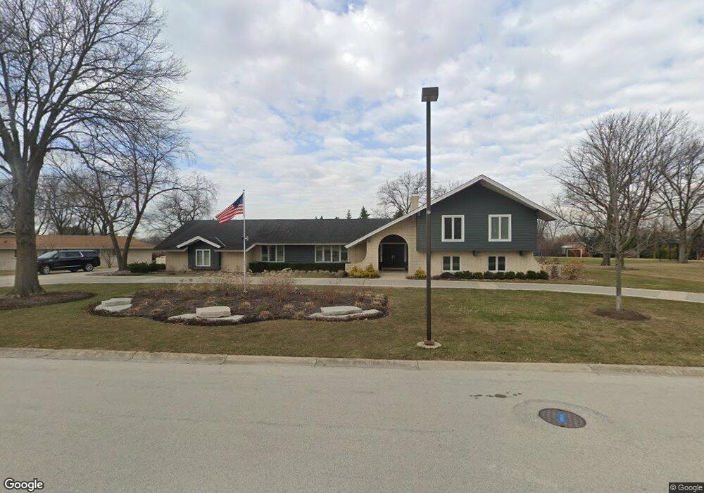
16 Windsor Dr Oak Brook, IL 60523
Estimated Value: $1,038,000 - $1,264,000
5
Beds
4
Baths
3,025
Sq Ft
$380/Sq Ft
Est. Value
About This Home
This home is located at 16 Windsor Dr, Oak Brook, IL 60523 and is currently estimated at $1,149,038, approximately $379 per square foot. 16 Windsor Dr is a home located in DuPage County with nearby schools including Brook Forest Elementary School, Butler Junior High School, and Hinsdale Central High School.
Ownership History
Date
Name
Owned For
Owner Type
Purchase Details
Closed on
Oct 26, 2017
Sold by
Windsor Drive Llc
Bought by
Bindon Judith G and Bindon James G
Current Estimated Value
Purchase Details
Closed on
Mar 11, 2011
Sold by
Resech Jean L and Jean L Resech Qualified Person
Bought by
Windsor Drive Llc
Purchase Details
Closed on
Dec 16, 2004
Sold by
Resech Raymond W and Resech Jean L
Bought by
Resech Jean L
Purchase Details
Closed on
Apr 16, 1998
Sold by
Resech Raymond W and Resech Jean L
Bought by
Resech Jean L and Resech Raymond W
Create a Home Valuation Report for This Property
The Home Valuation Report is an in-depth analysis detailing your home's value as well as a comparison with similar homes in the area
Home Values in the Area
Average Home Value in this Area
Purchase History
| Date | Buyer | Sale Price | Title Company |
|---|---|---|---|
| Bindon Judith G | $838,000 | Chicago Title Insurance Comp | |
| Windsor Drive Llc | -- | None Available | |
| Resech Jean L | -- | -- | |
| Resech Jean L | -- | -- | |
| Resech Jean L | -- | -- |
Source: Public Records
Tax History
| Year | Tax Paid | Tax Assessment Tax Assessment Total Assessment is a certain percentage of the fair market value that is determined by local assessors to be the total taxable value of land and additions on the property. | Land | Improvement |
|---|---|---|---|---|
| 2024 | $12,770 | $350,579 | $80,478 | $270,101 |
| 2023 | $12,207 | $324,190 | $74,420 | $249,770 |
| 2022 | $11,442 | $311,630 | $71,540 | $240,090 |
| 2021 | $10,929 | $303,880 | $69,760 | $234,120 |
| 2020 | $10,665 | $297,220 | $68,230 | $228,990 |
| 2019 | $10,142 | $282,580 | $64,870 | $217,710 |
| 2018 | $9,185 | $267,500 | $61,410 | $206,090 |
| 2017 | $8,601 | $254,910 | $58,520 | $196,390 |
| 2016 | $8,379 | $240,140 | $55,130 | $185,010 |
| 2015 | $8,261 | $223,720 | $51,360 | $172,360 |
| 2014 | $9,407 | $245,580 | $52,540 | $193,040 |
| 2013 | $9,330 | $249,040 | $53,280 | $195,760 |
Source: Public Records
Map
Nearby Homes
- 37 Sheffield Ln
- 3103 York Rd
- 3309 York Rd
- 3403 York Rd
- 3420 York Rd
- 11466 Ashley Woods Dr
- 3504 York Rd
- 1409 Burr Oak Rd Unit 414A
- 1409 Burr Oak Rd Unit 112A
- 1409 Burr Oak Rd Unit 111A
- 1409 Burr Oak Rd Unit 315A
- 1401 Burr Oak Rd Unit 202B
- 1401 Burr Oak Rd Unit 114B
- 1401 Burr Oak Rd Unit 108B
- 1401 Burr Oak Rd Unit 117B
- 1401 Burr Oak Rd Unit 105B
- 11438 Ashley Woods Dr
- 11460 Prescott Ln
- 2601 Burton Dr
- 11404 Prescott Ln
Your Personal Tour Guide
Ask me questions while you tour the home.