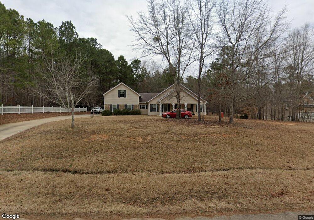
160 Andrew Ct Forsyth, GA 31029
Estimated Value: $314,000 - $355,000
3
Beds
3
Baths
2,265
Sq Ft
$148/Sq Ft
Est. Value
About This Home
This home is located at 160 Andrew Ct, Forsyth, GA 31029 and is currently estimated at $334,469, approximately $147 per square foot. 160 Andrew Ct is a home located in Monroe County with nearby schools including Katherine B. Sutton Elementary School and Mary Persons High School.
Ownership History
Date
Name
Owned For
Owner Type
Purchase Details
Closed on
Mar 8, 2023
Sold by
Autrey Juanita
Bought by
Martinez Katelyn Macie
Current Estimated Value
Purchase Details
Closed on
Oct 15, 2009
Sold by
Autrey Waymon M
Bought by
Autrey Juanita
Purchase Details
Closed on
May 11, 2007
Sold by
Not Provided
Bought by
Autrey Juanita
Home Financials for this Owner
Home Financials are based on the most recent Mortgage that was taken out on this home.
Original Mortgage
$78,000
Interest Rate
6.17%
Mortgage Type
New Conventional
Create a Home Valuation Report for This Property
The Home Valuation Report is an in-depth analysis detailing your home's value as well as a comparison with similar homes in the area
Home Values in the Area
Average Home Value in this Area
Purchase History
| Date | Buyer | Sale Price | Title Company |
|---|---|---|---|
| Martinez Katelyn Macie | -- | -- | |
| Autrey Juanita | -- | -- | |
| Autrey Juanita | $178,000 | -- |
Source: Public Records
Mortgage History
| Date | Status | Borrower | Loan Amount |
|---|---|---|---|
| Previous Owner | Autrey Juanita | $78,000 |
Source: Public Records
Tax History Compared to Growth
Tax History
| Year | Tax Paid | Tax Assessment Tax Assessment Total Assessment is a certain percentage of the fair market value that is determined by local assessors to be the total taxable value of land and additions on the property. | Land | Improvement |
|---|---|---|---|---|
| 2024 | $2,995 | $106,400 | $12,000 | $94,400 |
| 2023 | $1,151 | $90,800 | $12,000 | $78,800 |
| 2022 | $1,737 | $90,800 | $12,000 | $78,800 |
| 2021 | $1,224 | $75,684 | $10,000 | $65,684 |
| 2020 | $1,475 | $63,324 | $10,000 | $53,324 |
| 2019 | $1,486 | $63,324 | $10,000 | $53,324 |
| 2018 | $1,375 | $59,324 | $6,000 | $53,324 |
| 2017 | $1,666 | $57,324 | $4,000 | $53,324 |
| 2016 | $1,252 | $57,324 | $4,000 | $53,324 |
| 2015 | $1,123 | $54,840 | $4,000 | $50,840 |
| 2014 | $1,084 | $54,840 | $4,000 | $50,840 |
Source: Public Records
Map
Nearby Homes
- 160 Aaron Ct
- 6418 Georgia 42
- 196 Craig Rd
- 49 Homestead Cir Unit LOT 49A
- 381 Homestead Cir
- 40 Timber Dr
- 738 Teagle Rd
- 3528 Highway 42 S
- 120 Torbet Rd
- 119 Mack Cir
- 0 Garr Rd Unit 10439858
- LOT 48 Stokes Store Rd
- 49 Stokes Store Rd Unit 49
- 49 Stokes Store Rd
- 56 Ivey Cir
- 61 Duncan Cir
- 0 Duncan Cir Unit 24915548
- 674 Stokes Store Rd
- 739 Westbrooks Rd
- 1649 Stokes Store Rd
- 170 Andrew Ct
- 170 Andrew Ct Unit 25
- 150 Andrew Ct
- 151 Andrew Ct Unit 30
- 171 Andrew Ct Unit 28
- 171 Andrew Ct
- 130 Andrew Ct
- 161 Andrew Ct
- 181 Andrew Ct
- 181 Andrew Ct Unit 27
- 180 Andrew Ct
- 141 Andrew Ct
- 120 Andrew Ct
- 131 Andrew Ct
- 180 Aaron Ct
- 121 Andrew Ct
- 190 Aaron Ct
- 170 Aaron Ct
- 150 Aaron Ct
- 110 Andrew Ct