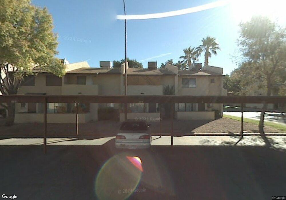
160 Bel Port Dr Unit 162 Las Vegas, NV 89110
Estimated Value: $214,000 - $221,130
2
Beds
2
Baths
1,104
Sq Ft
$197/Sq Ft
Est. Value
About This Home
This home is located at 160 Bel Port Dr Unit 162, Las Vegas, NV 89110 and is currently estimated at $217,377, approximately $196 per square foot. 160 Bel Port Dr Unit 162 is a home located in Clark County with nearby schools including Charlotte & Jerry Keller Elementary School, Richard J. Rundle Elementary School, and Duane D. Keller Middle School.
Ownership History
Date
Name
Owned For
Owner Type
Purchase Details
Closed on
Jan 13, 2022
Sold by
Williams George A and Williams Esther
Bought by
Armstrong Larry J and Armstrong Mary K
Current Estimated Value
Purchase Details
Closed on
Jun 6, 2006
Sold by
Williams George A and Williams Esther F
Bought by
Williams George A and Williams Esther F
Purchase Details
Closed on
Feb 4, 1994
Sold by
Williams Esther F
Bought by
Williams George A and Williams Esther F
Home Financials for this Owner
Home Financials are based on the most recent Mortgage that was taken out on this home.
Original Mortgage
$47,663
Interest Rate
7.1%
Mortgage Type
FHA
Create a Home Valuation Report for This Property
The Home Valuation Report is an in-depth analysis detailing your home's value as well as a comparison with similar homes in the area
Home Values in the Area
Average Home Value in this Area
Purchase History
| Date | Buyer | Sale Price | Title Company |
|---|---|---|---|
| Armstrong Larry J | $125,000 | Chicago Title | |
| Williams George A | -- | None Available | |
| Williams George A | -- | Nevada Title Company |
Source: Public Records
Mortgage History
| Date | Status | Borrower | Loan Amount |
|---|---|---|---|
| Previous Owner | Williams George A | $47,663 |
Source: Public Records
Tax History Compared to Growth
Tax History
| Year | Tax Paid | Tax Assessment Tax Assessment Total Assessment is a certain percentage of the fair market value that is determined by local assessors to be the total taxable value of land and additions on the property. | Land | Improvement |
|---|---|---|---|---|
| 2025 | $444 | $35,805 | $14,700 | $21,105 |
| 2024 | $412 | $35,805 | $14,700 | $21,105 |
| 2023 | $412 | $31,308 | $11,550 | $19,758 |
| 2022 | $382 | $29,887 | $10,850 | $19,037 |
| 2021 | $369 | $26,492 | $10,850 | $15,642 |
| 2020 | $352 | $25,682 | $9,100 | $16,582 |
| 2019 | $336 | $22,950 | $6,300 | $16,650 |
| 2018 | $321 | $21,014 | $4,900 | $16,114 |
| 2017 | $558 | $18,613 | $3,500 | $15,113 |
| 2016 | $305 | $10,558 | $2,100 | $8,458 |
| 2015 | $303 | $10,491 | $2,100 | $8,391 |
| 2014 | $294 | $9,637 | $1,750 | $7,887 |
Source: Public Records
Map
Nearby Homes
- 130 Bel Port Dr Unit 133
- 136 Sir George Dr
- 153 Sir Thomas Dr
- 179 Sir George Dr
- 111 Sir Arthur Dr
- 140 Sir David Way
- 5330 E Charleston Blvd Unit 2
- 5330 E Charleston Blvd Unit 113
- 0 E Charleston Blvd
- 4928 Ronan Dr
- 280 Sir Phillip St
- 1200 Pleasant Brook St
- 147 N Christy Ln
- 1224 Pleasant Brook St
- 332 Sir Jeffery Cir
- 5353 Hollow Brook Ave
- 360 Sir Richard Dr E
- 1300 S Arlington St Unit 126
- 1300 S Arlington St Unit 120
- 5564 Orchard Ln Unit 133
- 160 Bel Port Dr Unit 161
- 160 Bel Port Dr Unit 164
- 160 Bel Port Dr Unit 163
- 150 Bel Port Dr Unit 155
- 150 Bel Port Dr Unit 153
- 150 Bel Port Dr Unit 151
- 150 Bel Port Dr Unit 156
- 150 Bel Port Dr Unit 154
- 150 Bel Port Dr Unit 152
- 151 Bel Port Dr
- 164 Bel Port Dr
- 153 Bel Port Dr
- 154 Bel Port Dr
- 170 Bel Port Dr Unit 171
- 170 Bel Port Dr Unit 174
- 170 Bel Port Dr Unit 172
- 170 Bel Port Dr Unit 173
- 155 Bel Port Dr
- 171 Bel Port Dr
- 156 Bel Port Dr