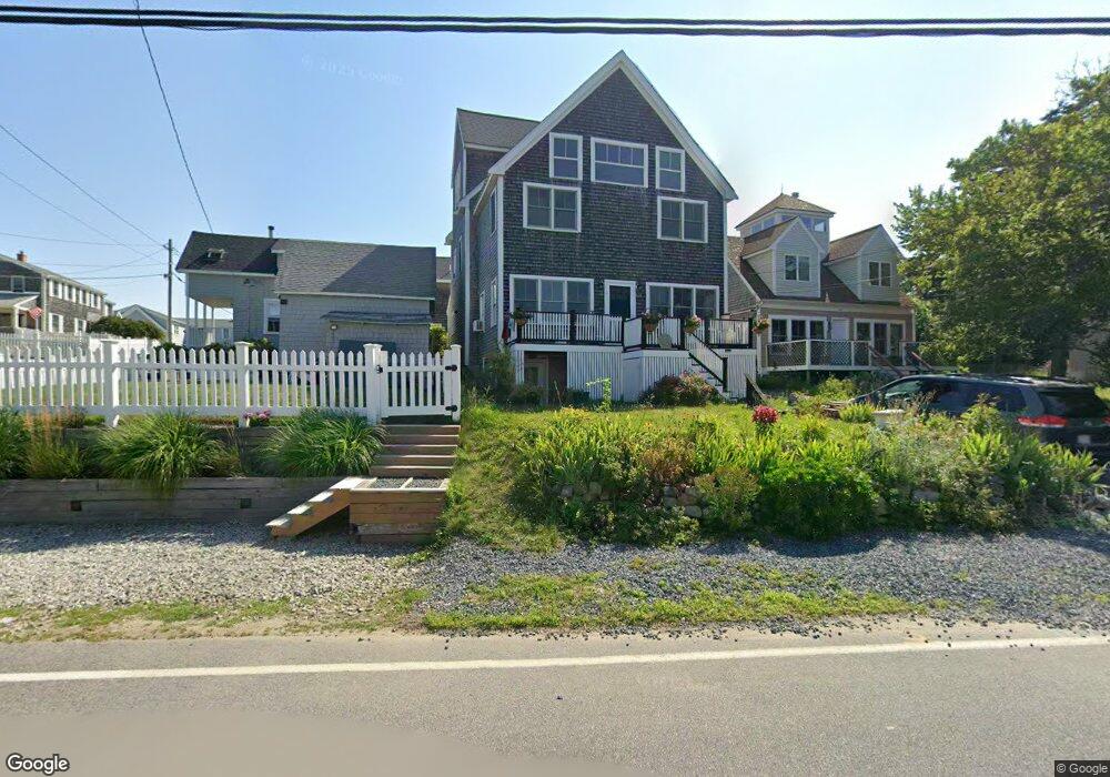
160 Island St Brant Rock, MA 02020
Ocean Bluff-Brant Rock NeighborhoodEstimated Value: $679,000 - $830,572
3
Beds
2
Baths
2,273
Sq Ft
$327/Sq Ft
Est. Value
About This Home
This home is located at 160 Island St, Brant Rock, MA 02020 and is currently estimated at $742,893, approximately $326 per square foot. 160 Island St is a home with nearby schools including Governor Edward Winslow School, Furnace Brook Middle School, and Marshfield High School.
Ownership History
Date
Name
Owned For
Owner Type
Purchase Details
Closed on
Jun 23, 1995
Sold by
160 Island Nt
Bought by
Mundt Peter J and Dilks-Mundt Jennifer
Current Estimated Value
Purchase Details
Closed on
Apr 7, 1994
Sold by
Norroway Pond Dev Corp
Bought by
Sullivan Inez E
Purchase Details
Closed on
Nov 22, 1993
Sold by
Villa Frank C
Bought by
Norroway Pond Dev Corp
Purchase Details
Closed on
Sep 13, 1988
Sold by
Cass Leo R
Bought by
Villa Frank C
Create a Home Valuation Report for This Property
The Home Valuation Report is an in-depth analysis detailing your home's value as well as a comparison with similar homes in the area
Home Values in the Area
Average Home Value in this Area
Purchase History
| Date | Buyer | Sale Price | Title Company |
|---|---|---|---|
| Mundt Peter J | $110,000 | -- | |
| Mundt Peter J | $110,000 | -- | |
| Sullivan Inez E | $43,000 | -- | |
| Norroway Pond Dev Corp | $70,000 | -- | |
| Villa Frank C | $87,000 | -- |
Source: Public Records
Mortgage History
| Date | Status | Borrower | Loan Amount |
|---|---|---|---|
| Open | Villa Frank C | $219,000 | |
| Closed | Villa Frank C | $250,000 |
Source: Public Records
Tax History Compared to Growth
Tax History
| Year | Tax Paid | Tax Assessment Tax Assessment Total Assessment is a certain percentage of the fair market value that is determined by local assessors to be the total taxable value of land and additions on the property. | Land | Improvement |
|---|---|---|---|---|
| 2025 | $6,677 | $674,400 | $248,800 | $425,600 |
| 2024 | $6,463 | $622,000 | $233,300 | $388,700 |
| 2023 | $6,028 | $548,400 | $209,900 | $338,500 |
| 2022 | $6,028 | $465,500 | $178,800 | $286,700 |
| 2021 | $5,629 | $426,800 | $171,100 | $255,700 |
| 2020 | $5,275 | $395,700 | $147,700 | $248,000 |
| 2019 | $5,087 | $380,200 | $147,700 | $232,500 |
| 2018 | $5,015 | $375,100 | $147,700 | $227,400 |
| 2017 | $4,720 | $344,000 | $140,000 | $204,000 |
| 2016 | $4,435 | $319,500 | $132,200 | $187,300 |
| 2015 | $4,178 | $314,400 | $132,200 | $182,200 |
| 2014 | $4,043 | $304,200 | $132,200 | $172,000 |
Source: Public Records
Map
Nearby Homes
- 23 Reed St
- 23 Reed St
- 23 Red Pony Path Unit 23 F
- 156 Island St
- 23 Reed St
- 21 Reed St
- 19 Reed St
- 19 Red Pony Path Unit 19 D
- 30 Thomas St
- 15 Reed St
- 163 Island St
- 15 Reed St
- 15 Reed St
- 15 Reed St Unit 15
- 15 Reed St Unit 1
- 16 Thomas St
- 36 Bradford St
- 16 Red Pony Path
- 16 Red Pony Path Unit 21 F
- 171 Island St