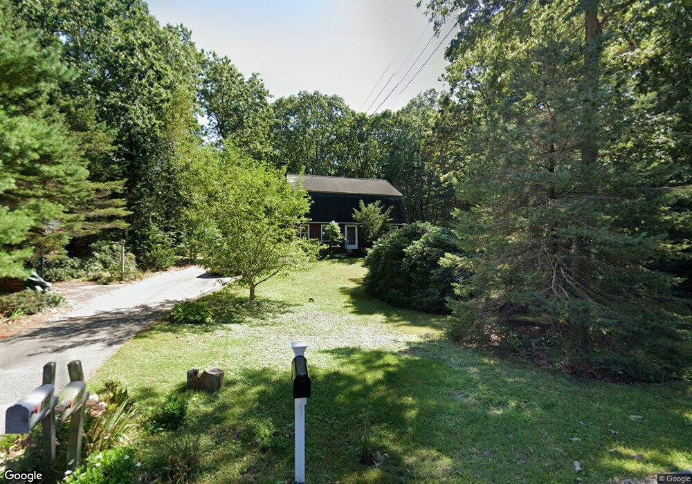
160 Myrtle St Wrentham, MA 02093
Estimated Value: $659,755 - $730,000
3
Beds
2
Baths
1,696
Sq Ft
$408/Sq Ft
Est. Value
About This Home
This home is located at 160 Myrtle St, Wrentham, MA 02093 and is currently estimated at $691,189, approximately $407 per square foot. 160 Myrtle St is a home located in Norfolk County with nearby schools including Delaney Elementary School, Charles E Roderick, and Foxborough Regional Charter School.
Ownership History
Date
Name
Owned For
Owner Type
Purchase Details
Closed on
Nov 3, 2003
Sold by
Obrien Craig L and Obrien Carol A
Bought by
Makuch Gary J and Makuch Patricia M
Current Estimated Value
Home Financials for this Owner
Home Financials are based on the most recent Mortgage that was taken out on this home.
Original Mortgage
$280,000
Interest Rate
6.05%
Mortgage Type
Purchase Money Mortgage
Purchase Details
Closed on
Feb 29, 2000
Sold by
Kassler Barry and Kassler Susan E
Bought by
Obrien Craig L and Obrien Carol A
Home Financials for this Owner
Home Financials are based on the most recent Mortgage that was taken out on this home.
Original Mortgage
$252,700
Interest Rate
8.15%
Mortgage Type
Purchase Money Mortgage
Create a Home Valuation Report for This Property
The Home Valuation Report is an in-depth analysis detailing your home's value as well as a comparison with similar homes in the area
Home Values in the Area
Average Home Value in this Area
Purchase History
| Date | Buyer | Sale Price | Title Company |
|---|---|---|---|
| Makuch Gary J | $380,000 | -- | |
| Obrien Craig L | $253,000 | -- |
Source: Public Records
Mortgage History
| Date | Status | Borrower | Loan Amount |
|---|---|---|---|
| Open | Obrien Craig L | $246,000 | |
| Closed | Obrien Craig L | $253,000 | |
| Closed | Obrien Craig L | $280,000 | |
| Previous Owner | Obrien Craig L | $252,700 |
Source: Public Records
Tax History Compared to Growth
Tax History
| Year | Tax Paid | Tax Assessment Tax Assessment Total Assessment is a certain percentage of the fair market value that is determined by local assessors to be the total taxable value of land and additions on the property. | Land | Improvement |
|---|---|---|---|---|
| 2025 | $6,589 | $568,500 | $302,600 | $265,900 |
| 2024 | $6,314 | $526,200 | $302,600 | $223,600 |
| 2023 | $6,215 | $492,500 | $275,000 | $217,500 |
| 2022 | $6,048 | $442,400 | $256,500 | $185,900 |
| 2021 | $5,722 | $406,700 | $223,900 | $182,800 |
| 2020 | $5,582 | $391,700 | $199,100 | $192,600 |
| 2019 | $5,531 | $391,700 | $199,100 | $192,600 |
| 2018 | $5,307 | $372,700 | $199,300 | $173,400 |
| 2017 | $5,193 | $364,400 | $195,500 | $168,900 |
| 2016 | $4,975 | $348,400 | $189,800 | $158,600 |
| 2015 | $4,931 | $329,200 | $182,500 | $146,700 |
| 2014 | $4,379 | $286,000 | $146,300 | $139,700 |
Source: Public Records
Map
Nearby Homes
- 65 Pond St
- 362 East St
- 483 Thurston St
- 1 Lorraine Metcalf Dr
- 120 Hawes St
- 25 Foxboro Rd
- 270 Dedham St
- 11 Goodwin Dr
- 10 Nature View Dr
- 15 Nature View Dr
- 319 Taunton St
- 7 Hill St Unit 10
- 20 Valley St Unit 20
- 71 Pond St
- 80 Mill St
- 10 W Birch Rd
- 131 Creek St Unit 7
- 11 Earle Stewart Ln
- 0 W Birch Rd
- 3 Oak Rd