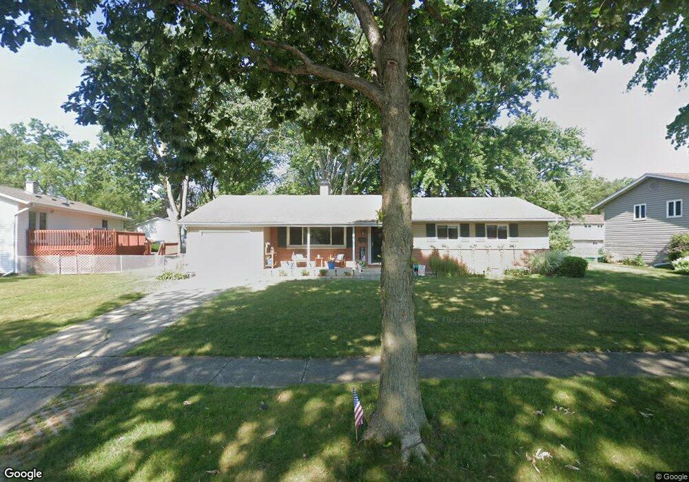
160 N Lytle Dr Palatine, IL 60074
Winston Park NeighborhoodEstimated Value: $416,000 - $446,000
3
Beds
3
Baths
1,843
Sq Ft
$236/Sq Ft
Est. Value
About This Home
This home is located at 160 N Lytle Dr, Palatine, IL 60074 and is currently estimated at $435,067, approximately $236 per square foot. 160 N Lytle Dr is a home located in Cook County with nearby schools including Winston Campus Elementary School, Palatine High School, and St Thomas Of Villanova School.
Ownership History
Date
Name
Owned For
Owner Type
Purchase Details
Closed on
Feb 20, 1995
Sold by
Shearer Gregory F and Shearer Martha N
Bought by
Schneider Paul A and Schneider Katherine M
Current Estimated Value
Home Financials for this Owner
Home Financials are based on the most recent Mortgage that was taken out on this home.
Original Mortgage
$120,800
Interest Rate
8.91%
Create a Home Valuation Report for This Property
The Home Valuation Report is an in-depth analysis detailing your home's value as well as a comparison with similar homes in the area
Home Values in the Area
Average Home Value in this Area
Purchase History
| Date | Buyer | Sale Price | Title Company |
|---|---|---|---|
| Schneider Paul A | $151,000 | -- |
Source: Public Records
Mortgage History
| Date | Status | Borrower | Loan Amount |
|---|---|---|---|
| Closed | Schneider Paul A | $120,800 |
Source: Public Records
Tax History Compared to Growth
Tax History
| Year | Tax Paid | Tax Assessment Tax Assessment Total Assessment is a certain percentage of the fair market value that is determined by local assessors to be the total taxable value of land and additions on the property. | Land | Improvement |
|---|---|---|---|---|
| 2024 | $7,604 | $29,000 | $6,720 | $22,280 |
| 2023 | $7,326 | $29,000 | $6,720 | $22,280 |
| 2022 | $7,326 | $29,000 | $6,720 | $22,280 |
| 2021 | $6,841 | $24,394 | $4,200 | $20,194 |
| 2020 | $6,812 | $24,394 | $4,200 | $20,194 |
| 2019 | $6,833 | $27,256 | $4,200 | $23,056 |
| 2018 | $7,660 | $28,083 | $3,780 | $24,303 |
| 2017 | $7,533 | $28,083 | $3,780 | $24,303 |
| 2016 | $7,255 | $28,083 | $3,780 | $24,303 |
| 2015 | $6,059 | $22,343 | $3,360 | $18,983 |
| 2014 | $6,002 | $22,343 | $3,360 | $18,983 |
| 2013 | $5,830 | $22,343 | $3,360 | $18,983 |
Source: Public Records
Map
Nearby Homes
- 315 N Lytle Dr
- 1018 E Kitson Dr
- 306 N Bissell Dr
- 45 S Stonington Dr Unit 4
- 111 S Baybrook Dr Unit 114
- 111 S Baybrook Dr Unit 514
- 105 S Stonington Dr Unit 304
- 1422 E Dorothy Dr
- 1408 E Reynolds Dr Unit 1
- 1426 E Anderson Dr
- 8 N Greenwood Ave
- 1163 E Plate Dr
- 945 E Kenilworth Ave Unit 312
- 945 E Kenilworth Ave Unit 318
- 945 E Kenilworth Ave Unit 429
- 945 E Kenilworth Ave Unit 120
- 147 S Rohlwing Rd
- 1417 E Joyce Ave
- 243 N Richards Dr
- 1207 E Sayles Dr
- 202 N Lytle Dr
- 1050 E Flake Dr
- 159 N Dean Dr
- 201 N Dean Dr
- 161 N Lytle Dr
- 210 N Lytle Dr
- 1038 E Flake Dr
- 209 N Dean Dr
- 205 N Lytle Dr
- 162 N Flake Dr
- 218 N Lytle Dr
- 1053 E Flake Dr
- 215 N Lytle Dr
- 217 N Dean Dr
- 1045 E Flake Dr
- 1065 E Flake Dr
- 160 N Dean Dr
- 204 N Dean Dr
- 208 N Flake Dr Unit 2
- 153 N Flake Dr