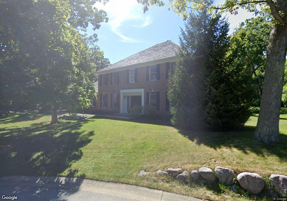
160 Philip Ct Lake Bluff, IL 60044
Estimated Value: $1,179,000 - $1,462,000
--
Bed
5
Baths
4,733
Sq Ft
$283/Sq Ft
Est. Value
About This Home
This home is located at 160 Philip Ct, Lake Bluff, IL 60044 and is currently estimated at $1,340,493, approximately $283 per square foot. 160 Philip Ct is a home located in Lake County with nearby schools including Lake Bluff Elementary School, Lake Bluff Middle School, and Lake Forest High School.
Ownership History
Date
Name
Owned For
Owner Type
Purchase Details
Closed on
Jun 29, 1994
Sold by
Superior Associates Ltd Partnership
Bought by
Lerum Norman J and Lerum Eileen
Current Estimated Value
Home Financials for this Owner
Home Financials are based on the most recent Mortgage that was taken out on this home.
Original Mortgage
$693,000
Interest Rate
8.66%
Create a Home Valuation Report for This Property
The Home Valuation Report is an in-depth analysis detailing your home's value as well as a comparison with similar homes in the area
Home Values in the Area
Average Home Value in this Area
Purchase History
| Date | Buyer | Sale Price | Title Company |
|---|---|---|---|
| Lerum Norman J | $727,500 | Chicago Title Insurance Co |
Source: Public Records
Mortgage History
| Date | Status | Borrower | Loan Amount |
|---|---|---|---|
| Closed | Lerum Norman J | $693,000 |
Source: Public Records
Tax History Compared to Growth
Tax History
| Year | Tax Paid | Tax Assessment Tax Assessment Total Assessment is a certain percentage of the fair market value that is determined by local assessors to be the total taxable value of land and additions on the property. | Land | Improvement |
|---|---|---|---|---|
| 2024 | $18,587 | $308,780 | $120,554 | $188,226 |
| 2023 | $17,671 | $271,088 | $105,838 | $165,250 |
| 2022 | $17,671 | $260,793 | $101,818 | $158,975 |
| 2021 | $16,682 | $258,544 | $100,940 | $157,604 |
| 2020 | $16,682 | $259,974 | $101,498 | $158,476 |
| 2019 | $18,152 | $286,638 | $99,635 | $187,003 |
| 2018 | $10,449 | $328,462 | $98,233 | $230,229 |
| 2017 | $20,183 | $322,972 | $96,591 | $226,381 |
| 2016 | $21,683 | $341,575 | $102,155 | $239,420 |
| 2015 | $21,489 | $353,295 | $96,191 | $257,104 |
| 2014 | $20,312 | $299,236 | $86,360 | $212,876 |
| 2012 | $19,046 | $301,832 | $87,109 | $214,723 |
Source: Public Records
Map
Nearby Homes
- 1061 Green Bay Rd
- 233 Kohl Ave
- 307 Forest View Dr
- 188 Melvin Dr
- 205 Bradford Ct
- 230 Bayshore Dr
- 505 Lincoln Ave
- 120 E Scranton Ave Unit 103
- 120 E Scranton Ave Unit 201
- 120 E Scranton Ave Unit 202
- 120 E Scranton Ave Unit 102
- 120 E Scranton Ave Unit 203
- 228 E Center Ave
- 511 Rockland Rd
- 11 Shagbark Rd
- 223 Sylvan Rd
- 666 Maple Ave
- 697 Bluff Rd
- 717 Burris Ave
- 240 Shore Acres Cir
- 170 Philip Ct
- 165 Philip Ct
- 21 Warrington Dr
- 23 Warrington Dr Unit 1
- 19 Warrington Dr
- 175 Philip Ct
- 17 Warrington Dr
- 15 Warrington Dr
- 55 Trowbridge Cir
- 18 Warrington Dr
- 16 Warrington Dr
- 13 Warrington Dr
- 45 Trowbridge Cir Unit IV
- 20 Warrington Dr
- 22 Warrington Dr
- 14 Warrington Dr
- 150 Norwich Ct
- 302 Rothbury Ct
- 11 Warrington Dr
- 24 Warrington Dr