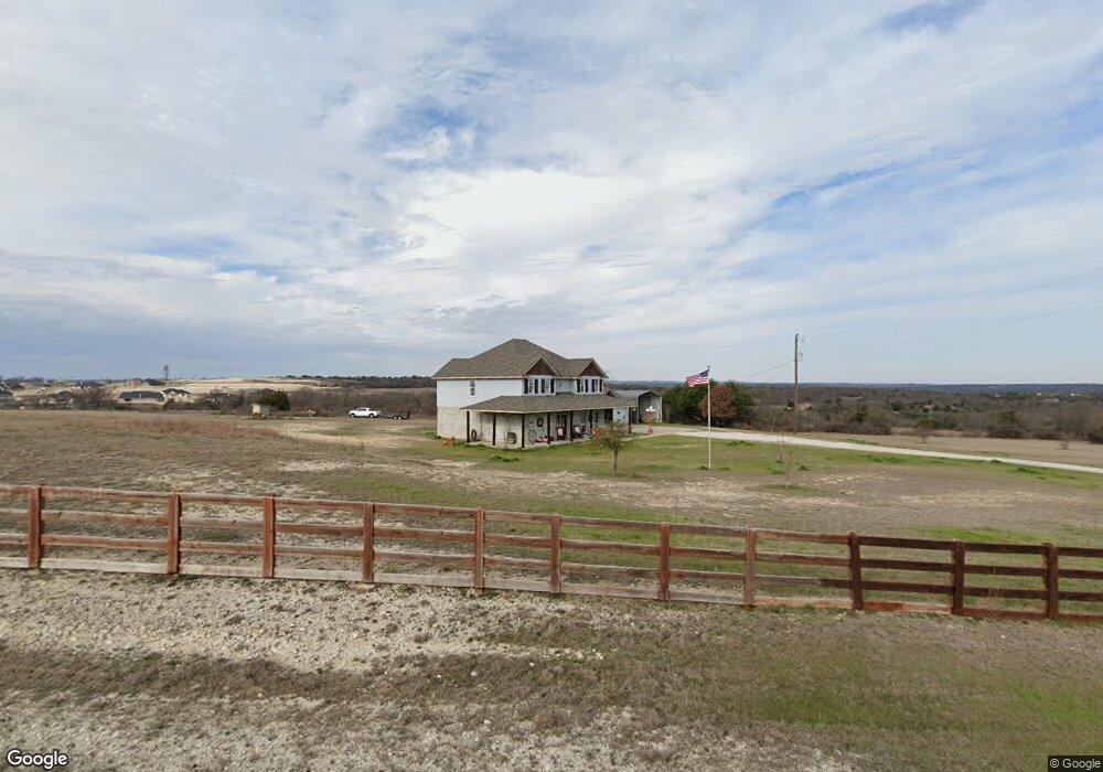
160 Quinn Ct Weatherford, TX 76085
Estimated Value: $654,000 - $689,000
--
Bed
--
Bath
2,662
Sq Ft
$252/Sq Ft
Est. Value
About This Home
This home is located at 160 Quinn Ct, Weatherford, TX 76085 and is currently estimated at $670,127, approximately $251 per square foot. 160 Quinn Ct is a home located in Parker County with nearby schools including Silver Creek Elementary School, Azle Elementary School, and Azle Junior High School.
Ownership History
Date
Name
Owned For
Owner Type
Purchase Details
Closed on
Oct 13, 2003
Sold by
Walsh Lee and Stoviak Jennifer
Bought by
Mccoll John D and Mccoll Dawna
Current Estimated Value
Purchase Details
Closed on
Feb 28, 1997
Bought by
Mccoll John D and Mccoll Dawna
Purchase Details
Closed on
Jun 29, 1995
Bought by
Mccoll John D and Mccoll Dawna
Purchase Details
Closed on
Dec 10, 1993
Bought by
Mccoll John D and Mccoll Dawna
Purchase Details
Closed on
Jan 1, 1901
Bought by
Mccoll John D and Mccoll Dawna
Create a Home Valuation Report for This Property
The Home Valuation Report is an in-depth analysis detailing your home's value as well as a comparison with similar homes in the area
Home Values in the Area
Average Home Value in this Area
Purchase History
| Date | Buyer | Sale Price | Title Company |
|---|---|---|---|
| Mccoll John D | -- | -- | |
| Mccoll John D | -- | -- | |
| Mccoll John D | -- | -- | |
| Mccoll John D | -- | -- | |
| Mccoll John D | -- | -- |
Source: Public Records
Tax History Compared to Growth
Tax History
| Year | Tax Paid | Tax Assessment Tax Assessment Total Assessment is a certain percentage of the fair market value that is determined by local assessors to be the total taxable value of land and additions on the property. | Land | Improvement |
|---|---|---|---|---|
| 2025 | $2,564 | $522,127 | -- | -- |
| 2024 | $2,564 | $474,661 | -- | -- |
| 2023 | $2,564 | $431,510 | $0 | $0 |
| 2022 | $6,874 | $469,550 | $127,110 | $342,440 |
| 2021 | $6,547 | $469,550 | $127,110 | $342,440 |
| 2020 | $5,920 | $369,500 | $117,010 | $252,490 |
| 2019 | $5,704 | $369,500 | $117,010 | $252,490 |
| 2018 | $5,202 | $253,730 | $75,280 | $178,450 |
| 2017 | $4,711 | $253,730 | $75,280 | $178,450 |
| 2016 | $4,283 | $219,240 | $64,120 | $155,120 |
| 2015 | $1,579 | $219,240 | $64,120 | $155,120 |
| 2014 | $3,776 | $203,260 | $64,120 | $139,140 |
Source: Public Records
Map
Nearby Homes
- 1020 Boulder Rd
- 1009 Boulder Rd
- 5017 Freestone Dr
- 7243 Veal Station Rd
- 1016 Don Eve Ct
- 1032 Don Eve Ct
- 1028 Don Eve Ct
- 1024 Don Eve Ct
- 1025 Don Eve Ct
- 1013 Don Eve Ct
- 1017 Don Eve Ct
- 1005 Don Eve Ct
- 1012 Don Eve Ct
- 181 Churchill Cir
- 1004 Don Eve Ct
- 1089 Flagstone Dr
- 1008 Don Eve Ct
- 143 Oak Meadow Ln
- 133 Miramar Cir
- 128 Oak Meadow Ln
- 201 Newsom Mound Rd
- 201 Newsom Mound Rd
- 1036 Boulder Rd
- 1032 Boulder Rd
- 1040 Boulder Rd
- 1028 Boulder Rd
- 157 Quinn Ct
- 1024 Boulder Rd
- 1044 Boulder Rd
- 1037 Boulder Rd
- 143 Quinn Ct
- 143 Quinn Ct
- 1033 Boulder Rd
- 1029 Boulder Rd
- 1041 Boulder Rd
- 132 Quinn Ct
- 1025 Boulder Rd
- 1052 Boulder Rd
- 188 Quinn Ct
- 1045 Boulder Rd