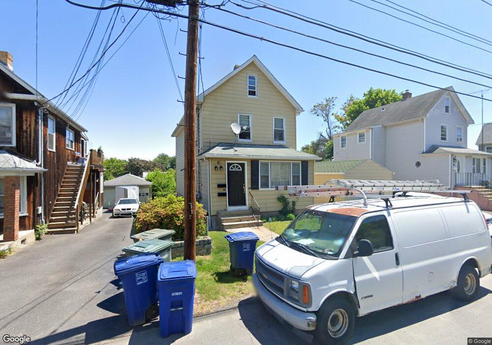
160 Sampson St Bridgeport, CT 06606
Brooklawn-Saint Vincent NeighborhoodEstimated Value: $431,000 - $569,000
4
Beds
2
Baths
2,276
Sq Ft
$215/Sq Ft
Est. Value
About This Home
This home is located at 160 Sampson St, Bridgeport, CT 06606 and is currently estimated at $490,184, approximately $215 per square foot. 160 Sampson St is a home located in Fairfield County with nearby schools including Madison School, Central High School, and Catholic Academy of Bridgeport-St. Raphael Academy.
Ownership History
Date
Name
Owned For
Owner Type
Purchase Details
Closed on
Nov 1, 2002
Sold by
Cecere Vincent and Cecere Angelo
Bought by
Lopez-Ospina John A and Lopez Jamie
Current Estimated Value
Home Financials for this Owner
Home Financials are based on the most recent Mortgage that was taken out on this home.
Original Mortgage
$162,000
Interest Rate
6.09%
Create a Home Valuation Report for This Property
The Home Valuation Report is an in-depth analysis detailing your home's value as well as a comparison with similar homes in the area
Home Values in the Area
Average Home Value in this Area
Purchase History
| Date | Buyer | Sale Price | Title Company |
|---|---|---|---|
| Lopez-Ospina John A | $180,000 | -- | |
| Lopez-Ospina John A | $180,000 | -- |
Source: Public Records
Mortgage History
| Date | Status | Borrower | Loan Amount |
|---|---|---|---|
| Open | Lopez-Ospina John A | $196,000 | |
| Closed | Lopez-Ospina John A | $162,000 |
Source: Public Records
Tax History Compared to Growth
Tax History
| Year | Tax Paid | Tax Assessment Tax Assessment Total Assessment is a certain percentage of the fair market value that is determined by local assessors to be the total taxable value of land and additions on the property. | Land | Improvement |
|---|---|---|---|---|
| 2025 | $7,736 | $178,040 | $69,890 | $108,150 |
| 2024 | $7,736 | $178,040 | $69,890 | $108,150 |
| 2023 | $7,736 | $178,040 | $69,890 | $108,150 |
| 2022 | $7,736 | $178,040 | $69,890 | $108,150 |
| 2021 | $7,736 | $178,040 | $69,890 | $108,150 |
| 2020 | $6,841 | $126,700 | $36,510 | $90,190 |
| 2019 | $6,841 | $126,700 | $36,510 | $90,190 |
| 2018 | $6,889 | $126,700 | $36,510 | $90,190 |
| 2017 | $6,889 | $126,700 | $36,510 | $90,190 |
| 2016 | $6,889 | $126,700 | $36,510 | $90,190 |
| 2015 | $6,960 | $164,920 | $44,180 | $120,740 |
| 2014 | $6,960 | $164,920 | $44,180 | $120,740 |
Source: Public Records
Map
Nearby Homes
- 241 Sampson St
- 11 Myron Ave
- 150 Alexander Dr
- 125 Alexander Dr
- 201 High Ridge Dr
- 119 Madison Terrace
- 203 Wayne St
- 252 Harlem Ave Unit B6
- 252 Harlem Ave Unit B5
- 508 Hawley Ave
- 105 Tremont Ave Unit E
- 105 Tremont Ave Unit B
- 2625 Park Ave Unit 12L
- 2625 Park Ave Unit 5N
- 106 Manhattan Ave Unit 108
- 76 Suburban Ave
- 123 Harlem Ave
- 631 Fairview Ave
- 1275 Capitol Ave
- 2675 Park Ave Unit 3
- 146 Sampson St
- 172 Sampson St
- 109 Holroyd St
- 97 Holroyd St
- 142 Holroyd St
- 142 Holroyd St Unit 1
- 142 Holroyd St Unit 2
- 142 Holroyd St Unit 3
- 184 Sampson St
- 159 Sampson St Unit 161
- 85 Holroyd St
- 151 Sampson St
- 143 Sampson St
- 126 Sampson St
- 173 Sampson St
- 198 Sampson St
- 135 Sampson St
- 176 Holroyd St
- 128 Sidney St
- 130 Holroyd St