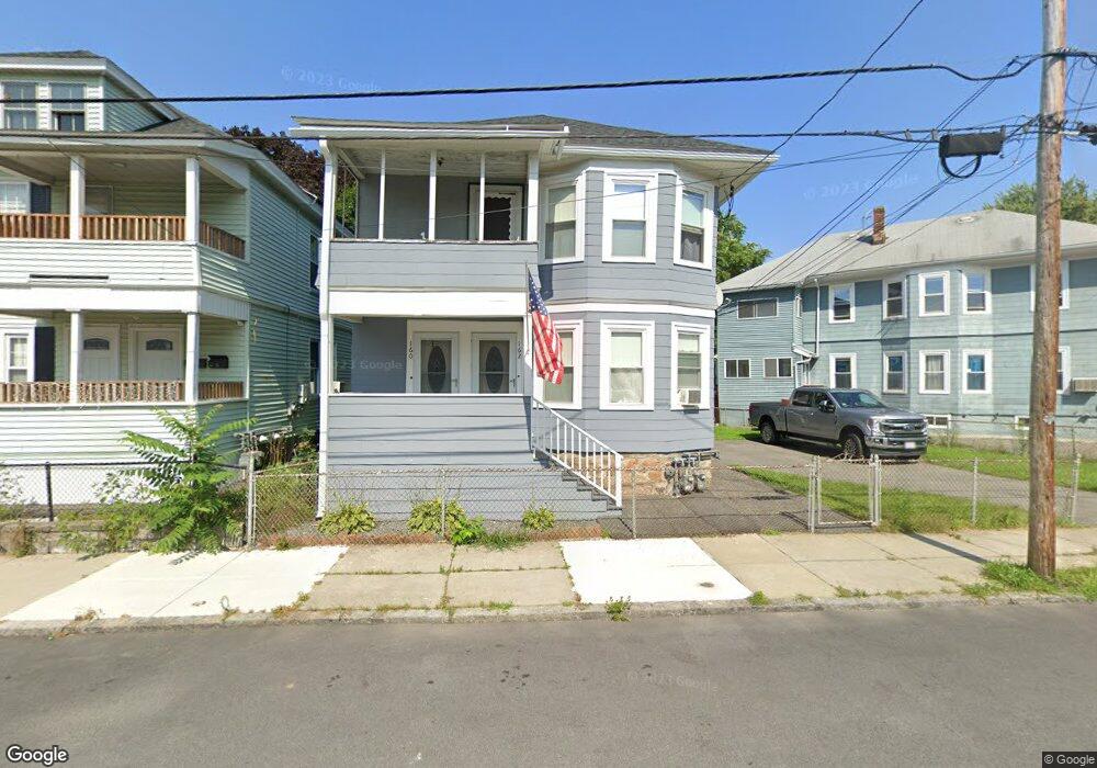
160 Sanborn St Unit 162 Lawrence, MA 01843
South West NeighborhoodEstimated Value: $559,627 - $754,000
4
Beds
2
Baths
2,278
Sq Ft
$298/Sq Ft
Est. Value
About This Home
This home is located at 160 Sanborn St Unit 162, Lawrence, MA 01843 and is currently estimated at $678,657, approximately $297 per square foot. 160 Sanborn St Unit 162 is a home located in Essex County with nearby schools including South Terrace Elementary School, Olive Branch Elementary School, and John Breen School.
Ownership History
Date
Name
Owned For
Owner Type
Purchase Details
Closed on
May 6, 2002
Sold by
Masse Pauline M and Daigle Gertrude B
Bought by
Turmel Doris E
Current Estimated Value
Home Financials for this Owner
Home Financials are based on the most recent Mortgage that was taken out on this home.
Original Mortgage
$65,000
Outstanding Balance
$27,833
Interest Rate
7.13%
Mortgage Type
Purchase Money Mortgage
Estimated Equity
$650,824
Create a Home Valuation Report for This Property
The Home Valuation Report is an in-depth analysis detailing your home's value as well as a comparison with similar homes in the area
Home Values in the Area
Average Home Value in this Area
Purchase History
| Date | Buyer | Sale Price | Title Company |
|---|---|---|---|
| Turmel Doris E | $50,000 | -- |
Source: Public Records
Mortgage History
| Date | Status | Borrower | Loan Amount |
|---|---|---|---|
| Open | Turmel Doris E | $65,000 |
Source: Public Records
Tax History Compared to Growth
Tax History
| Year | Tax Paid | Tax Assessment Tax Assessment Total Assessment is a certain percentage of the fair market value that is determined by local assessors to be the total taxable value of land and additions on the property. | Land | Improvement |
|---|---|---|---|---|
| 2025 | $4,682 | $532,000 | $98,800 | $433,200 |
| 2024 | $4,585 | $495,700 | $106,900 | $388,800 |
| 2023 | $4,458 | $438,800 | $99,200 | $339,600 |
| 2022 | $4,155 | $363,200 | $89,800 | $273,400 |
| 2021 | $4,060 | $330,900 | $89,800 | $241,100 |
| 2020 | $3,904 | $314,100 | $85,200 | $228,900 |
| 2019 | $3,904 | $285,400 | $70,800 | $214,600 |
| 2018 | $3,577 | $249,800 | $67,100 | $182,700 |
| 2017 | $3,321 | $216,500 | $63,400 | $153,100 |
| 2016 | $3,240 | $208,900 | $52,200 | $156,700 |
| 2015 | $3,178 | $210,200 | $52,200 | $158,000 |
Source: Public Records
Map
Nearby Homes
- 91-93 Newton St
- 629 Andover St
- 49 Bowdoin St Unit 51
- 8 Packard St
- 19 Front St
- 13 Kingston St
- 54 Amherst St
- 37 Tewksbury St Unit 39
- 132-134 S Broadway
- 15 Beaconsfield St
- 82 S Broadway
- 312 Water St Unit 36
- 12 Merrimack View Ct
- 11 W Hawley St
- 55-59 Water St
- 42 Beresford St
- 33 Jefferson St
- 5 W Kenneth St
- 95 Hancock St
- 24 Inman St Unit 32
- 162 Sanborn St
- 156 Sanborn St Unit 158
- 164 Sanborn St Unit 166
- 148 Sanborn St Unit 150
- 35 Bigelow St
- 46 Coolidge St
- 168 Sanborn St Unit 172
- 168 Sanborn St Unit 1
- 79 Bigelow St
- 167 Emmett St
- 149 Emmett St Unit 153
- 8 Coolidge St Unit 10
- 140 Sanborn St Unit 142
- 172 Sanborn St Unit 174
- 11 Bigelow St Unit 15
- 159 Emmett St
- 161-163 Sanborn St
- 11-15 Bigelow St
- 161 Sanborn St Unit 163
- 16 Coolidge St Unit 18