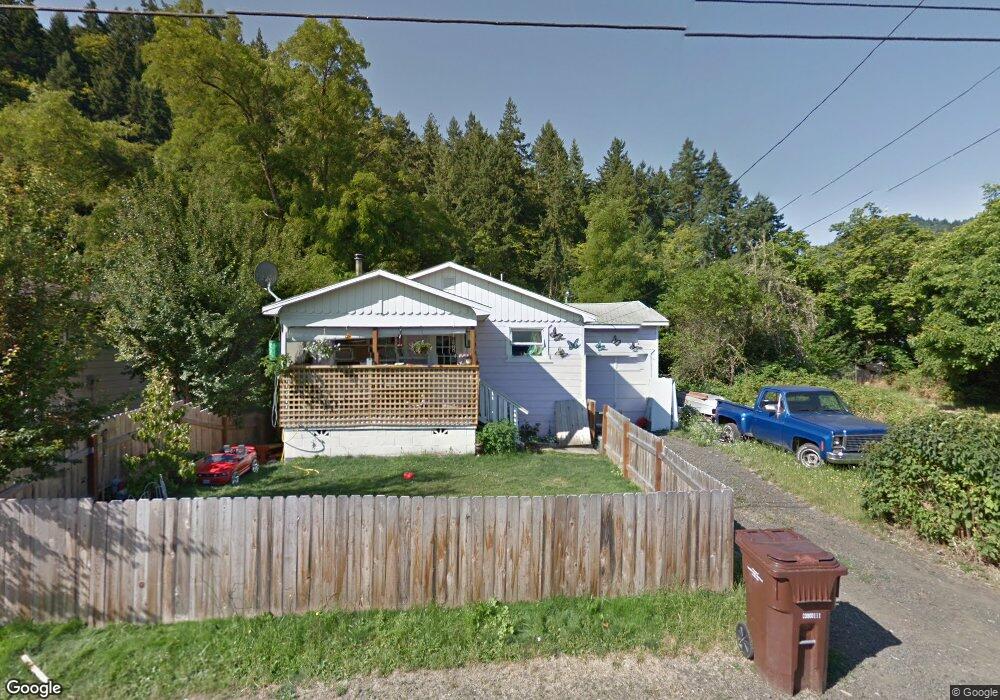
160 SE Mill St Myrtle Creek, OR 97457
Estimated Value: $112,000 - $190,129
2
Beds
1
Bath
720
Sq Ft
$209/Sq Ft
Est. Value
About This Home
This home is located at 160 SE Mill St, Myrtle Creek, OR 97457 and is currently estimated at $150,532, approximately $209 per square foot. 160 SE Mill St is a home located in Douglas County with nearby schools including South Umpqua High School.
Ownership History
Date
Name
Owned For
Owner Type
Purchase Details
Closed on
Nov 16, 2015
Sold by
Mcdougal Bros Investments
Bought by
Leelynn Inc
Current Estimated Value
Purchase Details
Closed on
May 19, 2015
Sold by
Goff Joan L
Bought by
Kremposki Rachel
Home Financials for this Owner
Home Financials are based on the most recent Mortgage that was taken out on this home.
Original Mortgage
$41,500
Interest Rate
3.67%
Mortgage Type
Seller Take Back
Purchase Details
Closed on
Jun 21, 2006
Sold by
Goff Daniel J
Bought by
Canfield Jacquelyn L
Create a Home Valuation Report for This Property
The Home Valuation Report is an in-depth analysis detailing your home's value as well as a comparison with similar homes in the area
Home Values in the Area
Average Home Value in this Area
Purchase History
| Date | Buyer | Sale Price | Title Company |
|---|---|---|---|
| Leelynn Inc | -- | None Available | |
| Kremposki Rachel | $43,500 | Amerititle | |
| Canfield Jacquelyn L | $47,160 | Amerititle |
Source: Public Records
Mortgage History
| Date | Status | Borrower | Loan Amount |
|---|---|---|---|
| Previous Owner | Kremposki Rachel | $41,500 |
Source: Public Records
Tax History Compared to Growth
Tax History
| Year | Tax Paid | Tax Assessment Tax Assessment Total Assessment is a certain percentage of the fair market value that is determined by local assessors to be the total taxable value of land and additions on the property. | Land | Improvement |
|---|---|---|---|---|
| 2024 | $800 | $59,806 | -- | -- |
| 2023 | $777 | $58,065 | $0 | $0 |
| 2022 | $754 | $56,374 | $0 | $0 |
| 2021 | $732 | $54,733 | $0 | $0 |
| 2020 | $711 | $53,139 | $0 | $0 |
| 2019 | $690 | $51,592 | $0 | $0 |
| 2018 | $670 | $50,090 | $0 | $0 |
| 2017 | $645 | $48,632 | $0 | $0 |
| 2016 | $614 | $47,216 | $0 | $0 |
| 2015 | $596 | $45,841 | $0 | $0 |
| 2014 | $588 | $44,506 | $0 | $0 |
| 2013 | -- | $43,210 | $0 | $0 |
Source: Public Records
Map
Nearby Homes
- 195 SE Mill St
- 217 SE Mill St
- 206 NE Laurel Ave
- 0 S Main St Unit 24686107
- 0 SE Meadowlark Ave Unit 370339863
- 420 SW 4th Ave
- 0 N Main St
- 455 Woody Ct
- 0 SE Ardis Ave Unit 7 24085450
- 0 SE Ardis Ave Unit 9 24630388
- 0 SE Ardis Ave Unit 8 24060428
- 0 SE Ardis Ave Unit 6,7,8,9 24184019
- 0 SE Ardis Ave Unit 6 24491349
- 186 NE Division St
- 0 SW Pioneer Way
- 650 SE Riverside Dr
- 407 NE Waite St
- 728 NW Morrison Ave
- 629 NE Johnson St
- 184 SE Cordelia Dr
- 170 SE Mill St
- 150 SE Mill St
- 180 SE Mill St
- 165 SE Mill St
- 190 SE Mill St
- 130 SE Mill St
- 0 SE Se Mill St
- 200 SE Mill St
- 193 S Main St
- 189 S Main St Unit 1
- 201 S Main St Unit 2
- 201 S Main St
- 210 SE Mill St
- 0 SE Bowden St Unit 152931782
- 0 SE Bowden St Unit 22122983
- 227 S Main St Unit 2
- 227 S Main St
- 205 SE Mill St
- 158 SE Bowden St
- 220 SE Mill St