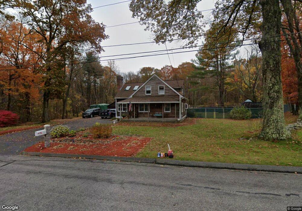
160 Sutton St Uxbridge, MA 01569
Estimated Value: $517,000 - $576,000
3
Beds
1
Bath
2,076
Sq Ft
$264/Sq Ft
Est. Value
About This Home
This home is located at 160 Sutton St, Uxbridge, MA 01569 and is currently estimated at $547,711, approximately $263 per square foot. 160 Sutton St is a home located in Worcester County with nearby schools including Uxbridge High School, Our Lady of the Valley Regional School, and Whitinsville Christian School.
Ownership History
Date
Name
Owned For
Owner Type
Purchase Details
Closed on
Oct 22, 2008
Sold by
Remillard Kevin J and Remillard Patricia K
Bought by
Remillard Tr Kevin J and Remillard Patricia K
Current Estimated Value
Create a Home Valuation Report for This Property
The Home Valuation Report is an in-depth analysis detailing your home's value as well as a comparison with similar homes in the area
Home Values in the Area
Average Home Value in this Area
Purchase History
| Date | Buyer | Sale Price | Title Company |
|---|---|---|---|
| Remillard Tr Kevin J | -- | -- |
Source: Public Records
Tax History
| Year | Tax Paid | Tax Assessment Tax Assessment Total Assessment is a certain percentage of the fair market value that is determined by local assessors to be the total taxable value of land and additions on the property. | Land | Improvement |
|---|---|---|---|---|
| 2025 | $64 | $491,500 | $170,100 | $321,400 |
| 2024 | $5,023 | $388,800 | $162,300 | $226,500 |
| 2023 | $4,908 | $351,800 | $139,300 | $212,500 |
| 2022 | $4,668 | $307,900 | $123,600 | $184,300 |
| 2021 | $4,833 | $305,500 | $121,200 | $184,300 |
| 2020 | $4,553 | $272,000 | $116,300 | $155,700 |
| 2019 | $4,603 | $265,300 | $116,300 | $149,000 |
| 2018 | $4,469 | $260,300 | $116,300 | $144,000 |
| 2017 | $4,684 | $276,200 | $113,900 | $162,300 |
| 2016 | $4,405 | $250,700 | $105,300 | $145,400 |
| 2015 | $4,317 | $248,100 | $105,300 | $142,800 |
Source: Public Records
Map
Nearby Homes
- 235 Rivulet St
- 0 Homestead Ave
- 79 Country Club Dr
- 138 Elm St
- 71 Rivulet St Unit B
- 22 Bayliss Way
- 237 Heritage Dr Unit 237
- 240 Heritage Dr
- 12 Hartford Ave E
- 164 Heritage Dr Unit 164
- 26 Rivulet St
- 37 Bayliss Way
- 125 Heritage Dr
- 128 Linwood Ave
- 3 Strathmore Shire Unit A
- 288-290 Providence Rd
- 208-210 Church St
- 30-32 Spring St
- 376 Douglas St
- 86 Hunter Rd
Your Personal Tour Guide
Ask me questions while you tour the home.