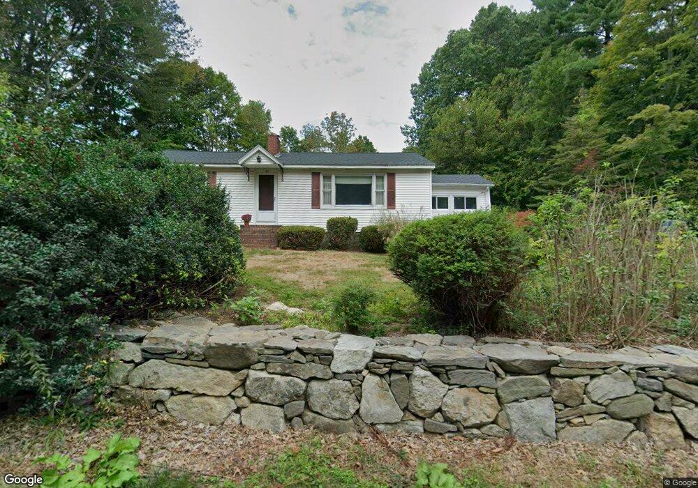
160 Thorndike St Dunstable, MA 01827
Estimated Value: $565,566 - $800,000
Studio
1
Bath
1,944
Sq Ft
$342/Sq Ft
Est. Value
About This Home
This home is located at 160 Thorndike St, Dunstable, MA 01827 and is currently estimated at $665,642, approximately $342 per square foot. 160 Thorndike St is a home located in Middlesex County with nearby schools including Groton Dunstable Regional High School, World Academy, and Academy of Notre Dame - Upper School.
Ownership History
Date
Name
Owned For
Owner Type
Purchase Details
Closed on
Jan 27, 2022
Sold by
Podgorni Jonathan L and Podgorni Julie A
Bought by
Podgorni Ft
Current Estimated Value
Purchase Details
Closed on
Jan 1, 1979
Bought by
Podgorni Jonathan and Podgorni Julie
Create a Home Valuation Report for This Property
The Home Valuation Report is an in-depth analysis detailing your home's value as well as a comparison with similar homes in the area
Home Values in the Area
Average Home Value in this Area
Purchase History
| Date | Buyer | Sale Price | Title Company |
|---|---|---|---|
| Podgorni Ft | -- | None Available | |
| Podgorni Jonathan | $55,200 | -- |
Source: Public Records
Mortgage History
| Date | Status | Borrower | Loan Amount |
|---|---|---|---|
| Previous Owner | Podgorni Jonathan | $100,000 | |
| Previous Owner | Podgorni Jonathan | $79,000 | |
| Previous Owner | Podgorni Jonathan | $15,000 |
Source: Public Records
Tax History
| Year | Tax Paid | Tax Assessment Tax Assessment Total Assessment is a certain percentage of the fair market value that is determined by local assessors to be the total taxable value of land and additions on the property. | Land | Improvement |
|---|---|---|---|---|
| 2025 | $5,863 | $426,400 | $216,500 | $209,900 |
| 2024 | $5,576 | $399,400 | $199,200 | $200,200 |
| 2023 | $5,766 | $385,200 | $199,200 | $186,000 |
| 2022 | $5,656 | $370,900 | $199,200 | $171,700 |
| 2021 | $5,099 | $310,700 | $182,400 | $128,300 |
| 2020 | $5,064 | $300,700 | $182,400 | $118,300 |
| 2019 | $4,898 | $287,100 | $182,400 | $104,700 |
| 2018 | $4,890 | $278,800 | $181,900 | $96,900 |
| 2017 | $4,672 | $274,500 | $181,900 | $92,600 |
| 2016 | $4,407 | $266,300 | $173,700 | $92,600 |
| 2015 | $3,915 | $234,000 | $146,000 | $88,000 |
| 2014 | $3,690 | $234,000 | $146,000 | $88,000 |
Source: Public Records
Map
Nearby Homes
- 4 Thorndike St
- 6 Green Heron Ln Unit U22
- 4 Strawberry Bank Rd Unit 12
- 38 Georgetown Dr
- 2 Strawberry Bank Rd Unit 17
- 4 Heritage Village Dr
- 20 Georgetown Dr
- 11 Lojko Dr
- 0 Lowell St
- 210 Brook Village Rd Unit U43
- 210 Brook Village Rd Unit U38
- 58 Wilderness Dr
- 8 Wilderness Dr
- 65 Wilderness Dr
- 4 Wilderness Dr
- 1 Wilderness Dr
- 1 Doucet Ave
- 8 Hikers Ln
- 4 Hikers Ln
- 2 Wilderness Dr
Your Personal Tour Guide
Ask me questions while you tour the home.