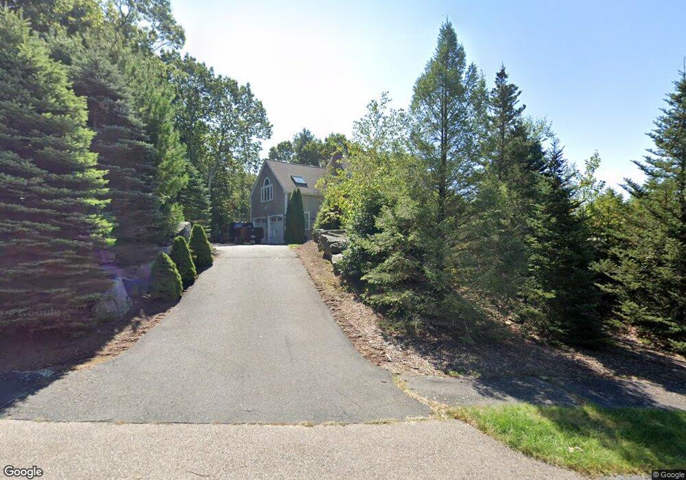
160 Tilting Rock Rd Wrentham, MA 02093
Estimated Value: $846,000 - $1,004,000
4
Beds
3
Baths
2,741
Sq Ft
$336/Sq Ft
Est. Value
About This Home
This home is located at 160 Tilting Rock Rd, Wrentham, MA 02093 and is currently estimated at $919,901, approximately $335 per square foot. 160 Tilting Rock Rd is a home located in Norfolk County with nearby schools including Delaney Elementary School, Charles E Roderick, and The Sage School.
Ownership History
Date
Name
Owned For
Owner Type
Purchase Details
Closed on
Jun 5, 2025
Sold by
Richardson David S and Richardson Kerry A
Bought by
Richardson Ret and Richardson
Current Estimated Value
Purchase Details
Closed on
Sep 30, 1994
Sold by
Pilgrim Rt
Bought by
Richardson David S and Richardson Kerry A
Create a Home Valuation Report for This Property
The Home Valuation Report is an in-depth analysis detailing your home's value as well as a comparison with similar homes in the area
Home Values in the Area
Average Home Value in this Area
Purchase History
| Date | Buyer | Sale Price | Title Company |
|---|---|---|---|
| Richardson Ret | -- | None Available | |
| Richardson Ret | -- | None Available | |
| Richardson David S | $241,500 | -- |
Source: Public Records
Mortgage History
| Date | Status | Borrower | Loan Amount |
|---|---|---|---|
| Previous Owner | Richardson David S | $315,000 | |
| Previous Owner | Richardson David S | $331,000 | |
| Previous Owner | Richardson David S | $260,500 |
Source: Public Records
Tax History Compared to Growth
Tax History
| Year | Tax Paid | Tax Assessment Tax Assessment Total Assessment is a certain percentage of the fair market value that is determined by local assessors to be the total taxable value of land and additions on the property. | Land | Improvement |
|---|---|---|---|---|
| 2025 | $9,020 | $778,300 | $291,700 | $486,600 |
| 2024 | $8,616 | $718,000 | $291,700 | $426,300 |
| 2023 | $8,584 | $680,200 | $265,300 | $414,900 |
| 2022 | $8,164 | $597,200 | $247,500 | $349,700 |
| 2021 | $7,567 | $537,800 | $216,000 | $321,800 |
| 2020 | $7,806 | $547,800 | $192,100 | $355,700 |
| 2019 | $7,734 | $547,700 | $208,100 | $339,600 |
| 2018 | $7,543 | $529,700 | $208,400 | $321,300 |
| 2017 | $7,342 | $515,200 | $204,400 | $310,800 |
| 2016 | $7,186 | $503,200 | $198,400 | $304,800 |
| 2015 | $6,991 | $466,700 | $176,100 | $290,600 |
| 2014 | $6,879 | $449,300 | $169,400 | $279,900 |
Source: Public Records
Map
Nearby Homes
- 319 Taunton St
- 10 Nature View Dr
- 15 Nature View Dr
- 362 East St
- 11 Earle Stewart Ln
- 131 Creek St Unit 7
- Lot 3 - 14 Earle Stewart Ln
- Lot 1 - Blueberry 2 Car Plan at King Philip Estates
- Lot 8 - Blueberry 2 Car Plan at King Philip Estates
- Lot 5 - Hughes 2 car Plan at King Philip Estates
- Lot 6 - Blueberry 3 Car Plan at King Philip Estates
- Lot 2 - Camden 2 Car Plan at King Philip Estates
- Lot 7 - Cedar Plan at King Philip Estates
- Lot 4 - Hemingway 2 Car Plan at King Philip Estates
- Lot 3 - Blueberry 2 Car Plan at King Philip Estates
- 1 Lorraine Metcalf Dr
- 270 Dedham St
- 120 Hawes St
- 65 Pond St
- 483 Thurston St
- 170 Tilting Rock Rd
- 150 Tilting Rock Rd
- 165 Tilting Rock Rd
- 130 Tilting Rock Rd
- 140 Tilting Rock Rd
- 180 Tilting Rock Rd
- 120 Tilting Rock Rd
- 125 Tilting Rock Rd
- 190 Tilting Rock Rd
- 110 Tilting Rock Rd
- 95 Tilting Rock Rd
- 200 Tilting Rock Rd
- 195 Tilting Rock Rd
- 100 Tilting Rock Rd
- 221 Taunton St
- 209 Taunton St
- 177 Taunton St
- 215 Taunton St
- 197 Taunton St
- 75 Tilting Rock Rd