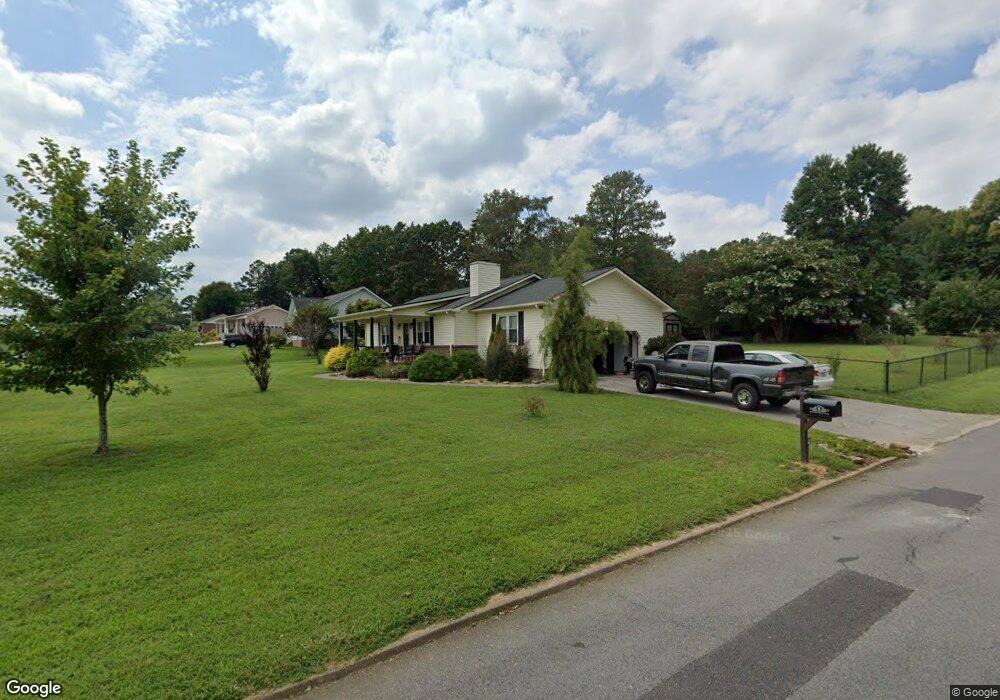
160 Upper Varnell Rd Cohutta, GA 30710
Estimated Value: $211,000 - $284,000
3
Beds
2
Baths
1,500
Sq Ft
$168/Sq Ft
Est. Value
About This Home
This home is located at 160 Upper Varnell Rd, Cohutta, GA 30710 and is currently estimated at $252,307, approximately $168 per square foot. 160 Upper Varnell Rd is a home located in Whitfield County with nearby schools including Varnell Elementary School and Coahulla Creek High School.
Ownership History
Date
Name
Owned For
Owner Type
Purchase Details
Closed on
Jun 24, 2016
Sold by
Brown Danny L and Brown Eunice I
Bought by
Stevens Shannon and Strickland Lisa M
Current Estimated Value
Home Financials for this Owner
Home Financials are based on the most recent Mortgage that was taken out on this home.
Original Mortgage
$91,805
Outstanding Balance
$72,295
Interest Rate
3.25%
Mortgage Type
FHA
Estimated Equity
$180,012
Purchase Details
Closed on
Aug 24, 2007
Sold by
Collins Timothy
Bought by
Brown Danny L
Purchase Details
Closed on
Apr 14, 2004
Sold by
Collins Timothy and Collins Donna M
Bought by
Collins Timothy
Purchase Details
Closed on
Sep 1, 1995
Bought by
Collins Timothy and Crook Donna M
Create a Home Valuation Report for This Property
The Home Valuation Report is an in-depth analysis detailing your home's value as well as a comparison with similar homes in the area
Home Values in the Area
Average Home Value in this Area
Purchase History
| Date | Buyer | Sale Price | Title Company |
|---|---|---|---|
| Stevens Shannon | $93,500 | -- | |
| Brown Danny L | $143,000 | -- | |
| Collins Timothy | -- | -- | |
| Collins Timothy | $85,800 | -- |
Source: Public Records
Mortgage History
| Date | Status | Borrower | Loan Amount |
|---|---|---|---|
| Open | Stevens Shannon | $91,805 |
Source: Public Records
Tax History Compared to Growth
Tax History
| Year | Tax Paid | Tax Assessment Tax Assessment Total Assessment is a certain percentage of the fair market value that is determined by local assessors to be the total taxable value of land and additions on the property. | Land | Improvement |
|---|---|---|---|---|
| 2024 | $1,569 | $83,836 | $18,400 | $65,436 |
| 2023 | $1,569 | $59,247 | $16,000 | $43,247 |
| 2022 | $996 | $42,330 | $8,400 | $33,930 |
| 2021 | $996 | $42,330 | $8,400 | $33,930 |
| 2020 | $1,019 | $42,330 | $8,400 | $33,930 |
| 2019 | $977 | $40,634 | $8,400 | $32,234 |
| 2018 | $988 | $40,634 | $8,400 | $32,234 |
| 2017 | $886 | $40,634 | $8,400 | $32,234 |
| 2016 | $1,143 | $37,717 | $8,400 | $29,317 |
| 2014 | $1,015 | $37,717 | $8,400 | $29,317 |
| 2013 | -- | $37,716 | $8,400 | $29,316 |
Source: Public Records
Map
Nearby Homes
- 0 Cleveland Hwy
- 103 Paddle Wheel Ct
- 0 Tee Top Dr
- 4223 Spring Valley Dr
- 0 Highway 2 Unit 1507324
- 0 Highway 2 Unit 1507220
- 0 Highway 2 Unit 1507215
- Lot 93 Country Way
- Lot 92 Country Way
- Lot 82 Highland Pointe Dr
- Lot 83 Highland Pointe Dr
- Lot 95 Highland Pointe Dr
- LOT 52 Highland Pointe Dr
- Lot 89 Highland Pointe Dr
- Lot 81 Highland Pointe Dr
- Lot 94 Highland Pointe Dr
- Lot 84 Highland Pointe Dr
- 0 Highland Pointe Dr Unit 129098
- Lot 88 Highland Pointe Dr
- Lot 80 Highland Pointe Dr
- 162 Upper Varnell Rd
- 158 Upper Varnell Rd
- 4103 Birdie Ln
- 164 Upper Varnell Rd
- 4105 Birdie Ln
- 4102 Birdie Ln
- 156 Upper Varnell Rd
- 4104 Dog Legg Dr
- 166 Upper Varnell Rd
- 4102 Dog Legg Dr
- 4107 Birdie Ln
- 4106 Dog Legg Dr
- 154 Upper Varnell Rd
- 158 Eagle Dr
- 160 Eagle Dr
- 4100 Dog Legg Dr
- 4108 Dog Legg Dr
- 4109 Birdie Ln
- 4107 Dog Legg Dr
- 4105 Dog Legg Dr