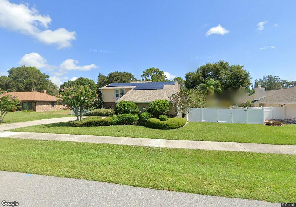
160 Waring Way Merritt Island, FL 32952
Estimated Value: $569,824 - $693,000
4
Beds
3
Baths
2,419
Sq Ft
$262/Sq Ft
Est. Value
About This Home
This home is located at 160 Waring Way, Merritt Island, FL 32952 and is currently estimated at $633,456, approximately $261 per square foot. 160 Waring Way is a home located in Brevard County with nearby schools including Tropical Elementary School, Thomas Jefferson Middle School, and Merritt Island High School.
Ownership History
Date
Name
Owned For
Owner Type
Purchase Details
Closed on
May 20, 2003
Sold by
Reid Bruce E
Bought by
Reid Diane M
Current Estimated Value
Home Financials for this Owner
Home Financials are based on the most recent Mortgage that was taken out on this home.
Original Mortgage
$159,000
Outstanding Balance
$69,104
Interest Rate
5.79%
Estimated Equity
$564,352
Purchase Details
Closed on
Apr 19, 1999
Sold by
Carbon Steven L and Carbon Margarita A
Bought by
Reid Bruce E and Reid Diane M
Home Financials for this Owner
Home Financials are based on the most recent Mortgage that was taken out on this home.
Original Mortgage
$160,650
Interest Rate
7.13%
Purchase Details
Closed on
Oct 27, 1995
Sold by
Stone Doris Estelle
Bought by
Carbon Steven L and Carbon Margarita A
Home Financials for this Owner
Home Financials are based on the most recent Mortgage that was taken out on this home.
Original Mortgage
$151,050
Interest Rate
7.58%
Create a Home Valuation Report for This Property
The Home Valuation Report is an in-depth analysis detailing your home's value as well as a comparison with similar homes in the area
Home Values in the Area
Average Home Value in this Area
Purchase History
| Date | Buyer | Sale Price | Title Company |
|---|---|---|---|
| Reid Diane M | -- | Island Title & Escrow Corp | |
| Reid Bruce E | $157,500 | -- | |
| Carbon Steven L | $159,000 | -- |
Source: Public Records
Mortgage History
| Date | Status | Borrower | Loan Amount |
|---|---|---|---|
| Open | Reid Diane M | $159,000 | |
| Previous Owner | Reid Bruce E | $160,650 | |
| Previous Owner | Carbon Steven L | $151,050 |
Source: Public Records
Tax History Compared to Growth
Tax History
| Year | Tax Paid | Tax Assessment Tax Assessment Total Assessment is a certain percentage of the fair market value that is determined by local assessors to be the total taxable value of land and additions on the property. | Land | Improvement |
|---|---|---|---|---|
| 2025 | $2,780 | $212,230 | -- | -- |
| 2024 | $2,742 | $206,250 | -- | -- |
| 2023 | $2,742 | $200,250 | $0 | $0 |
| 2022 | $2,565 | $194,420 | $0 | $0 |
| 2021 | $2,653 | $188,760 | $0 | $0 |
| 2020 | $2,579 | $186,160 | $0 | $0 |
| 2019 | $2,524 | $181,980 | $0 | $0 |
| 2018 | $2,526 | $178,590 | $0 | $0 |
| 2017 | $2,540 | $174,920 | $0 | $0 |
| 2016 | $2,577 | $171,330 | $49,000 | $122,330 |
| 2015 | $2,642 | $170,140 | $42,000 | $128,140 |
| 2014 | $2,658 | $168,790 | $42,000 | $126,790 |
Source: Public Records
Map
Nearby Homes
- 4065 Leona Ct
- 212 Rainbow St
- 1005 Old Parsonage Dr
- 1085 Old Parsonage Dr
- 4070 S Tropical Trail
- 1215 Old Parsonage Dr
- 0 Crooked Mile Rd
- 1165 Old Parsonage Dr
- 4297 Crooked Mile Rd
- 3700 S Courtenay Pkwy
- 4250 Blossom Cir
- 3695 Linnea Rd
- 4245 Hillview Cir
- 4385 Stillwaters Dr
- 4320 Crooked Mile Rd
- 4395 Crooked Mile Rd
- 1065 Mercedes Dr
- 000 S Unknown Pkwy
- 1239 Guy Island Dr
- 4760 Honeyridge Ln
- 150 Waring Way
- 170 Waring Way
- 3945 Wild Pine Ln
- 4040 Rhonda Ct
- 4045 Leona Ct
- 3935 Wild Pine Ln
- 140 Waring Way
- 180 Waring Way
- 4050 Rhonda Ct
- 4055 Leona Ct
- 130 Waring Way
- 3925 Wild Pine Ln
- 3955 Wild Pine Ln
- 190 Waring Way
- 4045 Rhonda Ct
- 4040 Leona Ct
- 3960 Crooked Mile Rd
- 3930 Wild Pine Ln
- 4060 Rhonda Ct
- 3915 Wild Pine Ln