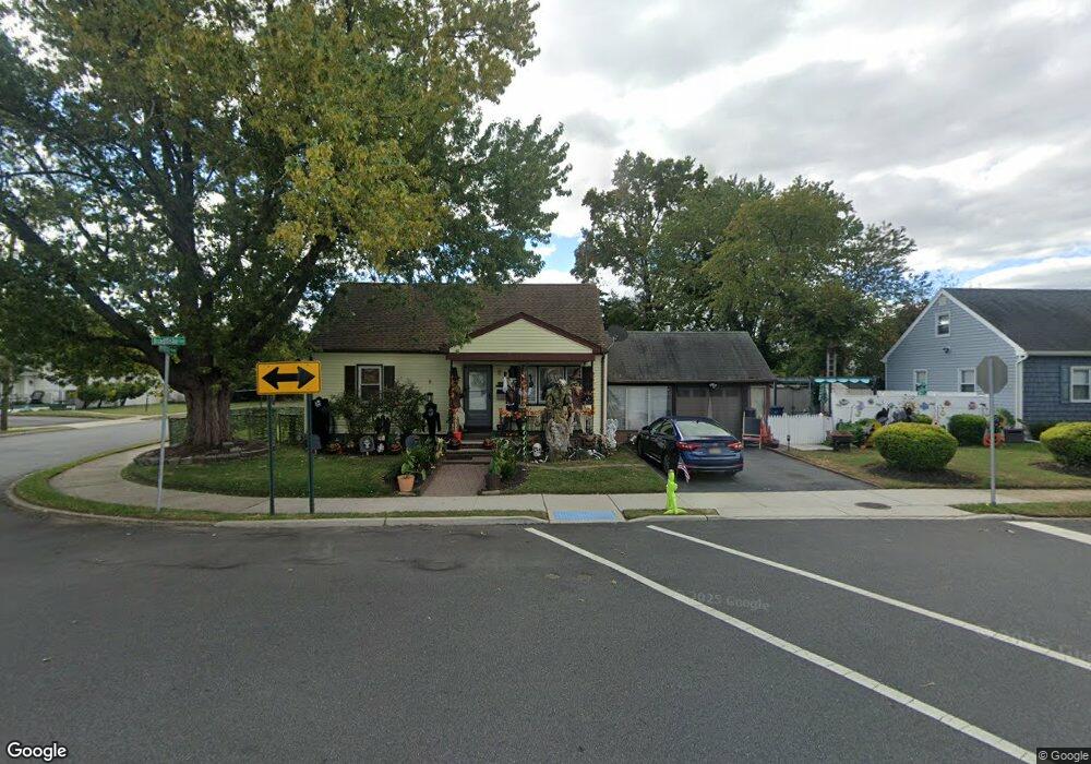
1600 Bradfiske Ave Neptune, NJ 07753
Estimated Value: $412,000 - $488,000
3
Beds
2
Baths
1,305
Sq Ft
$335/Sq Ft
Est. Value
About This Home
This home is located at 1600 Bradfiske Ave, Neptune, NJ 07753 and is currently estimated at $437,404, approximately $335 per square foot. 1600 Bradfiske Ave is a home located in Monmouth County with nearby schools including Neptune High School.
Ownership History
Date
Name
Owned For
Owner Type
Purchase Details
Closed on
Dec 23, 2002
Sold by
Oneill Lawrence
Bought by
Coles Donald and Murrin Catherine
Current Estimated Value
Home Financials for this Owner
Home Financials are based on the most recent Mortgage that was taken out on this home.
Original Mortgage
$160,481
Interest Rate
5.95%
Mortgage Type
FHA
Purchase Details
Closed on
Jul 12, 2002
Sold by
Smith Natalie
Bought by
Oneill Lawrence and Oneill Beatrice
Create a Home Valuation Report for This Property
The Home Valuation Report is an in-depth analysis detailing your home's value as well as a comparison with similar homes in the area
Home Values in the Area
Average Home Value in this Area
Purchase History
| Date | Buyer | Sale Price | Title Company |
|---|---|---|---|
| Coles Donald | $163,000 | -- | |
| Oneill Lawrence | $100,000 | -- |
Source: Public Records
Mortgage History
| Date | Status | Borrower | Loan Amount |
|---|---|---|---|
| Previous Owner | Coles Donald | $160,481 |
Source: Public Records
Tax History Compared to Growth
Tax History
| Year | Tax Paid | Tax Assessment Tax Assessment Total Assessment is a certain percentage of the fair market value that is determined by local assessors to be the total taxable value of land and additions on the property. | Land | Improvement |
|---|---|---|---|---|
| 2025 | $6,018 | $404,200 | $192,400 | $211,800 |
| 2024 | $5,366 | $343,700 | $167,000 | $176,700 |
| 2023 | $5,366 | $297,100 | $124,500 | $172,600 |
| 2022 | $3,789 | $227,400 | $80,000 | $147,400 |
| 2021 | $3,233 | $179,300 | $66,000 | $113,300 |
| 2020 | $3,349 | $158,100 | $50,700 | $107,400 |
| 2019 | $3,233 | $150,700 | $50,000 | $100,700 |
| 2018 | $3,255 | $150,000 | $50,000 | $100,000 |
| 2017 | $3,221 | $142,600 | $50,000 | $92,600 |
| 2016 | $3,196 | $141,100 | $50,000 | $91,100 |
| 2015 | $3,093 | $138,900 | $50,000 | $88,900 |
| 2014 | $4,291 | $158,400 | $55,000 | $103,400 |
Source: Public Records
Map
Nearby Homes
- 45 Ridge Ave
- 1501 Cherry Ln
- 152 Myrtle Ave
- 152 Division St
- 1509 Embury Ave
- 1608 Heck Ave
- 1502 Heck Ave
- 1601 Heck Ave
- 200 Drummond Ave
- 1221 11th Ave
- 230 Fisher Ave
- 55 N Route 35 Unit 12A
- 55 New Jersey 35 Unit 7
- 5 Ivy Place
- 264 Fisher Ave
- 503 Ridge Ave
- 1409 7th Ave
- 1317 7th Ave
- 135-137 Dewitt Ave
- 126 Dewitt Ave
- 33 Myrtle Ave
- 19 Myrtle Ave
- 1604 Bradfiske Ave
- 1606 Bradfiske Ave
- 1517 Cherry Ln
- 1513 Cherry Ln
- 1601 Huntington Ave
- 1603 Huntington Ave
- 1515 Cherry Ln
- 1511 Cherry Ln
- 1603 Bradfiske Ave
- 1605 Huntington Ave
- 18 Myrtle Ave
- 1608 Bradfiske Ave
- 1607 Huntington Ave
- 1509 Cherry Ln
- 148 Myrtle Ave
- 1607 Bradfiske Ave
- 1507 Cherry Ln
- 150 Myrtle Ave