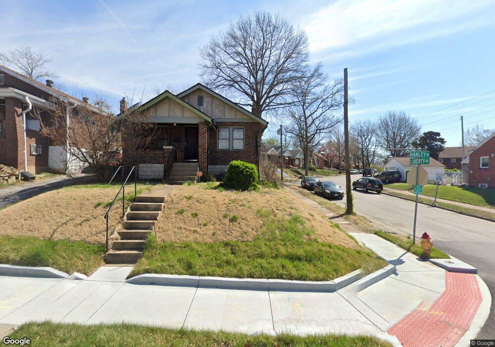
1600 N Hanley Rd Saint Louis, MO 63130
Estimated Value: $93,000 - $143,000
2
Beds
1
Bath
912
Sq Ft
$126/Sq Ft
Est. Value
About This Home
This home is located at 1600 N Hanley Rd, Saint Louis, MO 63130 and is currently estimated at $114,537, approximately $125 per square foot. 1600 N Hanley Rd is a home located in St. Louis County with nearby schools including Barbara C. Jordan Elementary School, Brittany Woods Middle School, and University City High School.
Ownership History
Date
Name
Owned For
Owner Type
Purchase Details
Closed on
Jan 14, 2005
Sold by
Ark Investments Inc
Bought by
Shepherd John and Clodfelter Karen L
Current Estimated Value
Home Financials for this Owner
Home Financials are based on the most recent Mortgage that was taken out on this home.
Original Mortgage
$55,600
Outstanding Balance
$27,942
Interest Rate
5.68%
Mortgage Type
Purchase Money Mortgage
Estimated Equity
$86,595
Create a Home Valuation Report for This Property
The Home Valuation Report is an in-depth analysis detailing your home's value as well as a comparison with similar homes in the area
Home Values in the Area
Average Home Value in this Area
Purchase History
| Date | Buyer | Sale Price | Title Company |
|---|---|---|---|
| Shepherd John | $69,500 | -- |
Source: Public Records
Mortgage History
| Date | Status | Borrower | Loan Amount |
|---|---|---|---|
| Open | Shepherd John | $55,600 | |
| Closed | Shepherd John | $13,900 |
Source: Public Records
Tax History Compared to Growth
Tax History
| Year | Tax Paid | Tax Assessment Tax Assessment Total Assessment is a certain percentage of the fair market value that is determined by local assessors to be the total taxable value of land and additions on the property. | Land | Improvement |
|---|---|---|---|---|
| 2025 | $1,288 | $20,390 | $4,350 | $16,040 |
| 2024 | $1,288 | $17,570 | $3,020 | $14,550 |
| 2023 | $1,286 | $17,570 | $3,020 | $14,550 |
| 2022 | $1,269 | $16,150 | $1,670 | $14,480 |
| 2021 | $1,257 | $16,150 | $1,670 | $14,480 |
| 2020 | $1,123 | $13,990 | $5,040 | $8,950 |
| 2019 | $1,112 | $13,990 | $5,040 | $8,950 |
| 2018 | $1,078 | $12,520 | $3,020 | $9,500 |
| 2017 | $1,080 | $12,520 | $3,020 | $9,500 |
| 2016 | $542 | $5,720 | $2,680 | $3,040 |
| 2015 | $544 | $5,720 | $2,680 | $3,040 |
| 2014 | $491 | $5,020 | $1,810 | $3,210 |
Source: Public Records
Map
Nearby Homes
- 7372 Liberty Ave
- 1545 Moore Place
- 7441 Trenton Ave
- 7335 Trenton Ave
- 7507 Liberty Ave
- 7336 Milan Ave
- 7339 Wayne Ave
- 8109 Washington St
- 1604 Quendo Ave
- 1617 Purdue Ave
- 7624 Fairham Ave
- 8008 Monroe Ave
- 8227 Page Ave
- 1609 Bradford Ave
- 7346 Canton Ave
- 8138 Underhill Dr
- 1520 Purdue Ave
- 1944 Falcon Dr
- 1459 Lyndale Ave
- 7171 White Oak Ln
- 1604 N Hanley Rd
- 1608 N Hanley Rd
- 7387 Liberty Ave
- 1566 N Hanley Rd
- 1610 N Hanley Rd
- 7385 Liberty Ave
- 7401 Liberty Ave
- 1560 N Hanley Rd
- 7382 Liberty Ave
- 7383 Liberty Ave
- 7922 Page Ave
- 7405 Liberty Ave
- 7924 Page Ave
- 7920 Page Ave
- 7952 Page Ave
- 7381 Liberty Ave
- 7918 Page Ave
- 7400 Liberty Ave
- 1558 N Hanley Rd
- 7956 Page Ave