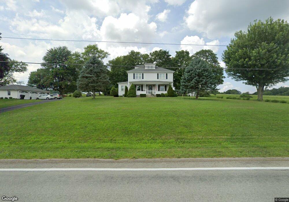
1600 State Route 168 Georgetown, PA 15043
Hanover Township NeighborhoodEstimated Value: $320,000 - $440,000
4
Beds
3
Baths
2,304
Sq Ft
$164/Sq Ft
Est. Value
About This Home
This home is located at 1600 State Route 168, Georgetown, PA 15043 and is currently estimated at $377,333, approximately $163 per square foot. 1600 State Route 168 is a home located in Beaver County with nearby schools including South Side El School, South Side Middle School, and South Side High School.
Ownership History
Date
Name
Owned For
Owner Type
Purchase Details
Closed on
Mar 18, 2016
Sold by
Andrews Ii John R and Andrews Hope Ann
Bought by
Mcdonald Kevin L and Mcdonald Amy J
Current Estimated Value
Home Financials for this Owner
Home Financials are based on the most recent Mortgage that was taken out on this home.
Original Mortgage
$117,500
Outstanding Balance
$50,657
Interest Rate
3.64%
Mortgage Type
VA
Estimated Equity
$326,676
Purchase Details
Closed on
Sep 13, 2010
Sold by
Andrews John R
Bought by
Andrews Ii John R and Andrews Hope Ann
Create a Home Valuation Report for This Property
The Home Valuation Report is an in-depth analysis detailing your home's value as well as a comparison with similar homes in the area
Home Values in the Area
Average Home Value in this Area
Purchase History
| Date | Buyer | Sale Price | Title Company |
|---|---|---|---|
| Mcdonald Kevin L | $231,000 | Pennsylvania Land Titles | |
| Andrews Ii John R | -- | None Available |
Source: Public Records
Mortgage History
| Date | Status | Borrower | Loan Amount |
|---|---|---|---|
| Open | Mcdonald Kevin L | $117,500 |
Source: Public Records
Tax History Compared to Growth
Tax History
| Year | Tax Paid | Tax Assessment Tax Assessment Total Assessment is a certain percentage of the fair market value that is determined by local assessors to be the total taxable value of land and additions on the property. | Land | Improvement |
|---|---|---|---|---|
| 2025 | $886 | $120,750 | $24,900 | $95,850 |
| 2024 | $3,529 | $120,750 | $24,900 | $95,850 |
| 2023 | $2,852 | $30,050 | $7,450 | $22,600 |
| 2022 | $2,774 | $30,050 | $7,450 | $22,600 |
| 2021 | $2,774 | $30,050 | $7,450 | $22,600 |
| 2020 | $2,694 | $30,050 | $7,450 | $22,600 |
| 2019 | $2,694 | $30,050 | $7,450 | $22,600 |
| 2018 | $2,641 | $30,050 | $7,450 | $22,600 |
| 2017 | $2,641 | $30,050 | $7,450 | $22,600 |
| 2016 | $2,527 | $30,050 | $7,450 | $22,600 |
| 2015 | $667 | $30,050 | $7,450 | $22,600 |
| 2014 | $667 | $30,050 | $7,450 | $22,600 |
Source: Public Records
Map
Nearby Homes
- 139 Hardins Run Rd
- 107 Francis Dr
- 0 Hardin Run Rd
- TBD Orchard Rd
- 144 Langham Dr
- 188 Laura Dr
- 7517 Veterans Blvd
- 264 Hanover Kendall Rd
- 316 Noll Rd
- 215 Harshaville Rd
- 0 Us-30 Unit 1713829
- 2618 US Route 30
- 32 Locust Hill Rd
- 4839 State Route 151
- 2463 Frankfort Rd
- 573 Shaffer Rd
- 3 Locust Hill Rd
- 24 Hawthorn Ln
- 4711 Veterans Blvd
- 93 Canfield Dr
- 1580 State Route 168
- 107 Temple Rd
- 1571 State Route 168
- 113 Temple Rd Unit 115
- 120 Temple Rd
- 142 Langfitt Rd
- 1653 State Route 168
- 324 Sunrise Dr
- 1558 State Route 168
- 1558 State Route 168
- 340 Sunrise Dr
- 333 Sunrise Dr
- 358 Sunrise Dr
- 156 Temple Rd
- 151 Temple Rd Unit 153
- 359 Sunrise Dr
- 135 Tomlinson Run Church Rd
- 141 Tomlinson Run Church Rd
- 1688 State Route 168
- 1688 State Route 168