Estimated Value: $433,000
--
Bed
--
Bath
10,586
Sq Ft
$41/Sq Ft
Est. Value
About This Home
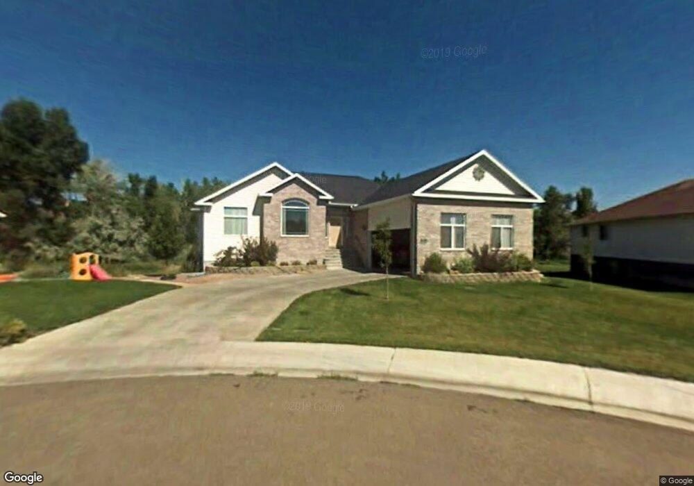
This home is located at 1600 W 550 N, Price, UT 84501 and is currently priced at $433,000, approximately $40 per square foot. 1600 W 550 N is a home located in Carbon County with nearby schools including Creekview School, Mont Harmon Junior High School, and Carbon High School.
Ownership History
Date
Name
Owned For
Owner Type
Purchase Details
Closed on
May 3, 2021
Sold by
Seeley Russell L and Seeley Kendra I
Bought by
Savage Marc T and Savage Stephanie M
Current Estimated Value
Home Financials for this Owner
Home Financials are based on the most recent Mortgage that was taken out on this home.
Original Mortgage
$288,000
Outstanding Balance
$259,465
Interest Rate
3%
Mortgage Type
New Conventional
Purchase Details
Closed on
Feb 21, 2017
Sold by
Hansen Jeffrey and Hansen Lynelle
Bought by
Hansen Trust
Purchase Details
Closed on
Feb 15, 2010
Sold by
Haddock Jared Boot and Haddock Paige Adele
Bought by
Seeley Russell L and Seeley Kendra I
Home Financials for this Owner
Home Financials are based on the most recent Mortgage that was taken out on this home.
Original Mortgage
$235,357
Interest Rate
4.75%
Mortgage Type
FHA
Create a Home Valuation Report for This Property
The Home Valuation Report is an in-depth analysis detailing your home's value as well as a comparison with similar homes in the area
Home Values in the Area
Average Home Value in this Area
Purchase History
| Date | Buyer | Sale Price | Title Company |
|---|---|---|---|
| Savage Marc T | -- | Professional Title Services | |
| Hansen Trust | -- | -- | |
| Seeley Russell L | -- | Professional Title Services |
Source: Public Records
Mortgage History
| Date | Status | Borrower | Loan Amount |
|---|---|---|---|
| Open | Savage Marc T | $288,000 | |
| Previous Owner | Seeley Russell L | $235,357 |
Source: Public Records
Tax History Compared to Growth
Tax History
| Year | Tax Paid | Tax Assessment Tax Assessment Total Assessment is a certain percentage of the fair market value that is determined by local assessors to be the total taxable value of land and additions on the property. | Land | Improvement |
|---|---|---|---|---|
| 2025 | $27,068 | $2,228,000 | $473,973 | $1,754,027 |
| 2024 | $23,814 | $1,982,641 | $473,973 | $1,508,668 |
| 2023 | $24,373 | $2,164,198 | $261,598 | $1,902,600 |
| 2022 | $26,320 | $2,096,528 | $114,395 | $1,982,133 |
| 2021 | $22,840 | $1,552,984 | $84,737 | $1,468,247 |
| 2020 | $22,367 | $1,387,717 | $0 | $0 |
| 2019 | $21,328 | $1,387,717 | $0 | $0 |
| 2018 | $20,907 | $1,387,717 | $0 | $0 |
| 2017 | $20,652 | $1,387,717 | $0 | $0 |
| 2016 | $18,627 | $1,387,717 | $0 | $0 |
| 2015 | $18,627 | $1,387,717 | $0 | $0 |
| 2014 | $15,187 | $1,139,070 | $0 | $0 |
| 2013 | $15,334 | $1,139,070 | $0 | $0 |
Source: Public Records
Map
Nearby Homes
- 1335 W Evergreen Dr
- 1189 W 290 N
- 126 N Balsam Way
- 109 N 1470 (Balsam Way) W
- 420 N Josephine Ln W
- 830 N 2140 W
- 401 N Fairgrounds Rd
- 2 Hilltop
- 702 W 1150 N Unit 4
- 670 W 1150 N
- 1643 N Mountain States Rd
- 275 N 500 W
- 1433 W 2060 N
- 1177 W 2060 N
- 495 S Fairgrounds Rd
- 82 W 200 N
- 1240 W 2360 N
- 240 N Carbon Ave
- 280 W 500 S
- 175 N 100 E
- 1600 W 550 N
- 1594 W 550 N
- 1610 W 550 N
- 1586 W 550 N
- 1605 W 550 N
- 1599 W 550 N
- 1615 W 550 N
- 1589 W 550 N
- 1578 W 550 N
- 1581 W 550 N
- 1560 W 550 N
- 1513 W Gordon Creek Rd
- 1505 W Gordon Creek Rd
- 1551 W Gordon Creek Rd
- 1578 W Gordon Creek Rd
- 1516 W Gordon Creek Rd
- 1499 W 620 N
- 680 N 1550 W
- 680 N 1550 W
- 1476 W Gordon Creek Rd