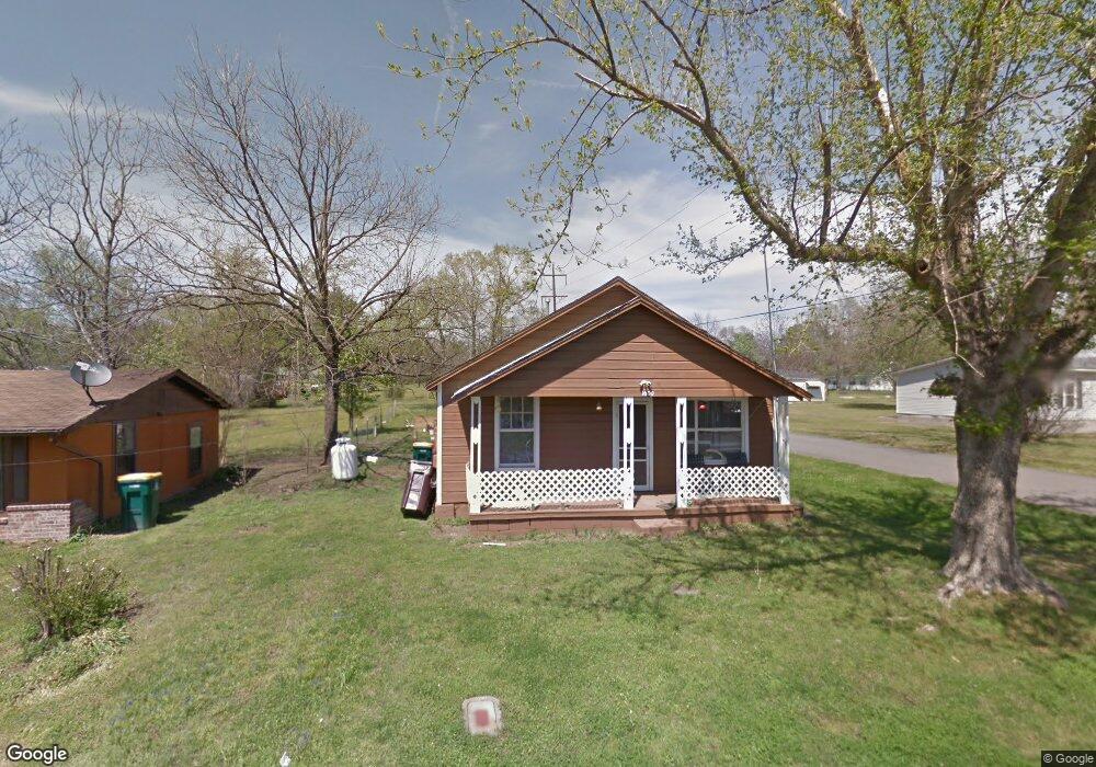
1600 W Higgins St Morrilton, AR 72110
Estimated Value: $61,000 - $107,000
--
Bed
1
Bath
810
Sq Ft
$100/Sq Ft
Est. Value
About This Home
This home is located at 1600 W Higgins St, Morrilton, AR 72110 and is currently estimated at $80,640, approximately $99 per square foot. 1600 W Higgins St is a home located in Conway County with nearby schools including Morrilton Primary School, Morrilton Elementary School, and Morrilton Intermediate School.
Ownership History
Date
Name
Owned For
Owner Type
Purchase Details
Closed on
Oct 2, 2024
Sold by
Roark Jason
Bought by
Zion Group Llc
Current Estimated Value
Purchase Details
Closed on
Oct 14, 2016
Sold by
Rhea Clonnie C
Bought by
Roark Jason
Purchase Details
Closed on
Aug 22, 2013
Sold by
Rehm Larry and Rehm Melissa
Bought by
Rhea Clonnie C
Purchase Details
Closed on
May 7, 2010
Sold by
Settlemire John W and Settlemire Dorothy L
Bought by
Rehm Larry and Rehm Melissa
Purchase Details
Closed on
Jan 22, 1997
Bought by
Rehm Lawrence Albert
Purchase Details
Closed on
Oct 1, 1983
Bought by
Rehm Walter B
Create a Home Valuation Report for This Property
The Home Valuation Report is an in-depth analysis detailing your home's value as well as a comparison with similar homes in the area
Home Values in the Area
Average Home Value in this Area
Purchase History
| Date | Buyer | Sale Price | Title Company |
|---|---|---|---|
| Zion Group Llc | -- | Morrilton Abstract | |
| Roark Jason | $11,000 | Benchmark Title Llc | |
| Rhea Clonnie C | -- | -- | |
| Rehm Larry | -- | -- | |
| Rehm Lawrence Albert | -- | -- | |
| Rehm Walter B | -- | -- |
Source: Public Records
Tax History Compared to Growth
Tax History
| Year | Tax Paid | Tax Assessment Tax Assessment Total Assessment is a certain percentage of the fair market value that is determined by local assessors to be the total taxable value of land and additions on the property. | Land | Improvement |
|---|---|---|---|---|
| 2024 | $293 | $5,700 | $1,260 | $4,440 |
| 2023 | $271 | $5,700 | $1,260 | $4,440 |
| 2022 | $248 | $5,700 | $1,260 | $4,440 |
| 2021 | $226 | $4,170 | $840 | $3,330 |
| 2020 | $226 | $4,170 | $840 | $3,330 |
| 2019 | $226 | $4,170 | $840 | $3,330 |
| 2018 | $226 | $4,170 | $840 | $3,330 |
| 2017 | $0 | $4,170 | $840 | $3,330 |
| 2016 | $0 | $4,170 | $840 | $3,330 |
| 2015 | -- | $4,170 | $840 | $3,330 |
| 2014 | $198 | $4,170 | $840 | $3,330 |
Source: Public Records
Map
Nearby Homes
- 505 N Walnut St
- Block 1 Lots 13 & 14
- Block 1 Lots 16 & 17
- TBD Burrow
- 805 W Elm St
- 707 N West St
- 605 N West St
- 116 Lane St
- 116 Lane St Unit 305 S Division Stree
- 202 N Griffin St
- 402 N Morrill St
- 407 N Oak St
- 304 S Ola St
- 403 W Church St
- 603 N Division St
- 200 N Morrill St
- 9 E Harding St
- 405 W Valley St
- 111 E Commerce St
- 403 S West St