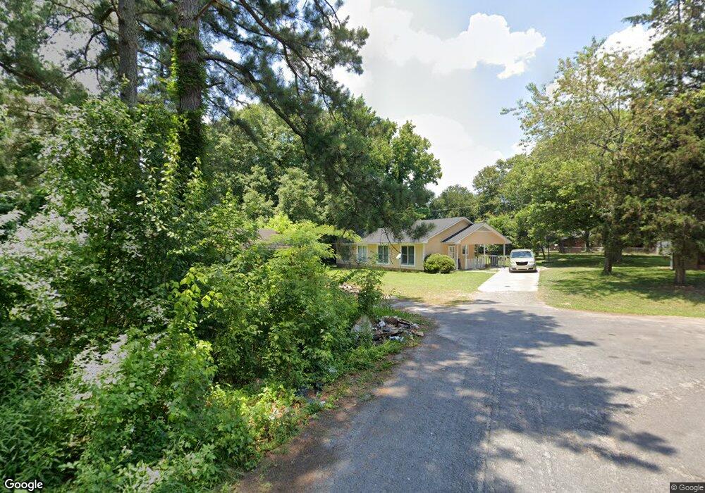
16001 Mustang Cir Laurinburg, NC 28352
Estimated Value: $97,000 - $127,000
3
Beds
1
Bath
1,012
Sq Ft
$108/Sq Ft
Est. Value
About This Home
This home is located at 16001 Mustang Cir, Laurinburg, NC 28352 and is currently estimated at $109,007, approximately $107 per square foot. 16001 Mustang Cir is a home located in Scotland County with nearby schools including Wagram Elementary School, Spring Hill Middle School, and Scotland High School.
Ownership History
Date
Name
Owned For
Owner Type
Purchase Details
Closed on
Mar 13, 2018
Sold by
Odom Charles R and Odom Tammy M
Bought by
Jaja Plroperties Llc
Current Estimated Value
Purchase Details
Closed on
Jan 11, 2007
Sold by
Rodgers Realty & Construction Company In
Bought by
Rodgers Rita
Home Financials for this Owner
Home Financials are based on the most recent Mortgage that was taken out on this home.
Original Mortgage
$43,875
Interest Rate
6.06%
Mortgage Type
Future Advance Clause Open End Mortgage
Create a Home Valuation Report for This Property
The Home Valuation Report is an in-depth analysis detailing your home's value as well as a comparison with similar homes in the area
Home Values in the Area
Average Home Value in this Area
Purchase History
| Date | Buyer | Sale Price | Title Company |
|---|---|---|---|
| Jaja Plroperties Llc | $320,000 | None Available | |
| Rodgers Rita | $52,000 | None Available |
Source: Public Records
Mortgage History
| Date | Status | Borrower | Loan Amount |
|---|---|---|---|
| Previous Owner | Rodgers Rita | $43,875 | |
| Closed | Jaja Plroperties Llc | $0 |
Source: Public Records
Tax History Compared to Growth
Tax History
| Year | Tax Paid | Tax Assessment Tax Assessment Total Assessment is a certain percentage of the fair market value that is determined by local assessors to be the total taxable value of land and additions on the property. | Land | Improvement |
|---|---|---|---|---|
| 2025 | $687 | $57,860 | $6,600 | $51,260 |
| 2024 | $681 | $57,860 | $6,600 | $51,260 |
| 2023 | $687 | $57,860 | $6,600 | $51,260 |
| 2022 | $687 | $57,860 | $6,600 | $51,260 |
| 2021 | $693 | $57,860 | $6,600 | $51,260 |
| 2020 | $686 | $57,860 | $6,600 | $51,260 |
| 2019 | $693 | $57,860 | $6,600 | $51,260 |
| 2018 | $731 | $61,490 | $6,600 | $54,890 |
| 2017 | $737 | $61,490 | $6,600 | $54,890 |
| 2016 | $743 | $61,490 | $6,600 | $54,890 |
| 2015 | $749 | $61,490 | $6,600 | $54,890 |
| 2014 | $664 | $0 | $0 | $0 |
Source: Public Records
Map
Nearby Homes
- 16081 Bronco Dr
- 17180 Barnes Dr
- 603 Lees Mill Rd
- 914 Cliffdale Dr
- 0 Queensdale St Unit 100539162
- 512 Produce Market Rd
- 009 Berry St
- 811 Anne St
- 916 Aberdeen Rd
- Tbd Highland Rd
- 817 Aberdeen Rd
- 220 N Pine St
- 22 3rd St
- 20 3rd St
- 201 2nd St
- 14120 Kiser Rd
- 411 E Church St
- 330 Mcrae St
- 614 Hall St
- 622 E Vance St
- 16021 Mustang Cir
- 17440 Lees Mill Rd
- 17420 Lees Mill Rd
- 15981 Mustang Cir
- 17460 Lees Mill Rd
- 17240 Pinto Place
- 15961 Mustang Cir
- 17480 Lees Mill Rd
- 17260 Pinto Place
- 16061 Bronco Dr
- 16061 Bronco Dr
- 15941 Bronco Dr
- 17521 Lees Mill Rd
- 15921 Bronco Dr
- 17220 Pinto Place
- 17501 Lees Mill Rd
- 17500 Lees Mill Rd
- 17541 Lees Mill Rd
- 00 Bronco Dr
- 16101 Bronco Dr