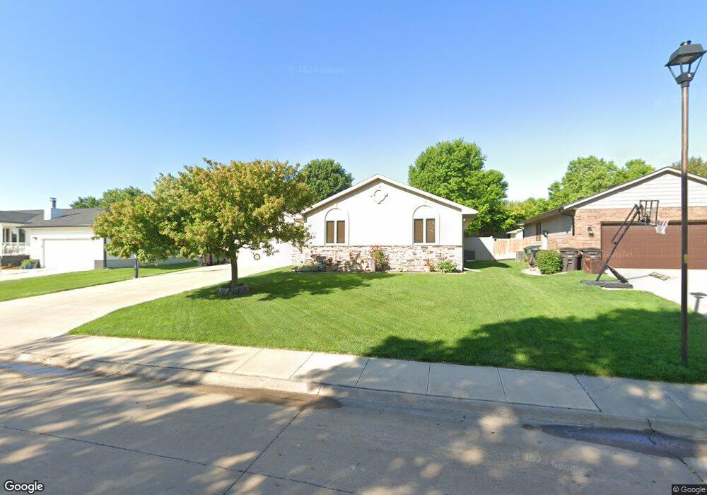
1601 Apache Ave Hastings, NE 68901
Estimated Value: $345,325 - $388,000
3
Beds
2
Baths
1,584
Sq Ft
$230/Sq Ft
Est. Value
About This Home
This home is located at 1601 Apache Ave, Hastings, NE 68901 and is currently estimated at $364,831, approximately $230 per square foot. 1601 Apache Ave is a home located in Adams County with nearby schools including Hastings Senior High School, St. Michael's Preschool & Elementary School, and Zion Lutheran School.
Ownership History
Date
Name
Owned For
Owner Type
Purchase Details
Closed on
Nov 24, 2020
Sold by
Rutt Christopher B
Bought by
Rutt Heather M
Current Estimated Value
Purchase Details
Closed on
Mar 7, 2014
Sold by
Kathol Tara M and Kathol Eric
Bought by
Lee James E and Lee Cindy S
Home Financials for this Owner
Home Financials are based on the most recent Mortgage that was taken out on this home.
Original Mortgage
$84,500
Interest Rate
4.36%
Mortgage Type
New Conventional
Purchase Details
Closed on
Aug 23, 2013
Sold by
Riley Elizabeth A
Bought by
Rutt Christopher B and Rutt Heather M
Home Financials for this Owner
Home Financials are based on the most recent Mortgage that was taken out on this home.
Original Mortgage
$30,000
Interest Rate
4.53%
Mortgage Type
Future Advance Clause Open End Mortgage
Create a Home Valuation Report for This Property
The Home Valuation Report is an in-depth analysis detailing your home's value as well as a comparison with similar homes in the area
Home Values in the Area
Average Home Value in this Area
Purchase History
| Date | Buyer | Sale Price | Title Company |
|---|---|---|---|
| Rutt Heather M | -- | None Available | |
| Lee James E | $180,000 | Elizabeth Prairie Title | |
| Rutt Christopher B | $200,000 | None Available |
Source: Public Records
Mortgage History
| Date | Status | Borrower | Loan Amount |
|---|---|---|---|
| Closed | Lee James E | $84,500 | |
| Previous Owner | Rutt Christopher B | $30,000 |
Source: Public Records
Tax History
| Year | Tax Paid | Tax Assessment Tax Assessment Total Assessment is a certain percentage of the fair market value that is determined by local assessors to be the total taxable value of land and additions on the property. | Land | Improvement |
|---|---|---|---|---|
| 2025 | $4,827 | $308,735 | $28,080 | $280,655 |
| 2024 | $5,008 | $308,735 | $28,080 | $280,655 |
| 2023 | $5,502 | $266,636 | $28,080 | $238,556 |
| 2022 | $4,754 | $211,063 | $28,080 | $182,983 |
| 2021 | $4,577 | $208,723 | $25,740 | $182,983 |
| 2020 | $4,501 | $208,723 | $25,740 | $182,983 |
| 2019 | $4,453 | $208,723 | $25,740 | $182,983 |
| 2018 | $4,317 | $201,280 | $18,720 | $182,560 |
| 2017 | $4,236 | $197,700 | $0 | $0 |
| 2016 | $4,030 | $187,890 | $18,720 | $169,170 |
| 2011 | -- | $169,970 | $16,850 | $153,120 |
Source: Public Records
Map
Nearby Homes
- 1720 Apache Ave
- 1406 Sheridan Place
- 1401 Heritage Dr
- 1233 Heritage Dr
- 1253 Westridge Dr
- 1225 Heritage Dr
- 1250 Heritage Place
- 1105 Jefferson Ave
- 1909 W 10th St
- 1934 W 9th St
- 2019 W 9th St
- 910 Jefferson Ave
- 1334 W 12th St
- 2412 W 8th St
- 736 N Barnes Ave
- 1810 W 8th St
- 1701 Boyce St
- 1831 W 8th St
- 2603 Bateman St
- 929 N Briggs Ave
- 1607 Apache Ave
- 1521 Apache Ave
- 1514 Arapahoe Ave
- 1510 Arapahoe Ave
- 1613 Apache Ave
- 1515 Apache Ave
- 1518 Arapahoe Ave
- 1600 Apache Ave
- 1606 Apache Ave
- 1506 Arapahoe Ave
- 1520 Apache Ave
- 1612 Apache Ave
- 1518 Apache Ave
- 1617 Apache Ave
- 1509 Apache Ave
- 1502 Arapahoe Ave
- 1512 Apache Ave
- 1616 Apache Ave
- 1521 Arapahoe Ave
- 1627 Apache Ave
Your Personal Tour Guide
Ask me questions while you tour the home.