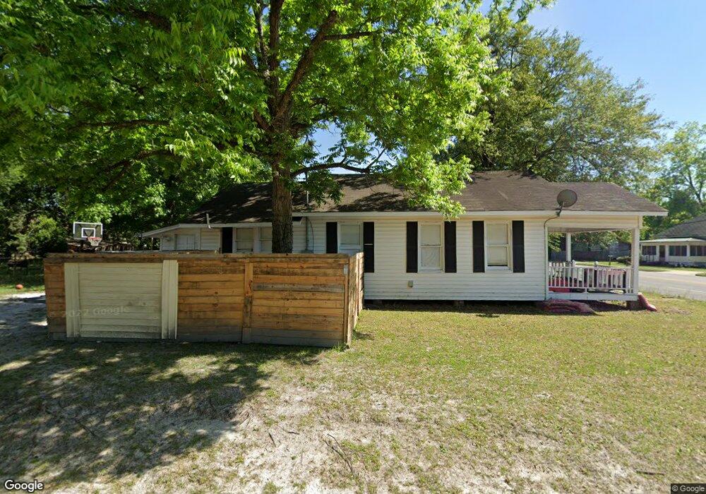
1601 Brunel St Waycross, GA 31501
Estimated Value: $83,000 - $138,000
2
Beds
1
Bath
1,040
Sq Ft
$100/Sq Ft
Est. Value
About This Home
This home is located at 1601 Brunel St, Waycross, GA 31501 and is currently estimated at $103,710, approximately $99 per square foot. 1601 Brunel St is a home located in Ware County with nearby schools including Memorial Drive Elementary School, Waycross Middle School, and Ware County High School.
Ownership History
Date
Name
Owned For
Owner Type
Purchase Details
Closed on
Oct 27, 2022
Sold by
Davis Delmar
Bought by
Hendricks Mailan
Current Estimated Value
Purchase Details
Closed on
Apr 6, 2020
Sold by
Lee Lisa Leann
Bought by
Lee Thomas Ryan
Purchase Details
Closed on
Mar 27, 2009
Sold by
Tarpley Jack Randall
Bought by
Sorrells James F and Sorrells Gloria C
Home Financials for this Owner
Home Financials are based on the most recent Mortgage that was taken out on this home.
Original Mortgage
$34,265
Interest Rate
5.14%
Mortgage Type
Future Advance Clause Open End Mortgage
Purchase Details
Closed on
May 24, 2004
Sold by
Lear Robert G
Bought by
Tarpley Jack Randall
Purchase Details
Closed on
Mar 19, 1986
Create a Home Valuation Report for This Property
The Home Valuation Report is an in-depth analysis detailing your home's value as well as a comparison with similar homes in the area
Home Values in the Area
Average Home Value in this Area
Purchase History
| Date | Buyer | Sale Price | Title Company |
|---|---|---|---|
| Hendricks Mailan | -- | -- | |
| Lee Thomas Ryan | -- | -- | |
| Sorrells James F | $25,000 | -- | |
| Tarpley Jack Randall | $10,000 | -- | |
| -- | $15,400 | -- |
Source: Public Records
Mortgage History
| Date | Status | Borrower | Loan Amount |
|---|---|---|---|
| Previous Owner | Sorrells James F | $34,265 |
Source: Public Records
Tax History Compared to Growth
Tax History
| Year | Tax Paid | Tax Assessment Tax Assessment Total Assessment is a certain percentage of the fair market value that is determined by local assessors to be the total taxable value of land and additions on the property. | Land | Improvement |
|---|---|---|---|---|
| 2024 | $689 | $23,366 | $1,560 | $21,806 |
| 2023 | $806 | $15,772 | $816 | $14,956 |
| 2022 | $629 | $15,772 | $816 | $14,956 |
| 2021 | $472 | $10,926 | $816 | $10,110 |
| 2020 | $469 | $10,756 | $816 | $9,940 |
| 2019 | $430 | $9,737 | $816 | $8,921 |
| 2018 | $416 | $9,312 | $816 | $8,496 |
| 2017 | $406 | $9,312 | $816 | $8,496 |
| 2016 | $406 | $9,312 | $816 | $8,496 |
| 2015 | $409 | $9,312 | $816 | $8,496 |
| 2014 | $408 | $9,312 | $816 | $8,496 |
| 2013 | -- | $9,312 | $816 | $8,496 |
Source: Public Records
Map
Nearby Homes
- 1602 Gilmore St
- 1504 Gilmore St
- 1613 Brunel St
- 1600 Brunel St
- 1606 Gilmore St
- 1606 Brunel St
- 1502 Gilmore St
- 1608 Gilmore St
- 1500 Brunel St
- 990 Brunel St
- 503 Brunel St
- 0 Brunel St
- 1610 Brunel St
- 1453 Brunel St
- 1612 Brunel St
- 1616 Gilmore St
- 1507 Gilmore St
- 1603 Gilmore St
- 1505 Littleton St
- 1503 Gilmore St