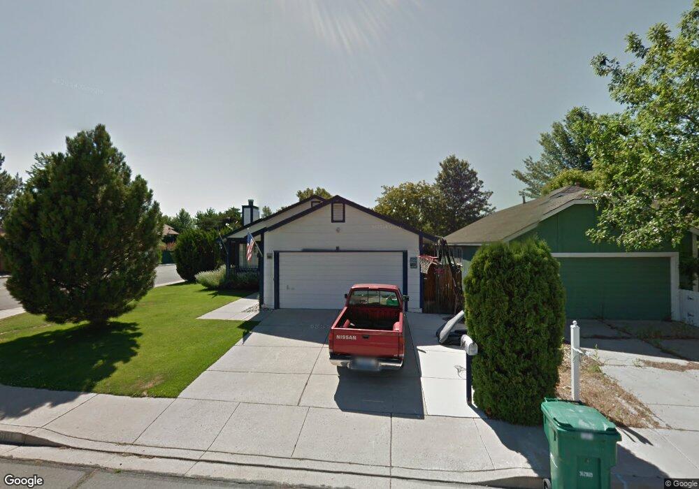
1601 Burnside Dr Sparks, NV 89434
O'Callaghan NeighborhoodEstimated Value: $434,558 - $454,000
3
Beds
2
Baths
1,376
Sq Ft
$322/Sq Ft
Est. Value
About This Home
This home is located at 1601 Burnside Dr, Sparks, NV 89434 and is currently estimated at $443,140, approximately $322 per square foot. 1601 Burnside Dr is a home located in Washoe County with nearby schools including Katherine Dunn Elementary School, George L Dilworth Middle School, and Edward C Reed High School.
Ownership History
Date
Name
Owned For
Owner Type
Purchase Details
Closed on
Mar 25, 2003
Sold by
Nguyen Hung Xuan and Nguyen Tri P
Bought by
Cardona Alfred M
Current Estimated Value
Home Financials for this Owner
Home Financials are based on the most recent Mortgage that was taken out on this home.
Original Mortgage
$162,000
Outstanding Balance
$68,880
Interest Rate
5.73%
Estimated Equity
$374,260
Purchase Details
Closed on
Dec 29, 1994
Sold by
Smith Cecilia Jean
Bought by
Nguyen Hung Xuan and Nguyen Tri P
Home Financials for this Owner
Home Financials are based on the most recent Mortgage that was taken out on this home.
Original Mortgage
$100,200
Interest Rate
9.2%
Create a Home Valuation Report for This Property
The Home Valuation Report is an in-depth analysis detailing your home's value as well as a comparison with similar homes in the area
Home Values in the Area
Average Home Value in this Area
Purchase History
| Date | Buyer | Sale Price | Title Company |
|---|---|---|---|
| Cardona Alfred M | $162,000 | Stewart Title Of Northern Nv | |
| Nguyen Hung Xuan | $125,500 | Western Title Company Inc |
Source: Public Records
Mortgage History
| Date | Status | Borrower | Loan Amount |
|---|---|---|---|
| Open | Cardona Alfred M | $162,000 | |
| Previous Owner | Nguyen Hung Xuan | $100,200 |
Source: Public Records
Tax History Compared to Growth
Tax History
| Year | Tax Paid | Tax Assessment Tax Assessment Total Assessment is a certain percentage of the fair market value that is determined by local assessors to be the total taxable value of land and additions on the property. | Land | Improvement |
|---|---|---|---|---|
| 2025 | $1,592 | $67,793 | $34,580 | $33,213 |
| 2024 | $1,592 | $66,712 | $32,725 | $33,987 |
| 2023 | $1,546 | $64,946 | $32,305 | $32,641 |
| 2022 | $1,501 | $53,571 | $26,005 | $27,566 |
| 2021 | $1,459 | $47,651 | $19,845 | $27,806 |
| 2020 | $1,415 | $47,986 | $19,775 | $28,211 |
| 2019 | $1,373 | $46,569 | $18,935 | $27,634 |
| 2018 | $1,333 | $41,313 | $13,965 | $27,348 |
| 2017 | $1,294 | $40,354 | $12,670 | $27,684 |
| 2016 | $1,262 | $39,884 | $11,410 | $28,474 |
| 2015 | $1,260 | $38,489 | $9,625 | $28,864 |
| 2014 | $1,215 | $36,117 | $8,225 | $27,892 |
| 2013 | -- | $32,463 | $6,090 | $26,373 |
Source: Public Records
Map
Nearby Homes
- 1770 Burnside Dr
- 1655 Sabatino Dr
- 1332 Coachman Ct
- 1990 Fargo Way
- 1728 Bluehaven Dr
- 1280 O'Callaghan Dr
- 2252 Sycamore Glen Dr
- 1544 Woodhaven Ln
- 1218 Junction Dr
- 2435 Sycamore Glen Dr Unit 2
- 1970 Woodhaven Ln
- 2407 Sunny Slope Dr Unit 1
- 2002 Wabash Cir
- 2688 Laguna Way
- 2763 Blossom View Dr
- 1897 Bonita Vista Dr
- 1688 Round Mountain Cir
- 2119 Avella Dr
- 1973 Rio Tinto Dr
- 2372 Napoli Dr
- 1631 Burnside Dr
- 1651 Burnside Dr
- 1602 Union St
- 1612 Union St
- 1581 Burnside Ct
- 1681 Burnside Dr
- 1632 Union St
- 1582 Union St
- 1642 Union St
- 1630 Burnside Dr
- 1600 Burnside Dr
- 1561 Burnside Ct
- 1711 Burnside Dr
- 1650 Burnside Dr
- 1580 Burnside Ct
- 1662 Union St
- 1680 Burnside Dr
- 1531 Burnside Ct
- 1542 Union St
- 1560 Burnside Ct