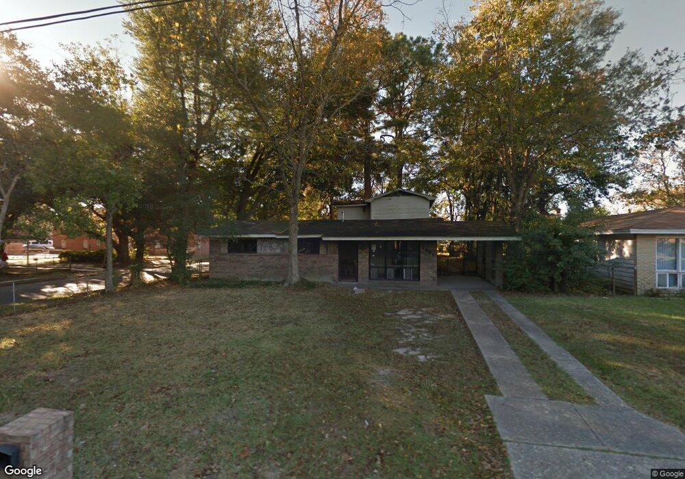
1601 Forrest St Mobile, AL 36605
Maryvale NeighborhoodEstimated Value: $57,000 - $172,000
3
Beds
2
Baths
2,300
Sq Ft
$46/Sq Ft
Est. Value
About This Home
This home is located at 1601 Forrest St, Mobile, AL 36605 and is currently estimated at $106,474, approximately $46 per square foot. 1601 Forrest St is a home located in Mobile County with nearby schools including George Hall Elementary School, Williamson High School, and Revelation Christian School.
Ownership History
Date
Name
Owned For
Owner Type
Purchase Details
Closed on
Jan 11, 2017
Sold by
Us Bank Na
Bought by
Nobles Corp Inc
Current Estimated Value
Purchase Details
Closed on
Sep 8, 2016
Sold by
Moore Edward E and Pettway Dianne W
Bought by
U S Bank Na
Purchase Details
Closed on
Nov 17, 2008
Sold by
Moore Edward E and Pettway Dianne W
Bought by
Lasalle Bank National Association
Purchase Details
Closed on
Oct 19, 2004
Sold by
Shepard Marion J and Shepard Mattie Marshall
Bought by
Moore Edward E and Pettway Dianne W
Home Financials for this Owner
Home Financials are based on the most recent Mortgage that was taken out on this home.
Original Mortgage
$68,000
Interest Rate
9.63%
Mortgage Type
Stand Alone First
Create a Home Valuation Report for This Property
The Home Valuation Report is an in-depth analysis detailing your home's value as well as a comparison with similar homes in the area
Home Values in the Area
Average Home Value in this Area
Purchase History
| Date | Buyer | Sale Price | Title Company |
|---|---|---|---|
| Nobles Corp Inc | $14,900 | None Available | |
| U S Bank Na | $20,600 | None Available | |
| Lasalle Bank National Association | $50,490 | None Available | |
| Moore Edward E | $80,000 | -- |
Source: Public Records
Mortgage History
| Date | Status | Borrower | Loan Amount |
|---|---|---|---|
| Previous Owner | Moore Edward E | $68,000 | |
| Closed | Moore Edward E | $12,000 |
Source: Public Records
Tax History
| Year | Tax Paid | Tax Assessment Tax Assessment Total Assessment is a certain percentage of the fair market value that is determined by local assessors to be the total taxable value of land and additions on the property. | Land | Improvement |
|---|---|---|---|---|
| 2025 | $881 | $13,980 | $1,600 | $12,380 |
| 2024 | $881 | $12,840 | $1,800 | $11,040 |
| 2023 | $803 | $12,640 | $1,800 | $10,840 |
| 2022 | $803 | $12,640 | $1,800 | $10,840 |
| 2021 | $836 | $13,160 | $1,360 | $11,800 |
| 2020 | $836 | $13,160 | $1,360 | $11,800 |
| 2019 | $909 | $14,320 | $2,140 | $12,180 |
| 2018 | $909 | $14,320 | $0 | $0 |
| 2017 | $909 | $14,320 | $0 | $0 |
| 2016 | $941 | $14,820 | $0 | $0 |
| 2013 | $808 | $12,340 | $0 | $0 |
Source: Public Records
Map
Nearby Homes
- 1564 Forrest St
- 1611 Forrest St
- 1714 Hurtel St
- 1550 Colgin St
- 1502 Duval St
- 1565 Orange St
- 1055 Bishop Wilmer Dr
- 1464 Douglas St
- 1712 Waterford St
- 1109 Preston Ave
- 1019 Colonial Ct
- 1017 Houston St
- 2007 Halls Mill Rd
- 1068 Arlington St
- 1303 Greenwood Ave
- 956 Weinacker Ave
- 661 Ruth St
- 2103 E Victory Dr
- 1255 Horton Dr
- 720 Johnston Ave
- 1603 Forrest St
- 1577 Forrest St
- 1605 Forrest St
- 1600 Hurtel St
- 1602 Hurtel St
- 1604 Hurtel St
- 1600 Forrest St
- 1602 Forrest St
- 1607 Forrest St
- 1604 Forrest St
- 1576 Forrest St
- 1569 Forrest St
- 1606 Hurtel St
- 1606 Forrest St
- 1609 Forrest St
- 1572 Forrest St
- 1608 Forrest St
- 1610 Forrest St
- 1568 Forrest St
- 1601 Van Dorn St
