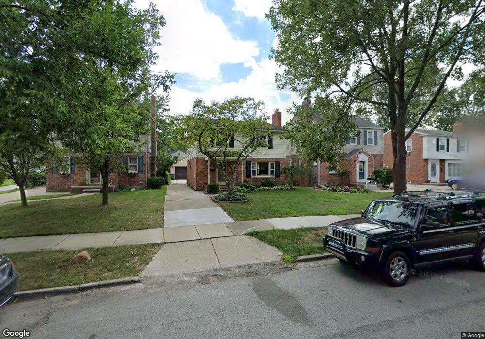
1601 Hampton Rd Unit Bldg-Unit Grosse Pointe Woods, MI 48236
Estimated Value: $375,000 - $442,000
3
Beds
3
Baths
1,936
Sq Ft
$214/Sq Ft
Est. Value
About This Home
This home is located at 1601 Hampton Rd Unit Bldg-Unit, Grosse Pointe Woods, MI 48236 and is currently estimated at $414,139, approximately $213 per square foot. 1601 Hampton Rd Unit Bldg-Unit is a home located in Wayne County with nearby schools including Ferry Elementary School, Parcells Middle School, and Grosse Pointe North High School.
Ownership History
Date
Name
Owned For
Owner Type
Purchase Details
Closed on
Jan 14, 2022
Sold by
James Howitt Matthew and Wrae Allison
Bought by
Duff James W and Duff Corienna M
Current Estimated Value
Purchase Details
Closed on
Jun 22, 2018
Sold by
Munerantz Stephen and Munerantz Carol
Bought by
Howitt Matthew James and Misner Allison Wrae
Home Financials for this Owner
Home Financials are based on the most recent Mortgage that was taken out on this home.
Original Mortgage
$234,000
Interest Rate
4.6%
Mortgage Type
New Conventional
Create a Home Valuation Report for This Property
The Home Valuation Report is an in-depth analysis detailing your home's value as well as a comparison with similar homes in the area
Home Values in the Area
Average Home Value in this Area
Purchase History
| Date | Buyer | Sale Price | Title Company |
|---|---|---|---|
| Duff James W | $369,000 | First American Title | |
| Duff James W | $369,000 | First American Title | |
| Howitt Matthew James | $269,000 | None Available |
Source: Public Records
Mortgage History
| Date | Status | Borrower | Loan Amount |
|---|---|---|---|
| Previous Owner | Howitt Matthew James | $234,000 |
Source: Public Records
Tax History
| Year | Tax Paid | Tax Assessment Tax Assessment Total Assessment is a certain percentage of the fair market value that is determined by local assessors to be the total taxable value of land and additions on the property. | Land | Improvement |
|---|---|---|---|---|
| 2025 | $5,907 | $198,800 | $0 | $0 |
| 2024 | $5,880 | $187,600 | $0 | $0 |
| 2023 | $5,655 | $164,700 | $0 | $0 |
| 2022 | $7,840 | $151,000 | $0 | $0 |
| 2021 | $7,474 | $143,800 | $0 | $0 |
| 2020 | $7,696 | $139,800 | $0 | $0 |
| 2019 | $7,533 | $130,100 | $0 | $0 |
| 2018 | $2,890 | $125,900 | $0 | $0 |
| 2017 | $3,358 | $121,900 | $0 | $0 |
| 2016 | $4,578 | $110,900 | $0 | $0 |
| 2015 | $7,935 | $102,000 | $0 | $0 |
| 2013 | $7,690 | $91,800 | $0 | $0 |
| 2012 | -- | $75,700 | $13,700 | $62,000 |
Source: Public Records
Map
Nearby Homes
- 1528 Roslyn Rd
- 1793 Roslyn Rd
- 1809 Roslyn Rd
- 1552 Brys Dr
- 1781 Brys Dr
- 1750 Vernier Rd Unit 6
- 1750 Vernier Rd Unit 22
- 1750 Vernier Rd Unit 10
- 1394 Hampton Rd
- 1381 Brys Dr
- 1374 Anita Ave
- 1341 Hawthorne Rd
- 1291 Roslyn Rd
- 1388 Vernier Rd
- 1376 Edmundton Dr
- 20740 Marter Rd
- 2005 Vernier Rd
- 2138 Ridgemont Rd
- 2202 Hollywood Ave
- 2223 Ridgemont Rd
- 1601 Hampton Rd
- 1609 Hampton Rd
- 1597 Hampton Rd
- 1617 Hampton Rd
- 1585 Hampton Rd
- 1625 Hampton Rd
- 1602 Hollywood Ave
- 1610 Hollywood Ave
- 1596 Hollywood Ave
- 1618 Hollywood Ave
- 1588 Hollywood Ave
- 1577 Hampton Rd
- 1633 Hampton Rd
- 1628 Hollywood Ave
- 1580 Hollywood Ave
- 1561 Hampton Rd
- 1636 Hollywood Ave
- 1600 Hampton Rd
- 1592 Hampton Rd
- 1608 Hampton Rd
Your Personal Tour Guide
Ask me questions while you tour the home.