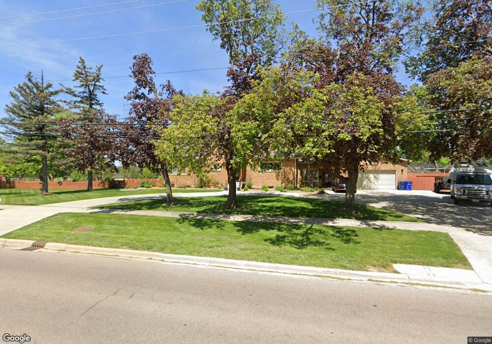
1601 Manchester Rd Wheaton, IL 60187
West Wheaton NeighborhoodEstimated Value: $582,000 - $669,159
--
Bed
1
Bath
2,496
Sq Ft
$257/Sq Ft
Est. Value
About This Home
This home is located at 1601 Manchester Rd, Wheaton, IL 60187 and is currently estimated at $640,290, approximately $256 per square foot. 1601 Manchester Rd is a home located in DuPage County with nearby schools including Clarence E Culver School, Emerson Elementary School, and Monroe Middle School.
Ownership History
Date
Name
Owned For
Owner Type
Purchase Details
Closed on
Jan 21, 2016
Sold by
Bacon Krystyna Ciupek and Ciupek Arthur
Bought by
Ciupek Arthur and Ciupek Monika C
Current Estimated Value
Home Financials for this Owner
Home Financials are based on the most recent Mortgage that was taken out on this home.
Original Mortgage
$200,000
Outstanding Balance
$160,556
Interest Rate
4.25%
Mortgage Type
New Conventional
Estimated Equity
$479,734
Purchase Details
Closed on
Mar 18, 2015
Sold by
Graf Bernice
Bought by
Ciupek Arthur and Ciupek Monika C
Home Financials for this Owner
Home Financials are based on the most recent Mortgage that was taken out on this home.
Original Mortgage
$299,653
Interest Rate
3.62%
Mortgage Type
FHA
Purchase Details
Closed on
Jan 6, 2011
Sold by
Park Deborah Graf and Rogers Carol Ann
Bought by
Graf Bernice Irene and The William & Bernice Graf Living Trust
Purchase Details
Closed on
Jul 22, 2009
Sold by
Graf William and Graf Bernice I
Bought by
Graf William and The William Graf Declaration Of Trust
Create a Home Valuation Report for This Property
The Home Valuation Report is an in-depth analysis detailing your home's value as well as a comparison with similar homes in the area
Home Values in the Area
Average Home Value in this Area
Purchase History
| Date | Buyer | Sale Price | Title Company |
|---|---|---|---|
| Ciupek Arthur | -- | National Title | |
| Ciupek Arthur | $310,000 | Attorney | |
| Graf Bernice Irene | -- | None Available | |
| 428 S West Street Llc | -- | None Available | |
| Graf William | -- | None Available |
Source: Public Records
Mortgage History
| Date | Status | Borrower | Loan Amount |
|---|---|---|---|
| Open | Ciupek Arthur | $200,000 | |
| Previous Owner | Ciupek Arthur | $299,653 |
Source: Public Records
Tax History Compared to Growth
Tax History
| Year | Tax Paid | Tax Assessment Tax Assessment Total Assessment is a certain percentage of the fair market value that is determined by local assessors to be the total taxable value of land and additions on the property. | Land | Improvement |
|---|---|---|---|---|
| 2024 | $12,223 | $197,638 | $40,436 | $157,202 |
| 2023 | $11,754 | $181,920 | $37,220 | $144,700 |
| 2022 | $11,492 | $171,940 | $35,190 | $136,750 |
| 2021 | $11,456 | $167,860 | $34,350 | $133,510 |
| 2020 | $11,421 | $166,300 | $34,030 | $132,270 |
| 2019 | $11,162 | $161,910 | $33,130 | $128,780 |
| 2018 | $7,659 | $111,750 | $31,220 | $80,530 |
| 2017 | $7,543 | $107,630 | $30,070 | $77,560 |
| 2016 | $7,439 | $103,330 | $28,870 | $74,460 |
| 2015 | $7,967 | $110,960 | $27,540 | $83,420 |
| 2014 | $9,250 | $125,080 | $44,340 | $80,740 |
| 2013 | $9,013 | $125,450 | $44,470 | $80,980 |
Source: Public Records
Map
Nearby Homes
- 119 N Dorchester Ave
- 1321 W Liberty Dr
- 200 N Erie St
- 0S015 Cottonwood Dr
- 0N042 Nepil Ave
- 505 S Knollwood Dr
- 1222 Champion Forest Ct
- 615 Polo Dr
- 26W278 Harrison Ave
- 1489 Woodcutter Ln Unit A
- 620 Crest St
- 1785 Grosvenor Cir Unit A
- 0S064 Calvin Ct
- 2059 W Roosevelt Rd
- 906 W Roosevelt Rd
- 904 Dartmouth Dr
- 921 & 933 N College Ave
- 0N105 Lot 1 Nepil Ave
- 0N105 Lot 2 Nepil Ave
- 418 W Franklin St
- 1601 Manchester Rd
- 1601 Manchester Rd
- 1601 Manchester Rd
- 302 Westwood Dr
- 308 Westwood Dr
- 314 Westwood Dr
- 1520 Manchester Rd
- 1516 Manchester Rd
- 1608 Manchester Rd
- 320 Westwood Dr
- 1510 Manchester Rd
- 217 White Oak Dr
- 402 Westwood Dr
- 219 N Pierce Ave
- 1506 Manchester Rd
- 213 White Oak Dr
- 303 Westwood Dr
- 309 Westwood Dr
- 408 Westwood Dr
- 321 Westwood Dr