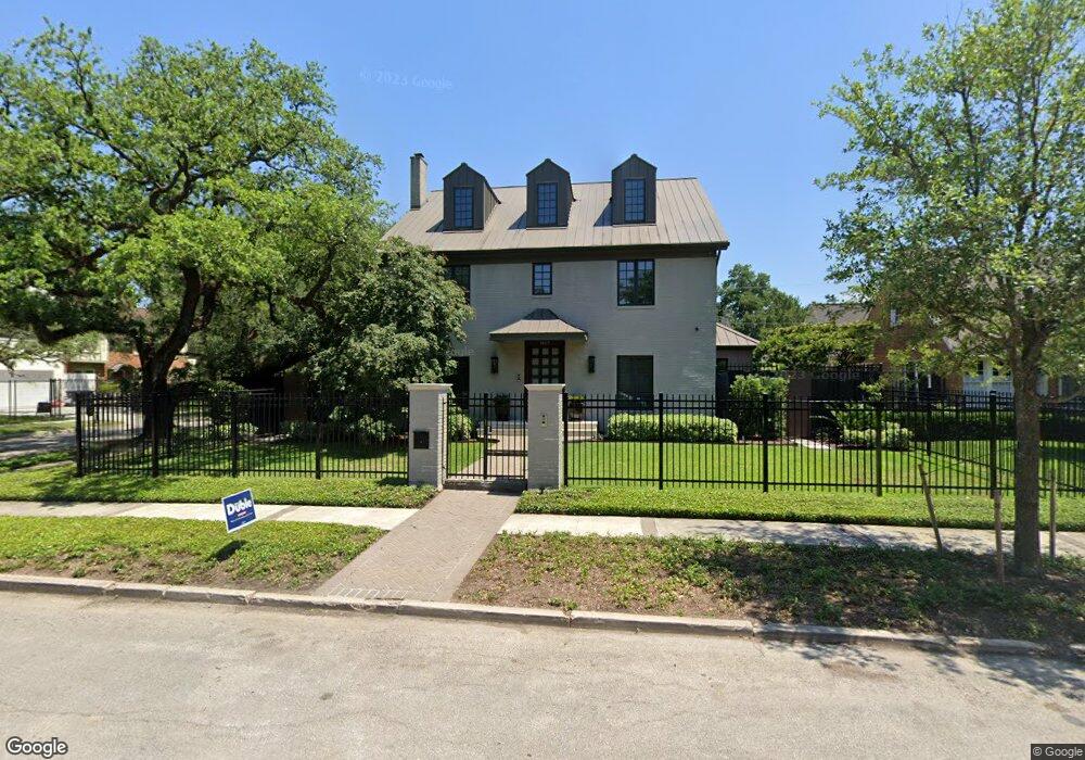
1601 Missouri St Houston, TX 77006
Montrose NeighborhoodEstimated Value: $897,000 - $1,267,981
4
Beds
4
Baths
3,208
Sq Ft
$328/Sq Ft
Est. Value
About This Home
This home is located at 1601 Missouri St, Houston, TX 77006 and is currently estimated at $1,052,495, approximately $328 per square foot. 1601 Missouri St is a home located in Harris County with nearby schools including Baker Montessori, Lanier Middle School, and Lamar High School.
Ownership History
Date
Name
Owned For
Owner Type
Purchase Details
Closed on
Feb 11, 2014
Sold by
Farhood Emile Harry
Bought by
Farhood Emile Harry and The E J Farhood Living Trust
Current Estimated Value
Purchase Details
Closed on
Feb 15, 2006
Sold by
Winston Phillip W
Bought by
Farhood Emile H
Home Financials for this Owner
Home Financials are based on the most recent Mortgage that was taken out on this home.
Original Mortgage
$417,000
Outstanding Balance
$234,059
Interest Rate
6.15%
Mortgage Type
Fannie Mae Freddie Mac
Estimated Equity
$818,437
Purchase Details
Closed on
Sep 16, 2005
Sold by
Gonzalez Glen and Callaway Blake
Bought by
Winston Philip W
Home Financials for this Owner
Home Financials are based on the most recent Mortgage that was taken out on this home.
Original Mortgage
$492,000
Interest Rate
5.8%
Mortgage Type
Fannie Mae Freddie Mac
Create a Home Valuation Report for This Property
The Home Valuation Report is an in-depth analysis detailing your home's value as well as a comparison with similar homes in the area
Home Values in the Area
Average Home Value in this Area
Purchase History
| Date | Buyer | Sale Price | Title Company |
|---|---|---|---|
| Farhood Emile Harry | -- | None Available | |
| Farhood Emile H | -- | Charter Title Company | |
| Winston Philip W | -- | Charter Title Company |
Source: Public Records
Mortgage History
| Date | Status | Borrower | Loan Amount |
|---|---|---|---|
| Open | Farhood Emile H | $417,000 | |
| Previous Owner | Winston Philip W | $492,000 |
Source: Public Records
Tax History Compared to Growth
Tax History
| Year | Tax Paid | Tax Assessment Tax Assessment Total Assessment is a certain percentage of the fair market value that is determined by local assessors to be the total taxable value of land and additions on the property. | Land | Improvement |
|---|---|---|---|---|
| 2025 | $18,869 | $1,240,000 | $781,000 | $459,000 |
| 2024 | $18,869 | $1,236,670 | $781,000 | $455,670 |
| 2023 | $18,869 | $1,194,733 | $781,000 | $413,733 |
| 2022 | $21,420 | $1,181,819 | $639,000 | $542,819 |
| 2021 | $20,611 | $884,354 | $639,000 | $245,354 |
| 2020 | $23,454 | $985,000 | $639,000 | $346,000 |
| 2019 | $22,196 | $877,144 | $544,500 | $332,644 |
| 2018 | $16,470 | $824,402 | $453,750 | $370,652 |
| 2017 | $21,876 | $824,402 | $453,750 | $370,652 |
| 2016 | $23,439 | $911,850 | $453,750 | $458,100 |
| 2015 | $14,911 | $851,226 | $393,250 | $457,976 |
| 2014 | $14,911 | $730,000 | $363,000 | $367,000 |
Source: Public Records
Map
Nearby Homes
- 1621 California St
- 1621 Cherryhurst St
- 3311 Yupon St Unit 611
- 3311 Yupon St Unit 519
- 1621 Haver St
- 1515 Hyde Park Blvd Unit 1
- 2516 Commonwealth St Unit 102
- 1709 Haver St
- 3403 Yupon St
- 1539 Westheimer Rd
- 2506 Mandell St Unit 3
- 1503 Harold St
- 2413 Ralph St Unit 2
- 3515 Yupon St
- 3540 Yupon St
- 2403 Commonwealth St
- 2410 Waugh Dr Unit 4C
- 2410 Waugh Dr Unit 3
- 1620 Harold St
- 1101 Hawthorne St
- 1607 Missouri St
- 2612 Yupon St
- 1606 California St
- 1611 Missouri St
- 2614 Yupon St
- 1612 California St
- 2616 Yupon St
- 1602 Missouri St
- 2607 Yupon St
- 2615 Yupon St
- 1528 California St Unit 6
- 1610 Missouri St
- 2617 Yupon St
- 1617 Missouri St
- 2601 Yupon St
- 1612 Missouri St
- 1618 California St
- 2701 Yupon St
- 1521 Missouri St Unit 3
- 1521 Missouri St Unit 1