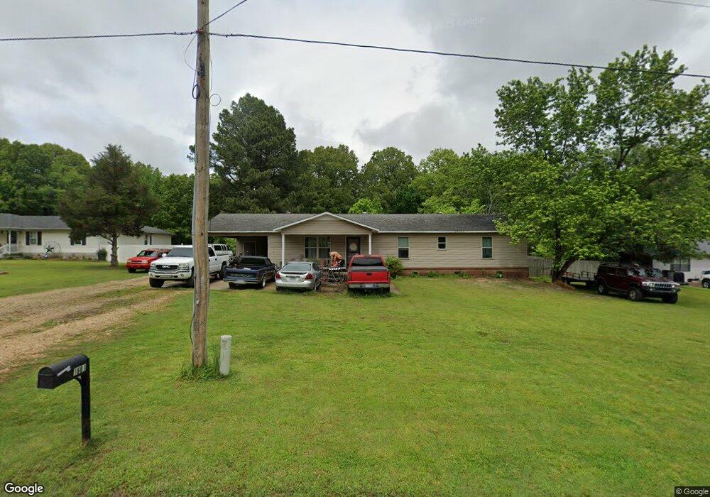
1601 Shady Grove Dr Paragould, AR 72450
Estimated Value: $187,331 - $204,000
--
Bed
2
Baths
1,638
Sq Ft
$118/Sq Ft
Est. Value
About This Home
This home is located at 1601 Shady Grove Dr, Paragould, AR 72450 and is currently estimated at $193,833, approximately $118 per square foot. 1601 Shady Grove Dr is a home located in Greene County with nearby schools including Paragould High School and St. Mary's Catholic School & Preschool.
Ownership History
Date
Name
Owned For
Owner Type
Purchase Details
Closed on
Oct 20, 2020
Sold by
Clark Lorrie and Clark David L
Bought by
Clark David L
Current Estimated Value
Home Financials for this Owner
Home Financials are based on the most recent Mortgage that was taken out on this home.
Original Mortgage
$68,650
Interest Rate
3%
Mortgage Type
New Conventional
Purchase Details
Closed on
Aug 5, 2005
Sold by
Pitcher Dawel G and Pitcher Peggy Sue
Bought by
Clark David L and Clark Lorrie
Home Financials for this Owner
Home Financials are based on the most recent Mortgage that was taken out on this home.
Original Mortgage
$85,000
Interest Rate
5.65%
Mortgage Type
New Conventional
Purchase Details
Closed on
Sep 17, 1991
Bought by
Pitcher D and Pitcher P
Purchase Details
Closed on
Feb 6, 1991
Bought by
Peggy Dawel G and Peggy Sue Pitcher
Create a Home Valuation Report for This Property
The Home Valuation Report is an in-depth analysis detailing your home's value as well as a comparison with similar homes in the area
Home Values in the Area
Average Home Value in this Area
Purchase History
| Date | Buyer | Sale Price | Title Company |
|---|---|---|---|
| Clark David L | -- | None Listed On Document | |
| Clark David L | -- | Transcontinental Title Compn | |
| Pitcher D | -- | -- | |
| Peggy Dawel G | -- | -- |
Source: Public Records
Mortgage History
| Date | Status | Borrower | Loan Amount |
|---|---|---|---|
| Previous Owner | Clark David L | $68,650 | |
| Previous Owner | Clark David L | $85,000 |
Source: Public Records
Tax History Compared to Growth
Tax History
| Year | Tax Paid | Tax Assessment Tax Assessment Total Assessment is a certain percentage of the fair market value that is determined by local assessors to be the total taxable value of land and additions on the property. | Land | Improvement |
|---|---|---|---|---|
| 2025 | $1,251 | $36,540 | $5,780 | $30,760 |
| 2024 | $1,194 | $36,540 | $5,780 | $30,760 |
| 2023 | $1,137 | $24,700 | $3,000 | $21,700 |
| 2022 | $762 | $24,700 | $3,000 | $21,700 |
| 2021 | $762 | $24,700 | $3,000 | $21,700 |
| 2020 | $1,071 | $23,280 | $3,600 | $19,680 |
| 2019 | $696 | $23,280 | $3,600 | $19,680 |
| 2018 | $720 | $23,280 | $3,600 | $19,680 |
| 2017 | $992 | $23,280 | $3,600 | $19,680 |
| 2016 | $597 | $23,280 | $3,600 | $19,680 |
| 2015 | $552 | $20,220 | $3,000 | $17,220 |
| 2014 | $909 | $20,220 | $3,000 | $17,220 |
Source: Public Records
Map
Nearby Homes
- 5 Arkansas 135
- 1201 William Hall Dr
- 1102 William Hall Dr
- 1110 Roberts Dr
- 1309 Morrow Dr
- 714 Thorne Dr
- 2200 N 8 1/2 St
- 2903 Purcell Rd
- 2102 N 22nd St
- Lot 21B N 8 1 2 St
- 604 Elizabeth Dr
- 3005 Purcell Rd
- 3.09 ac Purcell Rd
- 403 Elizabeth Dr
- 106 N 17th St
- 2802 N 4th St
- 3505 Purcell Rd
- 2300 Mount Carmel Rd
- 207 Gavin Dr
- 3613 Purcell Rd
- 1505 Shady Grove Dr
- 1603 Shady Grove Dr
- 1600 Shady Grove Dr
- 1503 Shady Grove Dr
- 1605 Shady Grove Dr
- 1606 Shady Grove Dr
- 1501 Shady Grove Dr
- 1607 Shady Grove Dr
- 1506 Shady Grove Dr
- 1407 Shady Grove Dr
- 1608 Shady Grove Dr
- 1405 Shady Grove Dr
- 1610 Shady Grove Dr
- 0 Shady Grove
- 1611 Shady Grove Dr
- 1612 Shady Grove Dr
- 1401 Shady Grove Dr
- 2510 Highway 135 N
- 2614 Highway 135 N
- 2612 Highway 135 N