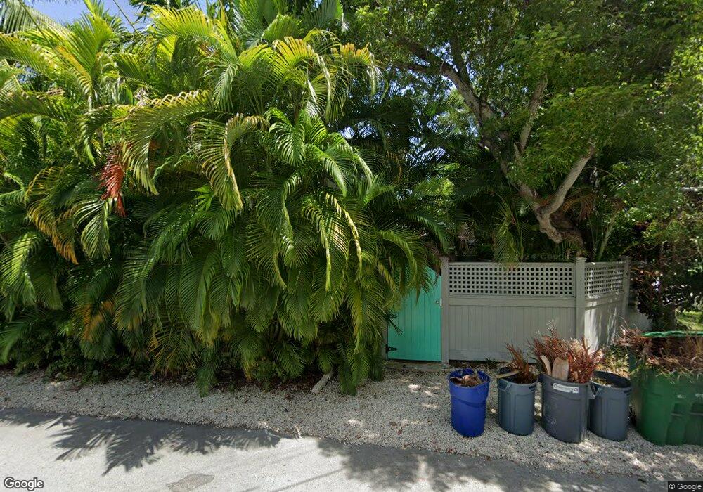
1601 Sirugo Ave Key West, FL 33040
Mid Town NeighborhoodEstimated Value: $1,615,994 - $2,271,000
3
Beds
3
Baths
1,750
Sq Ft
$1,099/Sq Ft
Est. Value
About This Home
This home is located at 1601 Sirugo Ave, Key West, FL 33040 and is currently estimated at $1,922,499, approximately $1,098 per square foot. 1601 Sirugo Ave is a home located in Monroe County with nearby schools including Horace O'Bryant School, Key West High School, and May Sands Montessori School.
Ownership History
Date
Name
Owned For
Owner Type
Purchase Details
Closed on
Apr 15, 2019
Sold by
Burnham Jeffrey P and Burnham Carol
Bought by
Burnham Jeffrey P and Bu Carol
Current Estimated Value
Purchase Details
Closed on
Dec 31, 2007
Sold by
Burnham Jeffery and Burnham Carol
Bought by
Burnham Jeffery and Burnham Carol
Purchase Details
Closed on
Oct 13, 2006
Sold by
1304 Laird Street Llc
Bought by
Burnham Jeffery and Burnham Carol
Purchase Details
Closed on
Jul 1, 1988
Bought by
Burnham Jeffrey P
Purchase Details
Closed on
Aug 1, 1984
Bought by
Burnham Jeffrey P
Purchase Details
Closed on
Feb 1, 1969
Bought by
Burnham Jeffrey P
Create a Home Valuation Report for This Property
The Home Valuation Report is an in-depth analysis detailing your home's value as well as a comparison with similar homes in the area
Home Values in the Area
Average Home Value in this Area
Purchase History
| Date | Buyer | Sale Price | Title Company |
|---|---|---|---|
| Burnham Jeffrey P | $100 | None Listed On Document | |
| Burnham Jeffery | -- | None Available | |
| Burnham Jeffery | $225,000 | None Available | |
| Burnham Jeffrey P | $160,000 | -- | |
| Burnham Jeffrey P | $85,000 | -- | |
| Burnham Jeffrey P | $18,000 | -- |
Source: Public Records
Tax History Compared to Growth
Tax History
| Year | Tax Paid | Tax Assessment Tax Assessment Total Assessment is a certain percentage of the fair market value that is determined by local assessors to be the total taxable value of land and additions on the property. | Land | Improvement |
|---|---|---|---|---|
| 2024 | $8,373 | $1,016,539 | -- | -- |
| 2023 | $8,373 | $986,932 | $0 | $0 |
| 2022 | $8,016 | $958,187 | $653,738 | $304,449 |
| 2021 | $6,587 | $703,401 | $431,827 | $271,574 |
| 2020 | $6,386 | $682,917 | $407,837 | $275,080 |
| 2019 | $6,455 | $684,875 | $409,601 | $275,274 |
| 2018 | $6,298 | $653,488 | $374,709 | $278,779 |
| 2017 | $6,464 | $660,304 | $0 | $0 |
| 2016 | $6,389 | $643,825 | $0 | $0 |
| 2015 | $5,859 | $545,312 | $0 | $0 |
| 2014 | $6,020 | $539,862 | $0 | $0 |
Source: Public Records
Map
Nearby Homes
- 1301 Atlantic Dr
- 1314 Johnson St
- 1522 Georgia St
- 1519 Johnson St
- 1501 Florida St
- 1501 White St
- 1222 von Phister St
- 1110 Johnson St
- 1101 Casa Marina Ct
- 1508 Johnson St
- 1341 Tropical St
- 1511 Johnson St
- 1515 Patricia St
- 1126 von Phister St
- 1420 White St
- 1523 Patricia St
- 1233 Washington St
- 1500 Atlantic Blvd Unit 409
- 1500 Atlantic Blvd Unit 414
- 1231 Washington St
- 1306 Laird St
- 1600 Sirugo Ave
- 1223 Laird St
- 1305 Atlantic Dr
- 1308 Laird St
- 1214 Laird St
- 1310 Laird St
- 1309 Atlantic Dr
- 1211 Laird St
- 1316 Johnson St
- 1307 Laird St
- 1312 Laird St
- 14 A & B Atlantic Dr
- 1314 Laird St
- 1624 Sirugo Ave
- 1209 Laird St
- 1306 Atlantic Dr
- 1302 Atlantic Dr
- 1314 Atlantic Dr
- 1312 Atlantic Dr
